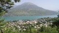
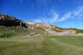
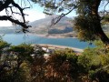
Savines-le-Lac as seen from Les Eygoires

A lovely walk that climbs steeply through the forest, passes through the town, runs alongside the new facilities by the lake and, unfortunately (there’s no getting round it), follows the RD954 for 500 metres.

Details

66730
Creation:
Last update:
Last review:
  • Walking
    Activity: Walking
  • ↔
    Distance: 3.27 mi
  • ◔
    Average duration: 2h 00 
  • ▲
    Difficulty: Easy

  • ⚐
    Back to start: Yes
  • ↗
    Ascent: + 571 ft
  • ↘
    Descent: - 591 ft

  • ▲
    Highest point: 3,117 ft
  • ▼
    Lowest point: 2,549 ft

Photos

Description of the walk

Coming from Savines-le-Lac towards Barcelonnette, park your car in the small car park on the right before the bridge and before the Eygoires municipal campsite.

(S/E) Opposite the car park, head up alongside the stream along a small path which, due to a lack of maintenance, is no longer signposted at the roadside.

(1) 150 metres further on, take the path on the left. This is where the ‘real’ climb begins.

(2) At the first junction, do not turn right towards Pierre Arnoux but turn left and follow the path.
Further on, do not take the small path that descends to the left towards Savines.

(3) Continue slightly to the right.
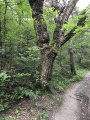
Walk past “the big oak tree”. At the next junction, do the same: keep to the left and follow the path to the fitness trail. Once again, do not turn right towards Pierre Arnoux; continue straight ahead. The path descends to the Barnafret stream.

(4) Cross the stream to reach the small forest track; take this to the left for 150 metres, then turn right above the water reservoir.

Follow this small path, which runs above the houses, to the Impasse du Paradisier, where you turn left.
You’ll reach the RN94; take a short detour to the left to climb back up above the town hall towards the church. Go straight on at the roundabout to reach the very end of Rue du Morgon, then head down it to the right until you reach the RD954; after crossing it, turn left and follow the road for 150 metres.

(5) Leave the road to the right after the car park and head down Rue du Perdiguier to the lakeside.
Follow the lake, passing the bouncy castles (oh, it’s not a pretty sight…), then take the new, small tarmac path that climbs up in front of you and leads you back to the Rd954, which you’ll follow to the right until you reach the car park (S/E).


Waypoints

  1. S/E : mi 0 - alt. 2,631 ft - Car park - Lac de Serre-Ponçon
  2. 1 : mi 0.11 - alt. 2,717 ft - Path on the left as you head uphill
  3. 2 : mi 0.22 - alt. 2,881 ft - Take the small path on the left
  4. 3 : mi 0.78 - alt. 3,002 ft - Junction with the Savines-le-Lac path
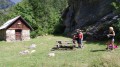
  5. 4 : mi 1.41 - alt. 2,858 ft - Picnic area – Torrent du Barnafret.
  6. 5 : mi 2.47 - alt. 2,612 ft - Turn right after the car park - La Durance
  7. S/E : mi 3.27 - alt. 2,631 ft - Car park - Lac de Serre-Ponçon

Notes

It’s a walk, but it’s best to wear walking shoes as the climb is over rocky ground.
There are no drinking fountains along the forest section of the route, but you’ll find some in town and by the lake.

Worth a visit

You can shorten the route by avoiding the town. To do this, simply follow the small path on the left just before (4), which runs alongside the stream, to the motorhome site on the edge of the D954, and then resume the route described above by turning left after crossing the road.
It’s a lovely and enjoyable walk along this little path.

Reviews and comments

4.3 / 5
Based on 2 reviews

Reliability of the description
4 / 5
Ease of following the route
4.5 / 5
Route interest
4.5 / 5
pejeanlo
pejeanlo

Overall rating : 5 / 5

Date of your route : Jun 06, 2024
Reliability of the description : ★★★★★ Very good
Ease of following the route : ★★★★★ Very good
Route interest : ★★★★★ Very good
Very busy route : Yes

No maintenance issues. One thing to note, though: the initial climb is very gruelling. The ‘difficulty: Easy’ rating seems to be an underestimate. A minimum level of fitness is required.

Machine-translated

gazok54
gazok54 ★

Thank you, jeanmarcfrisson.
If you’ve had any issues with the description, please do let me know what they are and give me some ideas on how to improve it.

Machine-translated

jeanmarcfrisson
jeanmarcfrisson

Overall rating : 3.7 / 5

Date of your route : Jul 03, 2016
Reliability of the description : ★★★☆☆ Average
Ease of following the route : ★★★★☆ Good
Route interest : ★★★★☆ Good

The start of the trail next to the stream is very steep, but once you’re at the top it’s brilliant

Machine-translated

Other walks in the area

For more walks, use our search engine .

The GPS track and description are the property of this route's author. Please do not copy them without permission.