Serre-Verger Wood

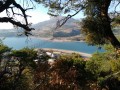
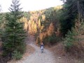
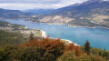
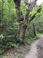
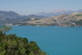
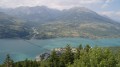
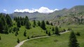
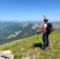
A pleasant walk to enjoy the shade in summer or the beautiful autumn colours, with a few lovely views of Lake Serre-Ponçon.

Details

856190
Creation:
Last update:
Last review:
  • Walking
    Activity: Walking
  • ↔
    Distance: 5.18 mi
  • ◔
    Average duration: 3h 40 
  • ▲
    Difficulty: Easy

  • ⚐
    Back to start: Yes
  • ↗
    Ascent: + 1,490 ft
  • ↘
    Descent: - 1,493 ft

  • ▲
    Highest point: 4,062 ft
  • ▼
    Lowest point: 2,671 ft

Photos

Description of the walk

Park in Savines-le-Lac in the car parks along the N94.

(S/E) Head east and follow theGR® 653D, which crosses the village via the N94. Turn right into Rue du Paradisier, walk a few metres along Impasse du Paradisier, then turn right onto a footpath.

(1) Shortly after leaving the tarmac, when theGR® climbs to the left round a tight bend, carry on straight ahead, keeping level.

(2) Just after passing a reservoir on the right, and before reaching the D468T, take a path on the left which starts off running parallel to the road. After about ten minutes’ climb, at the junction, turn right and join the Serre-Verger forest road.

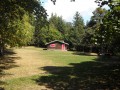
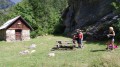
(3) Cross the road and continue climbing straight ahead along a fairly wide track. Stay on this main track at all times, ignoring the side paths on either side. You’ll reach a large picnic area, the highest point of the walk.

(4) Carry on straight ahead towards the north-east and head downhill until you rejoin theGR®653Don the Serre-Verger forest road.

(5) Turn left onto theGR® towards Villard Robert.

(6) At the junction, stay on theGR® by turning left.

(7) When you reach the area above the first houses in Savines, leave the wide track and follow theGR® as it branches off to the right onto a path, returning to the junction you passed shortly after setting off.

(1) Turn right and follow the same route as on the way out for this final section, which includes a few fairly steep sections. Return to the car park where you started (S/E).

Waypoints

  1. S/E : mi 0 - alt. 2,674 ft - Savines-le-Lac - Lac de Serre-Ponçon
  2. 1 : mi 0.25 - alt. 2,772 ft - Crossroads at the end of the circular loop
  3. 2 : mi 0.5 - alt. 2,828 ft - Path on the left
  4. 3 : mi 0.78 - alt. 3,120 ft - Serre-Verger forest track
  5. 4 : mi 1.81 - alt. 4,062 ft - Picnic area, straight ahead
  6. 5 : mi 3.06 - alt. 3,471 ft - Turn left onto the GR
  7. 6 : mi 3.57 - alt. 3,245 ft - Villard Robert, junction, left
  8. 7 : mi 4.58 - alt. 3,196 ft - Turn right onto the GR
  9. S/E : mi 5.18 - alt. 2,671 ft - Savines-le-Lac - La Durance

Notes

You can avoid the few steep sections of the walk from point (7) by staying on the wide Serre-Verger forest track to rejoin the outbound route at point (3).

Always be cautious and plan ahead when you're outdoors. Visorando and the author of this route cannot be held responsible for any accidents occurring on this route.

The GR® and PR® markings are the intellectual property of the Fédération Française de Randonnée Pédestre.

Reviews and comments

3.9 / 5
Based on 4 reviews

Reliability of the description
4.3 / 5
Ease of following the route
4.7 / 5
Route interest
2.8 / 5
frednord
frednord
• Edited:

This walk is not recommended at the moment. Firstly, the path (point 2) after the reservoir is almost invisible as it hasn’t been maintained at the start; you have to walk a bit further to see it… The climb between points 3 and 4 is very difficult, as the path has been damaged by flooding, but the worst part is the swarm of flies and countless other insects – it’s almost unbearable. I suppose it’s the dead wood that’s causing this. The Forestry Commission leaves it there to promote biodiversity – and they’ve certainly succeeded... What’s more, there’s a tree lying across the path; you have to squeeze past it... The descent from point 4 to 7 is pleasant. The path between 7 and 1 is steep, so you need to be careful. I don’t think this route is suitable for children...

Machine-translated

Gobin
Gobin

Overall rating : 4 / 5

Date of your route : Jul 15, 2024
Reliability of the description : ★★★★☆ Good
Ease of following the route : ★★★★★ Very good
Route interest : ★★★☆☆ Average
Very busy route : No

A short, pleasant walk.

Machine-translated

lois6
lois6

Overall rating : 3 / 5

Date of your route : Jul 18, 2021
Reliability of the description : ★★★★☆ Good
Ease of following the route : Not used / Not applicable
Route interest : ★★☆☆☆ Disappointing
Very busy route : No

I wasn't very interested in this walk – I was disappointed.

Machine-translated

Sharkz
Sharkz

Overall rating : 4.7 / 5

Date of your route : Jun 26, 2021
Reliability of the description : ★★★★★ Very good
Ease of following the route : ★★★★★ Very good
Route interest : ★★★★☆ Good
Very busy route : No

A short walk to warm up for the Pic du Morgon, which awaits us tomorrow. A few views of the lake. We even extended the walk to make it at least 10 km.
A fairly shaded walk

Machine-translated

dauphinois
dauphinois

I’m sorry you were disappointed by this walk. I’d like to make two points:

  • It’s recommended for enjoying the shade in summer or the beautiful autumn colours. That said, your review may be helpful to other walkers.
  • In the mountains in winter, it’s not unusual to encounter snow or ice, so it’s best to bring some basic equipment, such as snowshoes, for example.

Machine-translated

Lucie L
Lucie L

Overall rating : 3.3 / 5

Date of your route : Aug 21, 2020
Reliability of the description : ★★★★☆ Good
Ease of following the route : ★★★★☆ Good
Route interest : ★★☆☆☆ Disappointing
Very busy route : No

I was very disappointed with this walk, which I did last February.

For the most part, the path follows a rutted forest track with absolutely no views of the lake. At the top of the walk, there are a few picnic tables in the middle of a junction between several tracks rutted by lorries coming to harvest timber.

The descent isn’t any more interesting, but worse still, it’s very dangerous! The entire route was covered in a layer of ice several centimetres thick, which turned it into a bobsleigh run. It took me several hours to get back down, with half of the time spent teetering on the edge of the ravines at the side of the track. I rarely get scared when I’m out walking, but this really gave me a proper fright.

I’m not sure this hike is of any interest in summer, but I strongly advise against it in winter!

Machine-translated

Other walks in the area

For more walks, use our search engine .

The GPS track and description are the property of this route's author. Please do not copy them without permission.