Country:

 City:
City:


From Bourg-Saint-Maurice, follow the D902 up to Sainte-Foy-Tarentaise. At the hamlet of La Thuile, turn left towards the resort and wind your way through the tourist hamlet of Bon Conseil. At the top, take the forest road on the right (towards Le Monal, as mentioned), which becomes unpaved and leads to the car park known as Les Coleurs (beyond this point, only residents of L’Échaillon and Le Monal are permitted to drive).
Please note: another possible starting point is the hamlet of Le Chenal, reached by leaving the D902 further up: the climb is slightly shorter, but involves an additional 100 metres of elevation gain.
(S/E) Continue on foot along the track which climbs through the woodland before levelling out to cross the Échaillon, then the Ruisseau du Clou, and arrive at Monal.
(1) Head up the track to the right towards La Legettaz and, shortly after entering the forest, turn left onto the Sentier du Clou, which climbs steeply through the woods. When the path emerges into open ground, do not head right to rejoin the 4x4 track prematurely, but instead head left up a ridge offering a bird’s-eye view of Le Monal and continue until you rejoin the track further up.
(2) Follow it to the left, cutting across a bend via a grassy path, and emerge at the mouth of the Vallon du Clou, near the old Saint-Jacques Chapel.
(3) Continue along the sheep track which climbs up the flat section of the valley, above the lake, opposite the Chalets du Plan, as far as the Chalets des Balmes.
(4) Climb above the chalets and head eastwards up the path along the left bank of the Nant Pisse; further up, cross the Ruisseau du Lac Noir and follow it along the right bank to Lac Noir.
(5) Head off to the left, due north, following ascending paths and cairns which lead to a flat area on a ridge at around 2,700 metres.
(6) Start climbing straight up the slope, following tracks through the scree.
(Early in the season, when there are still large patches of snow, it is possible to climb to the top of this slope on the right, following the ski touring route shown on the IGN map)
Halfway up the slope, veer left towards the foot of the rocky ridge descending from the summit (scattered cairns).
(7) This is where the steepest and most gruelling part of the route begins: climb up to the right, straight up the slope, staying on the boundary between the scree of a wide couloir descending from the Pointe d’Archeboc and the rocks of the ridge: following the rock provides good footholds and, above all, handholds to prevent you from sliding back down with every step.
Gradually, the slope becomes less steep and, towards the end, a sort of stony gully even begins to take shape, leading to a flat snowfield – a modest remnant of the former Archamboc Glacier.
(8) Cross this snowfield then head up, following the ridge line, towards the crest between the two peaks of Archeboc and Ormelune; this ridge is easily followed to the right all the way to the summit.
(9) After taking in the view from the summit and its south-western secondary summit, descend through the rocks and scree, following the line of sight, to the snowfield where you rejoin the ascent route.
Most visitors continue on to climb Pointe d’Archeboc, following the ridge between the two peaks and then descending directly down the scree on the south face. Allow an extra hour or so.
(8) Descend the gentle valley you followed on the way up and, when the slope becomes steeper, veer decisively to the right to take the wide scree couloir, which, despite its steepness, is ultimately easy to descend with poles or an ice axe.
Do not go all the way to the bottom of the valley but stop descending at the foot of the final rocky outcrops.
(10) Then make a long traverse to the right across chaotic terrain and scree, without losing altitude, simply skirting the base of the numerous rocky outcrops that jut out into the scree cones.
Head for the outlet of the Lower Lake of the former Argentière Glacier, which you’ll reach with virtually no climb.
(11) Head west up a gully between two large moraines (a path marked with cairns in places) to reach a small pass overlooking Lac Blanc. Follow its eastern shore halfway up the slope and climb the weathered rocks of the ridge on its southern shore (cairns).
(12) Follow the cairns through rocky scree towards the south-west to descend onto a flat, grassy ridge overlooking Lac Brulet.
Descend (intermittent path) by sight towards the Lacs Verdet to the west. Aim for a small intermediate ridge with clearly visible cairns as you pass.
(13) From the outlet of the main lake, descend along grassy paths towards the small lower lake, fringed with cotton grass.
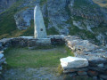
(14) From this lake, avoid following the path along its narrows, which tends to climb westwards; instead, return to near the outlet to descend via the most passable grassy slope and join, further down, a path that is finally well-marked (at around 2,640 m) which cuts across the slope towards the south-east. Follow this path, losing very little altitude, until you reach a flat area where a strange cairn-monument stands.
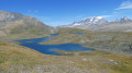
(15) Head westwards along the level path that cuts across the slope to a point above Lac du Clou.
(16) Descend by sight through the grass towards the lake.
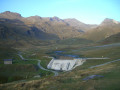
(17) From the southern shore, take the path down to the Chalets du Clou, then follow a track – whose bends can be cut across – to the foot of the dam.
(18) Head back up towards the site of the old Saint-Jacques Chapel and rejoin the ascent track.
(3) Follow this track down to the junction with the ascending path.
(2) From there, head down to Le Monal either directly via the ascent path, or by staying on the track – which is easier going but dusty – turning right at La Légettaz to reach Le Monal.
(1) Return via the Échaillon to the car park (S/E).

 Visorando Member
 Moderate
 Difficult
 Easy
Easy