Chalets de la Davie, Nazonde and Nancruet via the Via Alpina

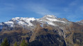
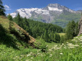
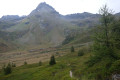
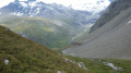
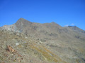
The Via Alpina offers a wealth of short walks; this one allows you to explore the small mountain hamlets, with the added bonus of a magnificent view of the Mont Pourri glaciers and the Dôme de la Sache.

Details

16337815
Creation:
Last update:
Last review:
  • Walking
    Activity: Walking
  • ↔
    Distance: 7.30 mi
  • ◔
    Average duration: 5h 00 
  • ▲
    Difficulty: Moderate

  • ⚐
    Back to start: Yes
  • ↗
    Ascent: + 1,877 ft
  • ↘
    Descent: - 1,870 ft

  • ▲
    Highest point: 7,218 ft
  • ▼
    Lowest point: 5,571 ft

Photos

Description of the walk

(S/E) From the Chenal car park, take the road on the right towards Le Monal.

(1) At Chenal d’en haut, turn left onto the dirt track.

(2) Turn right and follow the track to Le Fenil.

(3) Leave the track, cross the hamlet of Le Fenil and take a small path that climbs towards the larch forest. This relatively flat path offers views of the Inverneau and Gurraz glaciers and the Dôme de la Sache. Join the track just before the Ruisseau du Mayancet.

(4) Keep to the left on the track as it climbs.

(5) Leave the track and take the narrow path leading down to the right. Cross the Nant Cruet and climb up the other side. Pass by a large rock known as the Pierre du Carroley, then continue to the left as far as the Chalets de la Davie.

(6) Take the path leading down to the right, which joins the Via Alpina towards Villaret des Brévières.

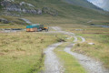
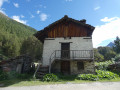
(7) Leave the path and turn right onto the small track that passes above the hamlet of Orsière. You’ll cross the Millo woods to emerge onto the Nazonde mountain pasture, where you might spot a fine flock of sheep (watch out for the Patou).

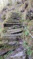
(8) Carry straight on along the path as it climbs, cross the plateau before descending into the Nant Cruet gorge: watch out for a few tricky sections with cables just before the stream. Continue to the hamlet of Nantcruet.

(9) Carry on straight ahead along the Via Alpina to rejoin the road you took on the way there.

(1) Head down to the left to return to the car park (S/E).
Waypoints

  1. S/E : mi 0 - alt. 5,571 ft - Chenal car park
  2. 1 : mi 0.18 - alt. 5,712 ft - Chenal d’en Haut, junction of the circular loop
  3. 2 : mi 0.44 - alt. 5,856 ft - Junction, turn right
  4. 3 : mi 1.26 - alt. 6,220 ft - Le Fenil
  5. 4 : mi 2.72 - alt. 6,736 ft - Track junction, on the left
  6. 5 : mi 3.08 - alt. 6,952 ft - End of track, path on the right
  7. 6 : mi 4.31 - alt. 6,932 ft - Chalets de la Davie
  8. 7 : mi 4.75 - alt. 6,480 ft - Junction, turn right
  9. 8 : mi 5.38 - alt. 6,155 ft - Nazonde
  10. 9 : mi 6.21 - alt. 6,056 ft - Nancruet
  11. S/E : mi 7.3 - alt. 5,571 ft - Chenal car park

Reviews and comments

4.7 / 5
Based on 2 reviews

Reliability of the description
5 / 5
Ease of following the route
5 / 5
Route interest
4 / 5
User 10072966

Overall rating : 4.3 / 5

Date of your route : Sep 20, 2025
Reliability of the description : ★★★★★ Very good
Ease of following the route : ★★★★★ Very good
Route interest : ★★★☆☆ Average
Very busy route : No

No one else on this hike at this time of year, except for a few hunters.
There are beautiful views of the surrounding glaciers, including a stunning view of Mount Pourri and some of its waterfalls.
A fairly easy, family-friendly hike.
Best done on a sunny day to enjoy the view!

A little too much road/road trail for my taste.

Machine-translated

vgasquet
vgasquet

Overall rating : 5 / 5

Date of your route : Aug 18, 2025
Reliability of the description : ★★★★★ Very good
Ease of following the route : ★★★★★ Very good
Route interest : ★★★★★ Very good
Very busy route : No

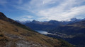
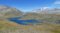
Hike without any particular difficulty. Beautiful views of the glaciers and waterfalls of Mont Pourri on this side (and on the other side too, via Lac de la Plagne)! Beautiful view of Lake St Guérin from the Davie chalet. Don't hesitate to cross the valley here via the chalet; the path is no longer very clear but the visibility of the expanse makes it easy to know where to go. You'll pass through some beautiful hamlets. The route is well worth it. Thank you very much

Machine-translated

Other walks in the area

For more walks, use our search engine .

The GPS track and description are the property of this route's author. Please do not copy them without permission.