


Refine your search for walks in Sillé-le-Philippe
Sillé-le-Philippe walks


 La Fosse aux Saneux in Sillé-le-Philippe
 Tourism professional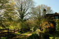
 9.40 mi
 +256 ft
 -246 ft
 4h 35
4h 35
 Moderate
 Departure from Sillé-le-Philippe (Sarthe)
The first mention of the parish under the name “Siliaco Philippi” dates back to the years 1145–1187. From the Middle Ages onwards, the parish seigneury was annexed to the Château de Passais, which itself fell under the barony of Touvoie, owned by the bishops of Le Mans, situated on the border between Savigné-L’Evêque and Saint-Corneille. Sillé-le-Philippe gave rise to the creation of a linear village; long remaining modest in size, it is now expanding due to its proximity to the Le Mans conurbation. This development also benefits the hamlet of Chanteloup (situated on the old royal road from Le Mans to Paris via Mortagne, now the RD 301), which once boasted several cafés and inns.
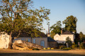
Palet de Gargantua Circuit
 5.19 mi
+79 ft
-72 ft
2h 25
5.19 mi
+79 ft
-72 ft
2h 25
 Easy
Departure from Torcé-en-Vallée (Sarthe)
Easy
Departure from Torcé-en-Vallée (Sarthe)
Known successively as Ecclesia de Torciaco, then Torcey and Notre Dame de Torcé, the former parish has been called Torcé-en-Vallée since 1926. The documents first mentioning it relate to the construction of the priory and the church. However, it is clear that Torcé’s history predates this, as evidenced by the megalith located at the western entrance to the village, known as the ‘Dolmen de Torcé’ or ‘Palet de Gargantua’. Human occupation may date back to the Middle Neolithic period.
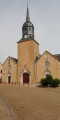
The village of Beaufay and the Butte de Montplaisir
 Association / Club / Walk leader
 13.33 mi
+459 ft
-446 ft
6h 30
13.33 mi
+459 ft
-446 ft
6h 30
 Difficult
Departure from Beaufay (Sarthe)
Difficult
Departure from Beaufay (Sarthe)
A good twenty kilometres of peaceful walking through the countryside along sunken lanes, with almost 100% of the route on footpaths (less than 1.5 km of tarmac!!!) in the Beaufay countryside.
The Butte de Montrentin as seen from Torcé-en-Vallée
 Visorando Member6.47 mi
+66 ft
-69 ft
3h 00
Moderate
Departure from Torcé-en-Vallée (Sarthe)
Visorando Member6.47 mi
+66 ft
-69 ft
3h 00
Moderate
Departure from Torcé-en-Vallée (Sarthe)
This walk, with little variation in elevation and no great difficulty, will allow you to explore the southern part of Torcé. The paths – sometimes tree-lined, sometimes sunny, and very often sandy – will take you to the foothills of the Butte de Montrentin.
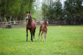
Stud farms and châteaux from Savigné-l'Évêque
 9.24 mi
+62 ft
-62 ft
4h 20
Moderate
Departure from Savigné-l'Évêque (Sarthe)
9.24 mi
+62 ft
-62 ft
4h 20
Moderate
Departure from Savigné-l'Évêque (Sarthe)
A region once densely populated along the ancient road from Le Mans to Évreux, and an important market town under the Ancien Régime, Savigné has long been favoured, due to its proximity to Le Mans, by the city’s notables, who have built or restored bourgeois houses and châteaux, sometimes on medieval seigneurial sites. Thus, as you follow the route, you will see Nuyet, dating from the late18th century, or, from the19th century, the châteaux of Le Rocher (now the town hall), Mortrie and Le Mesnil, where a major stud farm is located.
In the footsteps of the Crusaders, starting from Lombron
13.61 mi
+515 ft
-509 ft
6h 40
Difficult
Departure from Lombron (Sarthe)
Although local tradition places the first village at Bresteau, the Church of Saint-Martin, rebuilt by the monks of Saint-Vincent in the early 12th century, provides clear evidence of the antiquity of the village of Lombron. This beautiful church, open during the day, is well worth a visit both for the quality of its architecture (Romanesque choir and lantern tower, nave and chapels remodelled in the 14th and 15th centuries on their original foundations) and for its furnishings (16th-century statues including the Crucified Christ, the seigneurial bench of the Montmorency family, lords of Bresteau, terracotta bas-reliefs by Lebrun, circa 1760, 18th-century nave pews, etc.).
The Saint-Célerin circulars
 11.94 mi
+305 ft
-292 ft
5h 45
Moderate
Departure from Saint-Célerin (Sarthe)
11.94 mi
+305 ft
-292 ft
5h 45
Moderate
Departure from Saint-Célerin (Sarthe)
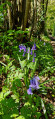
The earliest evidence of human settlement in Saint-Célerin is linked to the discovery of ancient coins, including a Gallic stater (1st or2nd century BC) and a Carolingian hoard dating from around 833, the year the locality of Caliniaco (known in French as Chahanay) was first mentioned.
The starting point of the 24 Hours of Le Mans from Montfort-le-Gesnois
 5.15 mi
+230 ft
-230 ft
2h 35
Easy
Departure from Montfort-le-Gesnois (Sarthe)
5.15 mi
+230 ft
-230 ft
2h 35
Easy
Departure from Montfort-le-Gesnois (Sarthe)
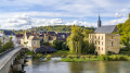
The present-day commune, formed by the merger of two former major market towns, stretches out parallel to the Huisne valley across uneven terrain. The old Pont de Gennes is at the lowest point (60 m), whilst the highest point (100 m) is at Montfort-le-Rotrou. The former is a crossroads village situated at the mouth of an old crossing point over the Huisne. The latter, situated on a strategic defensive site, is a linear settlement built under the protection of the castle. The two were joined by a gradual urban expansion in the 19th century. The walk takes you past the starting point of the first major motor race organised by the Automobile Club de France (ACF) in 1906, the forerunner of the 24 Hours of Le Mans.
From Le Tripoulin to La Vive Parence
 6.31 mi
+351 ft
-331 ft
3h 10
Easy
Departure from Bonnétable (Sarthe)
6.31 mi
+351 ft
-331 ft
3h 10
Easy
Departure from Bonnétable (Sarthe)
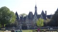
Spared by land consolidation, the commune of Bonnétable, best known for its medieval castle and deciduous forest, is much loved by walkers for its typical sunken paths and pleasant wooded countryside.
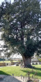
The thousand-year-old yew tree at Jauzé
 4.57 mi
+66 ft
-66 ft
2h 10
Easy
Departure from Terrehault (Sarthe)
4.57 mi
+66 ft
-66 ft
2h 10
Easy
Departure from Terrehault (Sarthe)
From Terrehault, follow the dirt tracks lined with pollarded trees to the village of Jauzé and its thousand-year-old yew tree.
The Maquis des Bois de la Croix in Connerré
 3.50 mi
+233 ft
-220 ft
1h 50
Easy
Departure from Connerré (Sarthe)
3.50 mi
+233 ft
-220 ft
1h 50
Easy
Departure from Connerré (Sarthe)
Situated in the Huisne valley, inhabited since prehistoric times, Connerré developed in the Middle Ages around a religious centre comprising the Church of Saint-Symphorien and a priory. The town, enclosed by a wall at the end of the 16th century, opened up at the end of the Ancien Régime thanks to the construction of bridges replacing fords and the expansion of transport links: the construction of the Paris–Nantes royal road around 1780, followed by the opening of a station on the Le Mans–Paris line in 1854. These developments fuelled the economic boom of the 19th century through fairs and markets and the growth of industry. The market town modernised and expanded gradually, then more rapidly from the 1970s onwards. Today, Connerré is an attractive small town, situated halfway between Le Mans and La Ferté-Bernard.
The Auvours hill in Yvré-l'Evêque
 5.30 mi
+541 ft
-525 ft
2h 55
Easy
Departure from Yvré-l'Évêque (Sarthe)
5.30 mi
+541 ft
-525 ft
2h 55
Easy
Departure from Yvré-l'Évêque (Sarthe)
An easy walk, 50% of which follows a path around the Auvours hill, which witnessed the War of 1870, where a tragic battle claimed 617 lives on 10 and 11 January 1871. Many mementoes of this war are housed in the church at Yvre, where one chapel is dedicated to the Papal Zouaves.
Yvré-l'Évêque route and its "Nature Boulevard"
 7.00 mi
+269 ft
-246 ft
3h 25
Moderate
Departure from Yvré-l'Évêque (Sarthe)
7.00 mi
+269 ft
-246 ft
3h 25
Moderate
Departure from Yvré-l'Évêque (Sarthe)
During this hike, you will have the opportunity to admire the Yvré countryside, its Roman bridge, the Gérence fountain and catch a glimpse of the beautiful Château de Vaux as you walk along the trails and part of the "Boulevard Nature".