Country:
 City:
City:


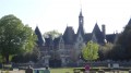
Start from the car park at Place du Château in Bonnetable. Green signposting.
(S/E) On leaving the car park, turn left into Rue du Maréchal Leclerc and cross the junction. Turn into Rue Saint-Sulpice.
(1) Take Rue du Maréchal Gallieni on the right and go straight on. Cross the railway line and continue for a few metres.
(2) Start on the left-hand side of the road and continue straight on through the woods. At the left-hand bend, continue straight ahead along the path until the next fork.
(3) Take the sunken path straight ahead. At the Fork in the road, go straight up the Chemin Raffeu and cross the small road.
(4) At the fork, continue left along Chemin de la Sizardière, pass the hamlet and head down the path that runs alongside the valley.
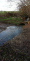
(5) Cross the small road and take the stony path opposite. Cross the Ruisseau de la Vive Parence on the right and head up the sunken path to La Bigotière. Continue straight on for about 750m until you reach a crossroads.
(6) Turn right and follow the edge of the woods. Take the D60 to the left and, at the path leading to the hamlet of Le Pin, follow the C104 to the right for 200m.
(7) At the junction with a track, turn right, cross Les Petites-Yvories (give way), then turn left and pass Les Grandes-Yvories. Turn right twice to pass La Regadellerie and La Grande-Troche, then continue straight on along the D60.
(8) At the right-hand bend, take the Chemin de la Maltière on the left, marked in yellow. After La Sourvannière, head down opposite, follow the D60 to the right for 200m then climb up to the right via the sunken lane. Pass La Bechetière and rejoin the junction from the outward journey.
(4) Head back down the path used on the way there until you reach the corner of the cemetery.
(9) At the corner, turn right onto Rue de la Langraie. At the end of the street, take the D7 to the right for 100m.
(10) At the Red Cross crossroads, turn left to cross the Cour l'Aunay and take the path on your left leading to the car park at Place du Château (S/E).

 Association / Club / Walk leader

 Visorando Member
 Moderate
  Tourism professional

 Difficult