Country:
 City:


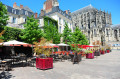
(S/E) Start in Le Mans, Rue Tristan Bernard, near the car park by the Saint-Aldric Fountain, which dates from 1527. Turn left into Rue des Grands Bois, then left at the end of the street (Rue Prémartine) and immediately right into Rue Vanneaux.
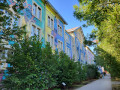
(1) At the roundabout, turn left onto Rue des Fauvettes and walk through the small playground. Turn right onto Rue des Cygnes. Continue in this direction along Rue de l’Ardoise.
(2) At the ‘Cygnes’ bus stop, take the small path running alongside Méhoncourt Castle.
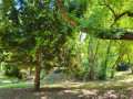
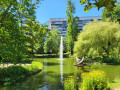
(3) Turn left at the end of the path. Walk 20 metres to Parc de Gazonfier. Cross Rue de l’Éventail. Enter the park. This is a realm of plum trees, poplars, ginkgo biloba, oaks and laburnums. Populated by remarkable trees, a meadow and two small woodlands were preserved during the neighbourhood’s urban development.
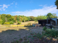
(4) Turn right before reaching the bottom of the park, heading back up towards the roundabout on Rue de Marivaux. Opposite, climb the steps leading to a cul-de-sac off Rue François Coppée. Turn left to reach the end of the cul-de-sac and continue straight on, following Rue de la Solitude, then keep going straight ahead along Chemin de Malpalu at a sharp right-hand bend in the road. Enjoy a superb 180° view of the western part of the city. The footpath turns into a road and leads to a school.
(5) At the Lycée Saint-Charles Sainte-Croix, turn right onto Rue Fernand Davoy. Carry on straight ahead at the roundabout and walk alongside the cemetery on Rue Emmanuel Maire, then turn left onto Rue de l’Éventail. Walk down this street until you reach the entrance to the Jardin des Plantes (on the right).
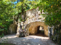
(6) Cross the park, starting with the English-style section of the garden. Take the rock-lined underpass (beneath Rue de Sinault). Walk through the French-style garden with its beautiful rose garden. Leave the garden via the exit onto Rue Prémartine. Then take Rue du Jardin des Plantes opposite, then turn right at its end onto Rue de la Rivière. Continue to the second junction.
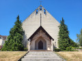
(7) Turn left (Rue des Pompes). Note the Maison des Pompes with its fascinating history. You’ll come to Rue d’Isaac. Turn right and you’ll come to the church of Saint-Aldric. Go round it on the right to take the footpath.
(8) At the end of the path, turn right onto Rue du Docteur Boëteau, then immediately left onto Rue Abraham to reach the tram stop. Cross Rue des Maillets and take the steps leading to the entrance of Parc Banjan.
(9) At the entrance to Parc Banjan, follow the main path, then take the path on the left. Walk round the playground. Continue to Boulevard Nature. Head up the path on the right. To leave the park, turn left onto Impasse Olivier and make sure you don’t miss the path on the right leading to Rue des Terrasses. Turn right, then left onto Rue de Sargé before continuing straight on (Rue des Fontenelles).
(10) 500 m further on, take the second right (Chemin de l’Osier). Cross Rue des Maillets to reach Rue de l’Osier. Continue straight on until you reach Parc de Verdigné.
(11) Cross the park, then at the exit, turn right (Rue d’Isaac) to take thefirst left onto Rue Claire-Fontaine, then right again onto Rue Tristan Bernard until you reach the starting point (S/E).


 Visorando Member
 Moderate

 Tourism professional