


Refine your search for walks in Saint-Vulbas
Saint-Vulbas walks


 Short circular walk from Saint-Vulbas
 Visorando Member
 2.33 mi
 +52 ft
 -52 ft
 1h 05
1h 05
 Easy
Easy
 Departure from Saint-Vulbas (Ain)
As part of its ‘Soft Mobility’ activities, the Plaine de l’Ain Sports Association offers a route to help you keep fit whilst exploring the towpath along the Rhône, the old port and the spring that proved fatal to Philibert the Fair.
La Balme les Grottes - Charette - Parmilieu
 10.93 mi
+961 ft
-961 ft
5h 50
10.93 mi
+961 ft
-961 ft
5h 50
 Moderate
Departure from La Balme-les-Grottes (Isère)
Moderate
Departure from La Balme-les-Grottes (Isère)
This is a fairly easy hike along the northern edge of the Isle Crémieu plateau, through fields, pleasant villages and a few wooded areas.
From Hières-sur-Amby to Larina
 6.11 mi
+840 ft
-840 ft
3h 30
Moderate
Departure from Hières-sur-Amby (Isère)
6.11 mi
+840 ft
-840 ft
3h 30
Moderate
Departure from Hières-sur-Amby (Isère)
This circuit takes us from the village of Hières-sur-Amby at the foot of the cliff to the archaeological site of Larina on the cliff. It offers panoramic views of the Pilat Massif, the Monts du Lyonnais, the plains of Lyon and the Ain, and the foothills of the Bugey.
From the Verbois Gorges to the Val d'Amby
 7.14 mi
+991 ft
-984 ft
4h 10
Moderate
Departure from Hières-sur-Amby (Isère)
7.14 mi
+991 ft
-984 ft
4h 10
Moderate
Departure from Hières-sur-Amby (Isère)
A shaded trail that takes you through the Gorges de Verbois, very pleasant in hot weather, and past some typical buildings.
Torjonas circular route via Brotel
 5.53 mi
+407 ft
-410 ft
2h 55
Easy
Departure from Saint-Baudille-de-la-Tour (Isère)
5.53 mi
+407 ft
-410 ft
2h 55
Easy
Departure from Saint-Baudille-de-la-Tour (Isère)
A lovely, uncrowded hike starting from Torjonas, between woods and rivers, with a variety of wildlife (cows, donkeys, sheep).
9 km circular loop with no significant elevation gain.
Bigues trail
 6.07 mi
+348 ft
-371 ft
3h 05
Easy
Departure from Parmilieu (Isère)
6.07 mi
+348 ft
-371 ft
3h 05
Easy
Departure from Parmilieu (Isère)
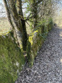
A little path that smells of hazelnuts... This pleasant, easy trail takes you through the charming little village of Parmilieu, a land of stone, quarries and traditional stone houses.
North of Crémieu - From the Larina plateau to the Chapelle des Aviateurs in Leyrieu
 9.02 mi
+1,424 ft
-1,424 ft
5h 25
Moderate
Departure from Vernas (Isère)
9.02 mi
+1,424 ft
-1,424 ft
5h 25
Moderate
Departure from Vernas (Isère)
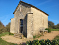
From medieval Vernas to ancient Larina and back via the limestone plateau to the Chapelle des Aviateurs (a memorial to two plane crashes), return to the Middle Ages via the fishpond at the Château Delphinal de Vernas.
Lemps Pond, Moulin de la Roche starting from Saint-Baudille-de-la-Tour
 8.64 mi
+571 ft
-591 ft
4h 30
Moderate
Departure from Saint-Baudille-de-la-Tour (Isère)
8.64 mi
+571 ft
-591 ft
4h 30
Moderate
Departure from Saint-Baudille-de-la-Tour (Isère)
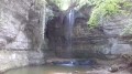
A walk in a natural environment where you can observe a wide variety of wildlife, including European pond turtles at the Lemps pond.
This hike can be done in late October or early November, when you can admire the beautiful autumn colours of the bald cypress trees at the Surbaix pond next to the La Roche waterfall.
Route des enfants à Sainte-Julie
3.39 mi
+79 ft
-79 ft
1h 40
Easy
Departure from Sainte-Julie (Ain)
This route forms part of a network of marked walking trails in the commune of Sainte-Julie, linking the village centre with the various hamlets.
The municipality aims to gradually map, signpost and maintain these routes to make walking in the area easier.
Circular route from the Larina plateau to Vernas
 5.87 mi
+922 ft
-912 ft
3h 30
Moderate
Departure from Vernas (Isère)
5.87 mi
+922 ft
-912 ft
3h 30
Moderate
Departure from Vernas (Isère)
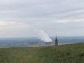
A circular route around the charming village of Vernas and across the Larina plateau. The viewpoint at the archaeological site offers magnificent views of the Jura, the Monts du Lyonnais and the Rhône plain. Further south on the plateau, on a clear day, you can see the Pilat and the Alps. A walk amidst the traces of human history from antiquity to the modern world.
Plateau des Aviateurs from Vernas
 7.15 mi
+902 ft
-902 ft
4h 05
Moderate
Departure from Vernas (Isère)
7.15 mi
+902 ft
-902 ft
4h 05
Moderate
Departure from Vernas (Isère)
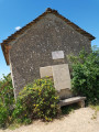
This is a very pleasant circular walk starting from the pretty village of Vernas, which takes you along attractive paths and trails, often shaded by trees, to the Plateau des Aviateurs, where a military aircraft crashed in 1944 and another in 1969. A small chapel, commemorative plaques and a sign commemorate these events. Wide panoramic views of the Rhône plains and the Alps in the distance can be enjoyed throughout the walk.
La Roche de l'Église via Souclin
 8.34 mi
+2,005 ft
-1,998 ft
5h 35
Moderate
Departure from Saint-Sorlin-en-Bugey (Ain)
8.34 mi
+2,005 ft
-1,998 ft
5h 35
Moderate
Departure from Saint-Sorlin-en-Bugey (Ain)
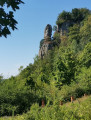
A very pleasant trail from Saint-Sorlin-en-Bugey leads first to the old village of Souclin and then to the Roche de l'Église, which overlooks it. This hike will appeal to lovers of old stones: old villages and paths often lined with timeless stone walls. This route has few paved roads and offers many panoramic views of the Rhône between Bouvesse and Vertrieu, the north of the Isère and, in good weather, even Lyon.
From Saint-Sorlin-en-Bugey to La Roche de l’Église
 11.11 mi
+2,602 ft
-2,579 ft
7h 20
Moderate
Departure from Saint-Sorlin-en-Bugey (Ain)
11.11 mi
+2,602 ft
-2,579 ft
7h 20
Moderate
Departure from Saint-Sorlin-en-Bugey (Ain)
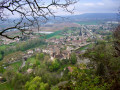
Here is a circular route in the Bugey region suitable for all seasons: starting from the pretty village of Saint-Sorlin-en-Bugey, it climbs to follow a series of ridges passing through Les Rochettes and then La Roche de l’Église before descending via Soudon to the Chapelle Saint-Christophe in Sault-Brenaz. The return to Saint-Sorlin over the Rochers de la Plaine and then the Rochers de la Craz offers views over the entire Rhône valley.
Rhône, Lagnieu Park and old railway line in Saint-Sorlin-en-Bugey
 5.20 mi
+190 ft
-194 ft
2h 35
Easy
Departure from Saint-Sorlin-en-Bugey (Ain)
5.20 mi
+190 ft
-194 ft
2h 35
Easy
Departure from Saint-Sorlin-en-Bugey (Ain)
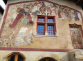
Starting from the beautiful village of Saint-Sorlin-en-Bugey, we reach the Rhône via the châteaux of Molard and La Durandière, follow the ViaRhôna, pass by the proud ruins of the dovecote of the former medieval leprosarium, then cross the public park of Lagnieu to return to our starting point along the old railway line, which has been converted into a footpath.
Croix de Bramafan from Lagnieu
 6.89 mi
+1,358 ft
-1,339 ft
4h 20
Moderate
Departure from Lagnieu (Ain)
6.89 mi
+1,358 ft
-1,339 ft
4h 20
Moderate
Departure from Lagnieu (Ain)
From Lagnieu, climb up to the Croix de Bramafan to discover a wide panorama of the Rhône plain, the Ain plain, Île Crémieu and, on a clear day, as far as Lyon. A very pleasant hike on well-shaded forest paths and trails.
Chapelle de Leyrieu
 5.18 mi
+728 ft
-741 ft
3h 00
Moderate
Departure from Leyrieu (Isère)
5.18 mi
+728 ft
-741 ft
3h 00
Moderate
Departure from Leyrieu (Isère)
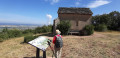
This shaded trail leads to the top of the cliff at the Leyrieu Chapel and offers superb views of the Lyon plains and the Pilat massif. On a clear day, you can see the Alps and the Vercors massif.
Brénaz – Fay – La Roche de l’Église
9.36 mi
+2,247 ft
-2,234 ft
6h 15
Moderate
Departure from Sault-Brénaz (Ain)
A very beautiful walk. A section, mostly shaded, along the cliff overlooking the Rhône, offers clearings with views of the river, the castles of Vertrieu and the Lyon conurbation. The two highest points of the hike (760 m), at the Rochettes antennas or the paragliding launch site and at the Roche de l’Église promontory, offer stunning views of the Rhône, the Vallée Bleue and the Alps. You’ll also enjoy some lovely sections through the woodland.
Remarkable sites, villages and natural areas starting from Sault-Brenaz
 11.25 mi
+2,329 ft
-2,323 ft
7h 10
Moderate
Departure from Sault-Brénaz (Ain)
11.25 mi
+2,329 ft
-2,323 ft
7h 10
Moderate
Departure from Sault-Brénaz (Ain)
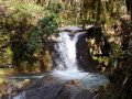
This hike allows you to visit the archaeological site of Colombier, enjoy pretty little villages and remarkable views (Croix du Grassonnet), discover the Grange Mignaval in the undergrowth and then, in a wild setting, an unusual old tuff quarry, observe magnificent little waterfalls, natural jacuzzis on the Crot au Gay and Rhéby streams, and get up close to the Demoiselles de Villebois, pretty rock formations.
See: Practical information
Walk around Optevoz between paths and woods
10.36 mi
+538 ft
-518 ft
5h 15
Moderate
Departure from Optevoz (Isère)
A pleasant little walk passing by three ponds.
The Battle of Anthon Trail
 Association / Club / Walk leader11.49 mi
+479 ft
-463 ft
5h 40
Moderate
Departure from Anthon (Isère)
Association / Club / Walk leader11.49 mi
+479 ft
-463 ft
5h 40
Moderate
Departure from Anthon (Isère)
The hike starts from the pretty village of Anthon (from where the Prince of Orange's army set off with Louis le Chalon's troops), passing through the Bois des Franchises and then the site of the battle: Les Férouillères, La Ferme de la Batterie, Les Burlanchères and then on to the ruins of Château de Malatrait.
Continue to the Ferme des Franchises, a place called Le Cheval Mort (where dead horses were buried), then take a short detour via the Étang des Portions and return by the same route.
The Lemps Pond
1.49 mi
+13 ft
-13 ft
0h 40
Easy
Departure from Optevoz (Isère)
A lovely family walk around a pond classified as a nature reserve, equipped with observation points for viewing local wildlife.
Circulars around Saint-Romain-de-Jalionas
 4.07 mi
+98 ft
-98 ft
1h 55
Easy
Departure from Saint-Romain-de-Jalionas (Isère)
4.07 mi
+98 ft
-98 ft
1h 55
Easy
Departure from Saint-Romain-de-Jalionas (Isère)
This short route will take you to the archaeological site of Villa du Vernai, along a gravel pit that has been transformed into a small lake, and to the Étang du Peillard.
 The Cottey Valley circular tour from Meximieux
16.87 mi
+577 ft
-577 ft
2 hrs
 Difficult
Departure from Meximieux (Ain)
Difficult
Departure from Meximieux (Ain)
This 30 km mountain bike route starts in Meximieux and takes you on a circular route through the very pleasant Cottey Valley. This mixed trail/road route presents two challenges: the gradient of the path and its unstable, stony surface. There is little elevation gain overall. The return journey through the maize fields is sometimes a bit damp, as farmers like to water the crops.
Short tour of the Siccieu and Saint-Julien lakes
 7.71 mi
+581 ft
-581 ft
4h 05
Moderate
Departure from Siccieu-Saint-Julien-et-Carisieu (Isère)
7.71 mi
+581 ft
-581 ft
4h 05
Moderate
Departure from Siccieu-Saint-Julien-et-Carisieu (Isère)
This circuit will take you to several ponds around Siccieu and Saint-Julien and offer superb views of the foothills of the Bugey and, on a clear day, the Alps.
From Vaux-Févroux to the Croix de Bramefan circular
 7.73 mi
+1,791 ft
-1,781 ft
5h 05
Moderate
Departure from Vaux-en-Bugey (Ain)
7.73 mi
+1,791 ft
-1,781 ft
5h 05
Moderate
Departure from Vaux-en-Bugey (Ain)
There are many ways to get to the Croix de Bramefan. This route is unique in that it first takes you along the ridge north of Vaux and, after crossing the Buizin stream, returns via the Bramefan ridge. Almost the entire route is through woodland. The "medium" rating for this hike is justified by the fact that the start of the route is all uphill and there are numerous crossroads that could lead you astray.
Croix de Bramafan, pools and Buizin waterfall starting from Vaux-en-Bugey
10.06 mi
+1,936 ft
-1,906 ft
6h 20
Moderate
Departure from Vaux-en-Bugey (Ain)
This hike through the woods follows sections of the GR®59, PR® and unmarked trails. It will take you to the Croix de Bramafan and its viewpoint, the pools and waterfall of Le Buizin, and the Chapelle de Nièvre. It will also take you through the beautiful village of Vaux-en-Bugey, which is crossed by the Buizin.
On the edge of the Étangs des Dombes lakes, starting from Meximieux
 5.45 mi
+322 ft
-312 ft
2h 45
Easy
Departure from Meximieux (Ain)
5.45 mi
+322 ft
-312 ft
2h 45
Easy
Departure from Meximieux (Ain)
This is an easy, short walk along quiet coastal paths in Meximieux, partly through farmland and partly through deciduous hedgerows. It is also a way to get close to some of the ponds in the Dombes and see lots of birds. At the Virgin of Saint-Sulpice, a beautiful panorama opens up before us, revealing the Ain plain, the Bugey and the Rhône, and even the Alps, depending on the weather.
Around Pérouges
 5.72 mi
+427 ft
-427 ft
3h 00
Moderate
Departure from Pérouges (Ain)
5.72 mi
+427 ft
-427 ft
3h 00
Moderate
Departure from Pérouges (Ain)
This loop will take you out of the medieval town to discover the varied landscape of the region, with woods, crops, a few old houses and panoramic views. The 9 km route is easy to follow and well marked in orange.
Vaux en Bugey-Siccieu
 18.01 mi
+1,181 ft
-1,086 ft
8 hrs
18.01 mi
+1,181 ft
-1,086 ft
8 hrs
 Very difficult
Departure from Vaux-en-Bugey (Ain)
Very difficult
Departure from Vaux-en-Bugey (Ain)
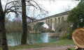
Fifth stage of the Way of St James. This somewhat long stage takes you across the Rhône at Lagnieu. The rest of the route is less interesting and, above all, involves too much tarmac, but there is no alternative if you want to rejoin the GR®65.
Courtenay - the Lemps pond
 5.09 mi
+154 ft
-148 ft
2h 30
Easy
Departure from Courtenay (Isère)
5.09 mi
+154 ft
-148 ft
2h 30
Easy
Departure from Courtenay (Isère)
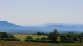
A lovely circuit in Île Crémieu with a visit to the Lemps Pond nature reserve. This circuit is open to all and presents no difficulty.
Torcieu - Mont Charvet - Château des Allymes - Croix des Moines
 12.03 mi
+3,458 ft
-3,445 ft
8h 35
Difficult
Departure from Torcieu (Ain)
12.03 mi
+3,458 ft
-3,445 ft
8h 35
Difficult
Departure from Torcieu (Ain)
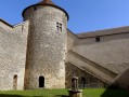
The proposed route, which is almost circular, provides access to the Château des Allymes from Torcieu.
This is a somewhat challenging hike with two distinct sections:
- steep sections above Torcieu (requiring the use of your hands at times),
- long stretches with a series of ascents and descents without excessive gradients.
Most of the route is through woodland (with limited views).
Walking poles are recommended, especially in wet conditions.
Croix des Moines, Mont Charvet, Mont Luisandre and Allymes from Torcieu
 12.70 mi
+3,704 ft
-3,704 ft
9h 05
Difficult
Departure from Torcieu (Ain)
12.70 mi
+3,704 ft
-3,704 ft
9h 05
Difficult
Departure from Torcieu (Ain)
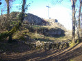
A circular route through the Bugey and its forests, featuring two steep and rugged sections to climb from Torcieu via the Rochers des Moines and descend towards the end along the ridge of the Rocher de la Cha area. The rest of the route is through woodland and unchallenging but relatively long, with a series of ascents and descents. The view from Mont Luisandre is sweeping, and this circular route allows you to visit two of the castles on the so-called “Four Castles” route.
On the Cleyzieu plateau in the Bugey region
 11.28 mi
+2,087 ft
-2,087 ft
7h 00
Difficult
Departure from Torcieu (Ain)
11.28 mi
+2,087 ft
-2,087 ft
7h 00
Difficult
Departure from Torcieu (Ain)
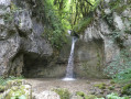
This walk offers a lovely route across the Cleyzieu plateau, starting from Montferrand (Torcieu).The main challenge is the climb up to the Grottes du Crochet, where you’ll need to be careful in wet weather (trekking poles recommended).Given the length of the route, the walk has been classified as ‘Difficult’.