


 Country:
 City:
City:


(S/E) From Place duLnt Giraud in Meximieux, in front of the post office, head north-west towards Place duGal Davison, then Place Blonay. Take Avenue du Dr Berthier on the right, then, 30 metres further on, turn left onto Rue du Fouilloux towards the cemetery.
(1) Leave the cemetery on your left and take the path leading to the pond. Go through the barrier blocking access to cars. Follow the path down to the stream.
(2) Carry your mountain bike to cross the stream via the bridge. You can wade across if the water is shallow. Head back up and turn left, heading south, onto the tarmac ‘Sous la Grace’ track.
(3) Take the Route de Trévoux on the right for 350 metres.
(4) Turn left onto the road to Bourg-Saint-Christophe and follow it for 650m.
(5) Take the dirt track on your right. The track runs straight ahead and is a bit tricky to spot. Then turn left and then right. The path becomes very, very steep for 200 metres, then levels out a little afterwards.
(6) At the top of this steep section, turn left. Head back down to the track, which you’ll follow northwards.
(7) After a climb of about 200 metres, keep to the left, heading west. For almost 3.5 km, there is no change in direction. You will pass through a small hamlet and then cross ‘our’ stream: Le Cottey.
(8) Take the first path on the left, heading south, after crossing the stream. The path is pleasant, with a gentle slope for almost 3 km until you reach the Chemin de la Grande Cote. Pass under the power lines.
(9) Turn left onto the D84b road and follow it for 700 metres.
(10) At the junction, turn right heading south for 550 metres to avoid the main roads.
(11) Turn left onto the Chemin du Verfay and follow it for 260 metres.
(12) Turn right onto Grande Rue, continuing as far as Bressole Church.
(13) Then turn left onto the ‘Chemin de la Plaine’. The path descends steeply, taking you round a hairpin bend and then under a high-voltage power line.
(14) Be careful not to miss the path on the left, heading north-east. Then turn right onto a rather steep descent, and head up the path opposite, ignoring the one branching off to the left. The climb is very steep, for about 150 metres.
(15) Take the path on the left. Continue straight on at the junction with the ‘Route du Cruisseau’ until you reach the centre of Béligneux.
(16) Turn left onto the Route de Bourg-Saint-Christophe for 100 metres, pass the church and turn right behind it towards Meximieux via the D1084. Join the D1084.
(17) Turn left onto the D1084 and pass under the motorway bridge. Take the first track on the right, heading south-east. Level crossing.
(18) Do not cross back over the motorway, but stay on the farm track that runs alongside it. Follow this track for 2.2 km to the ‘Croix Tombée’, passing under the power lines.
(19) Turn left, then right. The track used to be tarmac-surfaced, so it’s easier to walk on. Carry on straight ahead, heading north. Take care at around 1 km.
(20) Join the road on the left and leave it 30 metres further on by turning right, then carry on straight ahead.
(21) Take the Chemin de la Rouge on the right for 400 metres to join the D65b.
(22) Turn left until you reach the roundabout. Take thethird exit. Pass the station’s ‘drop-off point’.
(23) Go through the underpass to cross the tracks. At the end of the underpass, turn right heading north-east. Then turn left onto Rue de la Gare. At the roundabout, turn right to reach the post office (S/E).



 Visorando Member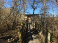
 Moderate
 Easy
Easy 
