Montferrand, Cleyzieu, Mont de l’Ange circular loop

A lovely walk, starting from Montferrand, which will take you through two villages: Cleyzieu and Mont de l'Ange. Be prepared for a few sections along the riverbank.

Details

n°58503215
Creation:
Last update:
Last review:
  • Walking
    Activity: Walking
  • ↔
    Distance: 8.20 mi
  • ◔
    Average duration: 5h 15 
  • ▲
    Difficulty: Average

  • ⚐
    Back to start: Yes
  • ↗
    Ascent: + 1,690 ft
  • ↘
    Descent: - 1,667 ft

  • ▲
    Highest point: 2,382 ft
  • ▼
    Lowest point: 892 ft

Description of the walk

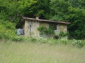
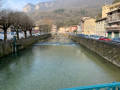
Park in the car park next to the railway line, a short distance from the village of Montferrand, right by the River Albarine.

(S/E) Walk to the centre of the village; at the wash house, take the tarmac road opposite on your right, which leaves the village and runs alongside the railway line on the right. You’ll reach a crossroads immediately after a gate leading to a farm field.

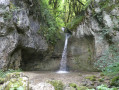
(1) Take the left-hand path, marked in yellow. Walk alongside the meadows until you reach the small stream, the Leat Ravinet, very close to the Cascade du Pissoir. You can make a detour to see this waterfall.

(2) Cross this stream, then continue to the right along the yellow-marked path, passing close to the Grotte du Pissoir. Cross the river over the stones – please note: in the event of heavy rain, the crossing may be difficult. Continue uphill through the forest, then, after a few hairpin bends, reach a quiet road.

(3) Turn right onto this road and follow it. Before reaching the village of Dorvan, you’ll come to a crossroads of footpaths.

(4) Leave the road and the yellow markings on your right, and turn left downhill onto this forest track. You’ll reach a bridge over a stream.

(5) Cross the bridge and continue until you reach the Leat Ravinet.

(6) Continue along the leat, alternating between its left and right banks. You’ll reach a Y-junction at a place called Le Muret.

(7) Turn left here, crossing the river. Head up the path alongside grazing meadows. You’ll come to a large, old wash house, below the village of Cleyzieu, with a sewage treatment works nearby.

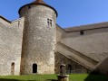
(8) Continue uphill to reach the centre of the beautiful village of Cleyzieu, passing in front of the church.

(9) Head towards Mont de l’Ange, as indicated on a sign, by taking a small road on the right as you leave the village after the church. You’ll reach a hairpin bend.

(10) Here you have two options:
- turn left and continue downhill to reach the village of Mont de l’Ange directly via the yellow-marked path,
- take the path opposite – this is the route shown on the map – and then rejoin the road. You’ll come to a three-way junction.

(11) Turn right, then take the path that follows it, keeping to the right. Enter the woodland and continue slightly uphill until you reach a T-junction at the highest point.

(12) Take the path on the left, head downhill and reach the edge of the woods at a place called Golet de Pètrement. Turn left and follow the edge of the woods. You’ll then come to a wider track, followed by the road at Creux de Lent.

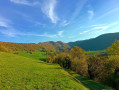
(13) Ignore the road here and take the path on the right. Cross the meadows. Continue across the open plateau, with beautiful, vast meadows stretching across the whole plateau. At a three-way junction in the path, keep left to reach the top of the Rochers de la Falconnière, at the Balcon de la Falconnière viewpoint.

(14) Walk along the top of the cliff, though it is quite a distance from the edge. Carry on until you leave the edge of the meadow. Join a wide path leading down into the forest. Follow this long, gently sloping path, which winds to the left, to reach the village of Mont de l’Ange.

(15) Walk through the village, reach the D60, then take the shortcut opposite which brings you back onto the road about a hundred metres further on. Then turn left onto it and follow it to the Montferrand car park (S/E).

Waypoints

  1. S/E : mi 0 - alt. 919 ft - Montferrand car park - Albarine (rivière)
  2. 1 : mi 0.45 - alt. 892 ft - Barrier
  3. 2 : mi 0.67 - alt. 951 ft - Pissoir Waterfall. Passage close to the - Grotte du Pissoir (Torcieu)
  4. 3 : mi 1.22 - alt. 1,339 ft - D60
  5. 4 : mi 1.84 - alt. 1,703 ft - Crossroads before Dorvan
  6. 5 : mi 2.01 - alt. 1,657 ft - Bridge over the river in the forest
  7. 6 : mi 2.28 - alt. 1,476 ft - Leat Ravinet
  8. 7 : mi 2.68 - alt. 1,555 ft - Bridge
  9. 8 : mi 3.07 - alt. 1,768 ft - Large wash house
  10. 9 : mi 3.37 - alt. 1,936 ft - Cleyzieu - Église Saint-Martin (Cleyzieu)
  11. 10 : mi 3.6 - alt. 2,014 ft - Junction (alternative route)
  12. 11 : mi 3.87 - alt. 2,169 ft - Circular forest loop junction
  13. 12 : mi 4.31 - alt. 2,382 ft - High point
  14. 13 : mi 5.16 - alt. 2,192 ft - Creux de Lent
  15. 14 : mi 5.82 - alt. 2,077 ft - Balcon de la Falconnière
  16. 15 : mi 6.9 - alt. 1,499 ft - Mont de l’Ange
  17. S/E : mi 8.2 - alt. 919 ft - Montferrand car park

Notes

Make sure you wear shoes suitable for walking in water, as the path runs alongside the bed of a small river.

Worth a visit

(9) Village of Cleyzieu.
Between (13) and (14), on the left in the middle of the meadow, right at the foot of a tree, lies the Gouffre de Lent; it has been sealed off for safety reasons.
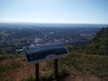
Between ::14: and after the Balcon de la Falconnière: a viewpoint on the right, offering a panoramic view from the edge of the cliff over the Albarine valley towards Saint-Rambert. Please note: this is a dangerous viewpoint; do not approach the edge.
(15) Mont de l’Ange: head here to discover the little bakery right in the centre of the village.

Reviews and comments

3.3 / 5
Based on 4 reviews

Reliability of the description
3 / 5
Ease of following the route
3 / 5
Route interest
4 / 5
mcordon
mcordon

Overall rating : 4 / 5

Date of your route : Dec 13, 2025
Reliability of the description : ★★★★☆ Good
Ease of following the route : ★★★★☆ Good
Route interest : ★★★★☆ Good
Very busy route : No

We followed the previous advice, namely to go from point 11 to 13, as the circular presents problems (undergrowth, no path).
Otherwise, it was a lovely walk with beautiful views. We just had a little trouble finding the path when crossing the stream.

Machine-translated

pjgrange
pjgrange

Overall rating : 2.7 / 5

Date of your route : Sep 01, 2025
Reliability of the description : ★★☆☆☆ Disappointing
Ease of following the route : ★★☆☆☆ Disappointing
Route interest : ★★★★☆ Good
Very busy route : No

Brambles and vegetation had invaded the path (which we guessed) at point 12. After persevering for a hundred metres or so in an attempt to find clear ground, we turned back to point 11 and went directly to point 13 without completing the proposed loop.
After point 15, you have to cross the road. The path also becomes very difficult here. But by persevering, some of us managed to reach the road further down... without following the route on the map.
Paul Grange

Machine-translated

User 3285024

Overall rating : 4 / 5

Date of your route : Aug 07, 2025
Reliability of the description : Not used / Not applicable
Ease of following the route : Not used / Not applicable
Route interest : ★★★★☆ Good
Very busy route : No

Hello
we did the tour yesterday, 7 August. When we got to point 12, we turned onto a path on the left. We found ourselves between two rows of newly planted trees and had difficulty getting through. After about 10 minutes, we were stuck because there was no path and we couldn't move forward due to the vegetation
This definitely needs to be reviewed when going from point 11 to point
Best regards
Alain Laplace

Machine-translated

Aga157
Aga157
• Edited:

Hello
Thank you for your comment. This is thefirst walk I’ve posted on Visorando. It’s true that the final section after the village of Mont de l’Ange has recently been altered due to work on a new power line. However, the path still exists in that area, which is currently under construction. There’s often local council or forestry work that disrupts the paths; generally, these areas are kept clear, but in this case, as it’s a small, unmarked path that cuts across a bend in the road, it hasn’t been protected.
In any case, you were very brave to go for a walk in this sweltering heat.
Enjoy your future walks! :-)

Machine-translated

Francis3001
Francis3001

Overall rating : 3.3 / 5

Date of your route : Aug 11, 2024
Reliability of the description : ★★★☆☆ Average
Ease of following the route : ★★★☆☆ Average
Route interest : ★★★★☆ Good
Very busy route : No

A lovely walk, very pleasant in the August heat as it’s very shaded. However, the route is rather poorly marked, with a few tricky spots to find. The end of the walk is very tedious after the village of Mont de l’Ange, as you find yourself on a path that’s been badly damaged by the laying of a power line. The final stretch, along the road, is also completely uninteresting. I wouldn’t recommend this to families with young children.

Machine-translated

Other walks in the area

For more walks, use our search engine .

The GPS track and description are the property of this route's author. Please do not copy them without permission.