


Refine your search for walks in Saint-Maclou
Saint-Maclou walks


 Around Saint-Maclou and Foulbec
 Visorando Member
 7.74 mi
 +535 ft
 -545 ft
 4h 00
4h 00
 Moderate
 Departure from Saint-Maclou (Eure)
A walk alongside racehorses through the countryside and along forest paths.
The Risle Maritime starting from Saint-Sulpice-de-Grimbouville
 7.12 mi
+367 ft
-367 ft
3h 35
Moderate
Departure from Saint-Sulpice-de-Grimbouville (Eure)
7.12 mi
+367 ft
-367 ft
3h 35
Moderate
Departure from Saint-Sulpice-de-Grimbouville (Eure)
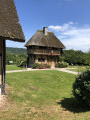
A walk through the Risle Maritime Marsh Sensitive Natural Area, then along the River Risle and the Pont-Audemer ponds, finishing with a slightly hilly stretch through the Bois d’Aubigny, home to majestic beech trees.
Amateur birdwatchers will be able to observe – and, above all, listen to – a wide variety of birds, ranging from small passerines to the majestic stork. Aubrac cows with their enormous horns graze peacefully in the marsh all year round; you may spot them from a distance.
Walk suggested by the Honfleur Terre d’Estuaire Tourist Office https://www.ot-honfleur.fr/
Risle Valley: Toutainville Ponds
 2.99 mi
+16 ft
-16 ft
1h 25
2.99 mi
+16 ft
-16 ft
1h 25
 Easy
Departure from Toutainville (Eure)
Easy
Departure from Toutainville (Eure)
A short, completely flat walk amongst the ponds of Toutainville.
 The young stork takes flight: a short tour of the Marais Vernier
 12.61 mi
+66 ft
-66 ft
1.5 hrs
Easy
Departure from Marais-Vernier (Eure)
12.61 mi
+66 ft
-66 ft
1.5 hrs
Easy
Departure from Marais-Vernier (Eure)
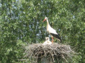
The stork has become the marsh’s iconic symbol: when the young stork takes flight from its family nest, it discovers this unspoilt natural landscape as it circles this ancient circular bend of the Seine, nestled within a vast amphitheatre of greenery. With its wet meadows stretching as far as the eye can see and its pretty thatched cottages, the Marais Vernier offers a landscape unique in Normandy that invites you to take a stroll, particularly in spring when the apple trees are in bloom.
The Route des Chaumières starting from Bouquelon
 8.29 mi
+623 ft
-597 ft
4h 20
Moderate
Departure from Bouquelon (Eure)
8.29 mi
+623 ft
-597 ft
4h 20
Moderate
Departure from Bouquelon (Eure)
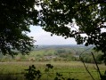
Starting from Bouquelon church, take a long descent along a wooded path, then follow the Route des Chaumières along the Marais Vernier, finally returning via the Bois du Plessis.
Secret walk to the Fontaine Caillou
 4.33 mi
+456 ft
-472 ft
2h 25
Easy
Departure from Fiquefleur-Équainville (Eure)
4.33 mi
+456 ft
-472 ft
2h 25
Easy
Departure from Fiquefleur-Équainville (Eure)
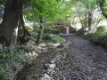
Far from the modern world, a small valley hidden between meadows and forest reveals an intimate and authentic Normandy, with magnificent trees, sunken paths, fresh springs, typical thatched cottages and rolling landscapes. This route is not marked, hence its name "secret walk": geolocation is therefore recommended.
Route de Quetteville, on the border between Calvados and Eure
9.19 mi
+623 ft
-620 ft
4h 45
Moderate
Departure from Quetteville (Calvados)
A lovely walk on the border between two departments in Normandy.
Hamlets and marshes along the Seine and Risle rivers
 12.80 mi
+610 ft
-581 ft
6h 25
Moderate
Departure from Berville-sur-Mer (Eure)
12.80 mi
+610 ft
-581 ft
6h 25
Moderate
Departure from Berville-sur-Mer (Eure)
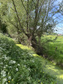
Near Honfleur in Normandy, along the Seine estuary and in the bocage, a hike of about 20 km on trails with majestic panoramic views.
From the banks of the Risle to the hillside of Manneville
 5.92 mi
+400 ft
-423 ft
3h 05
Easy
Departure from Manneville-sur-Risle (Eure)
5.92 mi
+400 ft
-423 ft
3h 05
Easy
Departure from Manneville-sur-Risle (Eure)
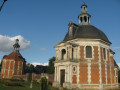
From the banks of the Risle, which have been developed for walking, to the forest bordering the valley, this varied route links the residential village of Manneville and the town of Pont-Audemer. It offers a lovely walk in Normandy between town and country, with interesting heritage sites and beautiful views.
The route is not signposted in its entirety (geolocation recommended with Visorando) but is based in part on theGR® 224 and the yellow-marked Chemin des Résistants.
Chemin de la Fosse aux Loups from Selles
3.24 mi
+390 ft
-377 ft
1h 50
Easy
Departure from Selles (Eure)
This very hilly and shaded circuit, between forests and hedgerows, will allow you to discover the Saint-Laurent spring and numerous yew trees. The route follows a well-marked blue PR® trail that you can rely on.
Walk in the Véronne valley
 4.97 mi
+495 ft
-502 ft
2h 45
Easy
Departure from Campigny (Eure) (Eure)
4.97 mi
+495 ft
-502 ft
2h 45
Easy
Departure from Campigny (Eure) (Eure)
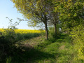
In Normandy, in the countryside near Pont-Audemer, there is a valley that has been preserved from urbanisation. The Véronne valley is ideal for walking along its sunken paths, which offer beautiful rural landscapes, natural sites of great beauty and interesting examples of built heritage.
This unmarked route crosses three official marked routes: one light blue route starting from Campigny (CY), one yellow route and one dark blue route starting from Saint Martin Saint Firmin (SM).
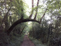
A walk as green as an orange.
 3.97 mi
+377 ft
-381 ft
2h 10
Easy
Departure from Fourneville (Calvados)
3.97 mi
+377 ft
-381 ft
2h 10
Easy
Departure from Fourneville (Calvados)
Near Honfleur, the little river called the Orange flows through a preserved valley. The paths run through a landscape of meadows enclosed by hedges with beautiful half-timbered houses, a true essence of Normandy.
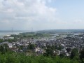
The Chapel of Notre-Dame-de-Grâce in Honfleur
 3.15 mi
+299 ft
-299 ft
1h 40
Easy
Departure from Honfleur (Calvados)
3.15 mi
+299 ft
-299 ft
1h 40
Easy
Departure from Honfleur (Calvados)
Take a stroll around Honfleur, with its charming harbour and churches, and climb up to the beautiful Notre-Dame-de-Grâce chapel, which offers stunning views of Honfleur, Le Havre, the mouth of the Seine and the Pont de Normandie bridge.
Grand Tour of Honfleur
 3.94 mi
+299 ft
-299 ft
2h 05
Moderate
Departure from Honfleur (Calvados)
3.94 mi
+299 ft
-299 ft
2h 05
Moderate
Departure from Honfleur (Calvados)
This walk, almost in the town centre, aims to show you the main points of interest in Honfleur.
The Véronne Trail
5.55 mi
+453 ft
-469 ft
3h 20
Easy
Departure from Saint-Étienne-l'Allier (Eure)
You’ll be charmed by this refreshing walk, which offers numerous panoramic views of the Véronne valley, which has retained its traditional landscape of meadows enclosed by hedgerows and embankments, with its sunken paths lined with trees that are sometimes spectacular. The route crosses the Véronne (a tributary of the Risle) and follows the river several times; we are truly on the ‘waterways’.
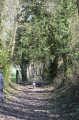
Chemin de l'Aubertine
 5.52 mi
+66 ft
-66 ft
2h 35
Easy
Departure from Lieurey (Eure)
5.52 mi
+66 ft
-66 ft
2h 35
Easy
Departure from Lieurey (Eure)
2 possible routes: a short one of 4 km or a long one of 9 km.
Set in the heart of the bocage countryside, this route is bordered for nearly 60% of its length by embankments and hedgerows that form a well-preserved bocage landscape. Easy and flat, this route offers a lovely walk through typical Normandy countryside, amidst meadows and fields.