Country:
 City:
City:


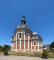
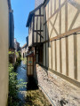
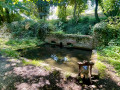
Park in the car park between the church and the school in Fourmetot.
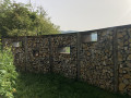
(S/E) Head south along the path leading from the car park, which runs alongside the village hall, then turn right downhill to join the Route de la Croisée. Take the road on the left, pass a rough-hewn stone gate on the right-hand side and continue to a junction.
(1) Follow the narrow ‘Sentier des Écoliers’ on the left until you reach a crossroads.
(2) Turn left and walk for about 100 m. Then head right onto the path which leads further into the woodland and comes out at a crossroads on the edge of the woods.
(3) Take the Sente Sagan on the right and walk for about 1 km until you reach the Route du Hameau Thomas. Continue straight on.
(4) Follow the Impasse de la Prévôté to the left, then the Chemin de la Prévôté, again to the left, and carry on until you reach a T-junction.
(5) Turn left onto Chemin de la Butte Cavellier. Carry on straight ahead, cross Route du Chemin de Rouen and take a short first turn left then right to enter the cul-de-sac.
(6) Take the Chemin de la Mare Saussaye on the right and walk for about 400 m until you reach the junction with the Route du Houx Gaillard.
(7) Take this road to the left, then, once you’re directly opposite the power line, turn left again, following the GR®224. You’ll reach the Marettes buildings.
(8) Head to the right. Join the Chemin du Mont Perrot and follow it in the same direction until you reach the junction with Rue Clairville.
(9) Turn left, cross Rue de Saint-Laurent then Rue Charles Gabet and enter Impasse des Violettes. Once at the end, take the path leading down towards Rue des Courts Vals. Join Route de Fourmetot by turning right onto Rue des Courts Vals for a few metres.
(10) Carefully cross Route de Fourmetot and take Impasse des Fougères opposite, which passes the Corneille-sur-Risle picnic area. After about 600 metres, the path turns sharply right and leads onto Chemin de la Herche. Take the path on the left, head down towards the D675 and cross it at the pedestrian crossing opposite the restaurant. Then take the Chemin du Boulangard, situated slightly to the left of the restaurant, and head down to the junction with the Chemin de la Vierge.
(11) Turn left towards the Ruelles neighbourhood, walk for about 700 m, then turn right onto Rue du Lavoir and cross the two bridges over the Risle. Continue along Rue des Douves, passing the former Le Foll factory on your left, and carry on straight ahead along Route de la Fontaine Noyer until you reach Route de Condé (D39).
(12) Cross it carefully to reach the embankment on the opposite side, which marks the boundary of a disused railway line. Climb up the embankment, cross the overgrown railway tracks to reach a path. Take this path to the right and, after about 150 m, turn left onto a long climb which starts in a straight line and then continues to the right with a 90° bend. Continue to the junction with the Chemin de la Pierre Plate.
(13) Turn left and continue straight on until you reach the junction with the Route de la Haute Voie, at a place called La Viéville.
(14) Turn right to join the GR®224. Cross the three-way junction with care, then continue straight on along the Chemin de Monteney (GR®224). Keep to the right at the three-way junction and continue on the GR®224 to reach Saint-Paul-sur-Risle.
(15) First turn left then right, and turn left at the next junction to follow the Chemin du Milieu, staying on the GR®224.
(16) Cross the footbridge over the Véronne, turn left onto the Chemin des Hautes Planches and continue straight on until you reach the junction with Rue Jean Joly.
(17) Follow this street to the right towards Pont-Audemer, then continue straight on along Rue de la Roquette until you reach Route de Lisieux (D139).
(18) Take this road to the right until you reach the roundabout on Avenue Georges Pompidou.
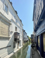
(19) Turn left to reach a second roundabout, cross at the pedestrian crossing and arrive at Place du Pot d’Étain. Take Rue Gambetta, veering slightly to the left, cross Place Victor Hugo and continue along Rue Thiers, which crosses the River Risle. Join Rue de la République with the Church of Saint-Ouen on your right.
(20) Turn left onto Rue de la Place de la Ville, then right onto Rue Sadi Carnot with its mansions. Turn right onto Rue Clémecin with its small stone bridge spanning a canal. Then turn left onto Rue de la République to reach the Pont de Rouen, which crosses the River Risle. Carry on straight ahead to Place de Verdun, then turn right onto Route de Quillebeuf until you reach the junction with Rue Louis Leble.
(21) Turn left to follow this street and head uphill until you rejoin Route de Quillebeuf. Cross the road at the pedestrian crossing, then follow it to the right until you reach the bend. Leave the road to take Sente du Petit Val, slightly to the left, and continue to the junction with Rue des Bois Fréville.
(22) Turn right, then turn right again at the ‘Hauts Vents’ junction to join the road of the same name.
(23) Take the road on the left and follow it until you reach a roundabout just past the town hall in Manneville-sur-Risle.
(24) Carry on straight ahead along the Chemin de la Futaie de Bonnebos, passing the Bonnebos Chapel on your left. Continue straight on along this path, then follow the Allée de la Hêtraie until you reach Saint-Denis Church.
(25) Turn right onto the Chemin de la Forge au Cœur and carry on until you see a forest track branching off to the left.
(26) Turn left onto this forest track towards Houx Gaillard, which runs between La Sapinière and La Côte de Hudar. You’ll come out onto Route du Hudar; carry straight on until you reach the three-way junction.
(27) Carry on straight ahead, leaving the Route de la Sablière on your right; continue for about 200 metres, then turn right onto Impasse Vorillon until you reach the Route du Houx Gaillard.
(28) Turn left onto it, cross the junction and continue along Route de la Ferme des Portes until you reach the turn-off for Impasse du Caillou Blanc, which branches off slightly to the left.
(29) Turn left, cross Route du Auzoux and carry on straight ahead to reach Impasse de la Mare.
(30) Turn right, reach the Route de la Croisée and turn left to follow this road to the car park (S/E).
 Visorando Member
 Easy
Easy 
 Moderate
 Tourist office