Country:
 City:
City:


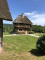
The starting point for this walk is in front of the striking town hall in Saint-Sulpice-de-Grimbouville; there is a car park on the other side of the RD312.
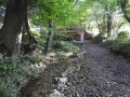
(S/E) Take the path leading downhill which skirts a meadow behind the town hall, towards the wash houses. After the covered walkway, turn right, cross the wooden footbridge and continue along a grassy path.
(1) At the junction, ignore the path to the left and carry on straight ahead along a stony, carriage-accessible track lined with trees.
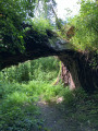
(2) Cross the wooden footbridge on the right marked with a Blue Cross and a Red Cross and White Cross, then turn left immediately onto a grassy path between two fences. After the next footbridge, keep left and cross another wooden footbridge, then continue along a path through the woodland. Leave a small path on your left and carry on following the yellow markings; go through a metal gate to reach the River Risle. Take care – the path is narrow and runs close to the riverbank!!!
(3) Turn right to follow the river upstream for 3 km along a grassy path that is rather poorly maintained and little used in its first section.
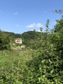
(4) Cross the metal footbridge and look out for the Château de Saint-Mards-sur-Risle on the opposite bank of the Risle, up on the hillside. Pass under the motorway and continue along the river on a wide, well-maintained grassy path.
(5) At the end of this path, at the corner of the campsite, turn right onto the Route des Étangs. Cross the road and follow the yellow signposting by taking the stony path opposite, which runs alongside the campsite on your right, then past the Pont-Audemer ponds on your left.
(6) Pass the sailing club on your left and take the wooden-paved path through the woodland. At the end of this path, turn left, continuing to follow the yellow markings, then turn right onto the path lined with fences to reach the pond.
(7) Retrace your steps for a few metres to take the path on the right. Then turn left, leaving the two paths on your left behind, and walk alongside the lake on your left along a shaded path which leads to the lakeshore.
(8) Go through the gate on the right, cross the railway line and take Rue Grestain, the first street on the right. Continue to the end of this road, which crosses the railway line again. Once at the end, head up to the left along Rue du Vieux Merisier, which branches off to the right further on and leads to Rue des Étangs. Take this road to the left, then, at the Stop sign, turn right to go under the motorway. Take care in this area, as traffic is heavy and there is a motorway exit.
Go round the roundabout on the right and take the first street on the right after the motorway toll station, then walk alongside the football pitch on your left. Turn left onto Chemin de la Fière, which runs between the football pitch and the playground.
(9) Leave the Impasse du Moulin on your right and take the uphill road which, at the next junction, becomes the Chemin de la Couture. Join the RD312, cross it carefully and take the Chemin du Bois d’Aubigny (GR®), which is slightly to the left, to reach the forest.
(10) Enter the forest and turn right to follow the steeply sloping path which joins a road at the hamlet of Fine Mare. Take this road to the right and follow it until you leave the hamlet.
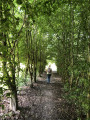
(11) After the last house, head straight down to the right along the small path through the woodland, then turn left twice to follow the gently ascending path.
(12) Take the first path on the right to leave the woods and join the Chemin du Calvaire, then the D312. Follow the departmental road to the left without crossing it and head for the car park (S/E).

 Visorando Member
 Easy
Easy 


 Difficult