Mont Rôti in Saint-Georges-de-Vièvre

On the hills near Pont-Audemer and Bec-Hélloin Abbey in the Risle Valley,
on a clear day you can see the Seine estuary in the distance.

Details

1788011
Creation:
Last update:
Last review:
  • Walking
    Activity: Walking
  • ↔
    Distance: 6.00 mi
  • ◔
    Average duration: 3h 10 
  • ▲
    Difficulty: Easy

  • ⚐
    Back to start: Yes
  • ↗
    Ascent: + 440 ft
  • ↘
    Descent: - 430 ft

  • ▲
    Highest point: 620 ft
  • ▼
    Lowest point: 410 ft

Description of the walk

Set off from the campsite car park, on the outskirts of Saint-Georges-du-Vièvre.

(S/E) With your back to the village, continue along the road (D38). You will reach a Fork in the road.

(1) Turn left onto the road heading towards the woods and running alongside them. You’ll reach a clearing.

(2) Look for a path on the left marked in blue. Take this path and descend gradually through the woods towards the valley. You’ll reach a small road (D47).

(3) Turn right onto it. Cross a small stream via the bridge. Continue along this road to the hamlet of Le Buet, at the bottom of a charming little valley.

(4) Take the road on the right. At the next T-junction, turn right again onto the blue-marked path, which climbs gradually back up to the woods. You’ll rejoin the D38.

(5) Follow it to the left. Stay on this road until you reach a crossroads with a cross.

(6) Turn right onto the road. Cross the Bois du Mont Rôti to reach another junction at the edge of the woodland.

(7) Turn right onto the path, which is still marked in blue, and walk along the edge of the woodland. Continue along a small track near the hamlet of La Capelle, at the top of Mont Rôti (one of the highest points in the Eure department).

(8) At the first junction, turn right towards the mast at the summit of the hill, from where you can see the other side of the hill.

(9) Return to the previous junction.

(8) Turn right back onto the road and you’ll soon reach the first junction.

(1) Return to the campsite car park (S/E) via the same route as on the way there.

Waypoints

  1. S/E : mi 0 - alt. 486 ft - Car park at the Saint-Georges-du-Vievre campsite
  2. 1 : mi 0.24 - alt. 495 ft - Crossroads of the circular loop
  3. 2 : mi 0.81 - alt. 591 ft - Start of the blue-marked trail
  4. 3 : mi 1.24 - alt. 459 ft - Road junction
  5. 4 : mi 1.93 - alt. 492 ft - Le Buet crossroads
  6. 5 : mi 2.72 - alt. 561 ft - Junction with the D38
  7. 6 : mi 3.44 - alt. 449 ft - Crossroads
  8. 7 : mi 3.92 - alt. 587 ft - Crossroads: path marked in blue
  9. 8 : mi 4.94 - alt. 584 ft - Summit of Mont Rôti
  10. 9 : mi 5.08 - alt. 607 ft - Pylon
  11. S/E : mi 6 - alt. 486 ft - Car park at the Saint-Georges-du-Vievre campsite

Notes

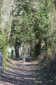
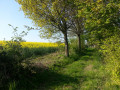
The route, which is easy and pleasant, alternates between footpaths and quiet country lanes.

Worth a visit

(8) In fine weather, enjoy the view over the Seine estuary. A sign indicates that the Germans set up an observation post here during the war.
Visit Bec-Hélloin Abbey, a few kilometres away in the pleasant Risle Valley.
This is a Benedictine abbey founded in the early11thcentury and restored in the18th century.
It is still home to Benedictine monks and is open to visitors.

Reviews and comments

4.1 / 5
Based on 4 reviews

Reliability of the description
4.3 / 5
Ease of following the route
4.5 / 5
Route interest
3.5 / 5
noelja
noelja

Overall rating : 4 / 5

Date of your route : Jul 03, 2022
Reliability of the description : ★★★★☆ Good
Ease of following the route : ★★★★★ Very good
Route interest : ★★★☆☆ Average
Very busy route : No

In my view, the blue markings have been replaced by yellow ones (the blue ones are old, faded and hard to see)
There are far too many roads, even though they are rarely used and often run through woodland.
Going to point 8 is (in my view :-)) of no interest: there’s no better view on either side of the ‘Mont’.
The sign explaining the history of the observation post is, strangely enough, very poorly positioned; we nearly missed it…
It was a fine, clear day, but we couldn’t see the Seine estuary in the distance, and I doubt you can see it from the path… I think you’d need to climb a few metres higher, which is what the occupant did when building the raised observation post…
The paths through the woods, on the other hand, are very pleasant, with comparatively more flora and fauna than in the Montfort Forest.
Thanks to the author of this walk

Machine-translated

430MARTINE
430MARTINE

Overall rating : 4.7 / 5

Date of your route : Apr 10, 2021
Reliability of the description : ★★★★★ Very good
Ease of following the route : ★★★★★ Very good
Route interest : ★★★★☆ Good
Very busy route : Yes

A lovely walk.

Machine-translated

MXR876
MXR876

Overall rating : 4 / 5

Date of your route : Oct 07, 2020
Reliability of the description : ★★★★☆ Good
Ease of following the route : ★★★★☆ Good
Route interest : ★★★★☆ Good
Very busy route : Yes

a short, pleasant walk

Machine-translated

sbz761
sbz761

Overall rating : 3.7 / 5

Date of your route : Jul 27, 2019
Reliability of the description : ★★★★☆ Good
Ease of following the route : ★★★★☆ Good
Route interest : ★★★☆☆ Average

A lovely little walk in Normandy – quite pleasant, though there’s a bit too much road involved; that’s its only drawback.

Machine-translated

Other walks in the area

For more walks, use our search engine .

The GPS track and description are the property of this route's author. Please do not copy them without permission.