


Refine your search for walks in Saignelégier
Saignelégier walks


 Walk around the Étang de la Gruère
 Visorando Member
 2.01 mi
 +56 ft
 -56 ft
 1h 00
 Easy
 Departure from Saignelégier (Canton of Jura)
Situated at an altitude of 1,000 metres, the Étang de la Gruère was created as a result of peat extraction. Restored by the Jura government, this exceptional environment has become a nature reserve. Set amongst the magnificent pastoral landscapes of the Franches-Montagnes, the site offers a chance to escape into the very Scandinavian atmosphere of the pond and its surroundings. The route around the lake is extremely easy, and consists largely of a wooden boardwalk where you needn’t worry about mud.
Circular route via “Chez le Bolé” to Goumois
 7.51 mi
+2,369 ft
-2,343 ft
5h 30
 Difficult
Departure from Goumois (Canton du Jura) (Canton of Jura)
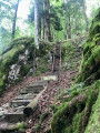
Circular hike starting from Goumois for a short but intense hike, mainly through woodland.
As you cross the bridge, look out for the Rocher du Singe on your left – it’s incredible.
The climb up to “Chez le Bolé” follows a challenging (but not dangerous) path – expect chains and ladders along the way!
Return via Muriaux, along lovely paths and some lovely, steep descents!
Vautenaivre millstream leat
 6.89 mi
+951 ft
-945 ft
4h 00
 Moderate
Departure from Goumois (Canton du Jura) (Canton of Jura)
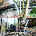
Coming from Goumois (Switzerland), park at the end of the Vautenaivre leat, next to a small rest area (with barbecue).
Les Sommêtres via La Goule
 9.04 mi
+2,254 ft
-2,267 ft
6h 05
Moderate
Departure from Le Noirmont (Canton of Jura)
This is a challenging walk, best done in dry weather, with a steady climb followed by a fairly technical descent through undergrowth with roots and stones.
Nature lovers will be delighted by the Doubs valley and its banks, the views from the Roches des Sommêtres and the architecture of the churches and houses in the village of Le Noirmont.
The banks of the Doubs, Les Chapelles and the Corniche de Goumois viewpoint
 13.42 mi
+2,320 ft
-2,320 ft
8h 10
Difficult
Departure from Damprichard (Doubs)
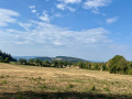
Set off to explore these magnificent trails, which are very pleasant along the River Doubs. The Leat d’Étoz and its Notre-Dame-des-Ermites Chapel, steeped in history and legend. Magnificent wooden sculptures in Urtière and its Saint-Roch Chapel. A walk through woodland, forest and meadows.
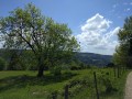
Damprichard on the banks of the Doubs
 8.85 mi
+1,949 ft
-1,952 ft
5h 45
Moderate
Departure from Damprichard (Doubs)
Views of the Chassera and the wind turbines in Switzerland, with the landscapes of the Haut Doubs.
Le Chasseral via Combe Grède and Dairy Farm de Morat from Villeret
11.29 mi
+3,442 ft
-3,432 ft
8h 10
 Very difficult
Departure from Villeret (Canton de Berne) (Canton of Bern)
Departure from Villeret in the Bernese Jura near Saint-Imier, climb via the Combe Grède, passing through Pré aux Auges, Les Limes, then along the ridge overlooking the Métairie de Morat facing the Chasseral, before reaching and following the ridge leading directly to the signal (television tower) and the summit of the Chasseral. The magnificent view from the summit ridge amply rewards hikers for their efforts on the climb, allowing them to enjoy, in particular, the three lakes (Biel, Neuchâtel and Morat) and the highest peaks of the Bernese Alps in good weather. The descent is via Pré aux Auges and the dairy farms of the Planes and Métairie aux Renards. A beautiful encounter on the descent, with a herd of chamois above the Métairie des Plânes.
Le Chasseral - Saint-Imier
15.10 mi
+4,347 ft
-4,350 ft
10h 45
Difficult
Departure from Villeret (Canton de Berne) (Canton of Bern)
The route forms a loop via the Métairie des Plânes, climbing the Combe Grède before reaching the Chasseral ridge to the east of the summit via the Métairie du Milieu.All the difficulties are behind you when you reach the summit, where you can enjoy a picnic. Return to the car park by descending via Les Limes and La Vieille Vacherie.
(i)User comment on 21 June 2025
On Thursday 19 June, when we set off from Villeret, the Combe Grède pass was closed due to rockfalls and fallen trees and therefore inaccessible. For more information, contact the tourist office in St-Imier or Villeret. >This passage to Chasseral can be bypassed from the start by taking the left-hand path towards Les Limes, Derrière, then Pré au Auges, where you come out at the Combe Grède exit. To return from the Hotel du Chasseral, the trail leads to the Métairie de St-Jean, then back to Pré aux Auges, where you head towards St-Imier and then Villeret.
The Crampoulotte, the Old Females and the Ladders of Death
 5.91 mi
+1,683 ft
-1,683 ft
4h 10
Moderate
Departure from Charquemont (Doubs)
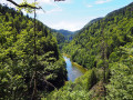
The ladders will probably be closed until autumn. Along picturesque, steep paths, winding through a jumble of mossy rocks, La Crampoulotte and its old ladies offer wild views of the Doubs valley. After a stop at the old charcoal kiln, you will walk along the peaceful banks of the river, a haven for ducks and fishermen. Then, facing the Échelles de la Mort (Ladders of Death), which turn out to be comfortable family stairs, you will make a sporty return via the evocative Couleuse aux Loups.
Circular Loop of the Échelles de la Mort via Le Refrain and the three belvédères.
 8.67 mi
+1,857 ft
-1,857 ft
5h 35
Moderate
Departure from Charquemont (Doubs)
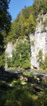
Superb hike in the Doubs Gorges offering magnificent panoramic views of the gorges and the surrounding Swiss Jura peaks. To get there, you will need to pass through the famous Échelles de la Mort, which are impressive but relatively easy to climb. Once you reach the ridge, you will go from the Cendrée viewpoint to the Vieilles Femelles viewpoint via the Crampoulotte viewpoint, before descending to the banks of the river via the magnificent Charbonnière du Haut site. The return journey is along a bucolic path with a pretty waterfall at the Ulysse bridge.
The Vieilles Femelles viewpoint
 5.11 mi
+1,243 ft
-1,230 ft
3h 25
Moderate
Departure from Charquemont (Doubs)
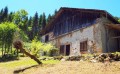
The ladders are likely to remain closed until autumn. From the ‘Ladders of Death’ to the ‘Old Ladies’, here are two places that evoke many poetic images. The ladders will prove to be comfortable, family-friendly staircases. As for these old ladies, they’ll offer you a wild view over the Franco-Swiss Doubs valley. Return via the peaceful riverbanks, a haven for ducks and anglers.
Banks of the Doubs, two magnificent viewpoints and the Grotte des Moines
 10.88 mi
+2,697 ft
-2,697 ft
7h 20
Difficult
Departure from Charquemont (Doubs)
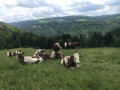
Set off to explore the banks of the Doubs, an old mill, the ruins of the Chapelle des Essarts Cuenot and two superb viewpoints: the Vieilles Femelles and the Échelles de la Mort. To finish, a lovely climb up to the Bois de la Biche to discover the Grotte des Moines and its ‘hidden’ box where you can leave a little note to say you’ve been there! Return via a magnificent path running alongside the banks of the Doubs.
Chasseral - Frinvillier
 11.34 mi
+571 ft
-3,875 ft
5h 45
Difficult
Departure from Nods (Canton de Berne) (Canton of Bern)
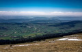
Ninth stage from Les Rousses to Lake Constance via the Jura ridges. At the summit of Chasseral, you pass close to the imposing 114-metre transmitter, a metal sentinel standing at an altitude of 1,606 metres, the highest point of this stage. From there, the trail levels out and takes you on a peaceful descent along the ridge, winding between large century-old trees and the typical pastures of the Bernese Jura, where the air is fragrant with alpine herbs. At an altitude of around 1,000 metres, the landscape narrows: you reach the steepest part of the route, where rocks jut out and steps carved into the stone bear witness to the steeper terrain. The view then opens up onto the Bernese Jura mountain range, before the path gently descends towards the steep-sided Schüss valley. The steady descent takes you to the charming village of Frinvillier, nestled in the valley. Here you will cross the Suze bridge, the final passage of this stage rich in contrasts and panoramic views.
The Réclère Caves
 8.60 mi
+1,772 ft
-1,781 ft
5h 30
Moderate
Departure from Montjoie-le-Château (Doubs)
From the castle ruins, you will climb up to the ledges where, like tightrope walkers from one border marker to the next, you will walk along the ridge line, neither in France nor in Switzerland. You will reach the Réclère Caves, considered the most beautiful in the world by the first explorers in 1886. From Journey to the Centre of the Earth by Jules Verne to Conan Doyle's The Lost World, you will squeeze between dinosaur feet. The return journey, via the old farmhouse at Montavon, will be less adventurous.
Short circular walk to the Grotte du Château de la Roche from Soulce-Cernay
 3.40 mi
+860 ft
-873 ft
2h 20
Moderate
Departure from Soulce-Cernay (Doubs)
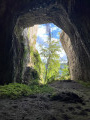
Discover a cave that was once temporarily transformed into a castle and has since become a paradise for cavers. A hike best enjoyed on fine summer days, making the most of the cool air of the Doubs Valley.
The Death Ladders from La Cendrée
 Association / Club / Walk leader
 5.20 mi
+1,772 ft
-1,795 ft
3h 55
Moderate
Departure from Charquemont (Doubs)
Beautiful views, a lovely setting and an unusual part of the hike, crossing the death ladders.
The Death Ladders
 7.11 mi
+1,739 ft
-1,739 ft
4h 45
Moderate
Departure from Charquemont (Doubs)
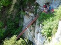
There are no danger points on these ladders. This site, steeped in history, bears witness to the fear once inspired by these legendary places, the scene of many fatal accidents during the "bricotte" (smuggling) era, when the ladders were nothing more than tree trunks crossed by pieces of wood. Today, these comfortable family staircases, which you can climb safely, will allow you to discover the Doubs Gorges from a variety of viewpoints.
The wild Biaufond valley with ladders, steps and footbridges
 11.21 mi
+3,261 ft
-3,248 ft
8h 00
Difficult
Departure from Fournet-Blancheroche (Doubs)
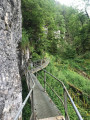
Set off to explore the Combe de Biaufond (in Switzerland) with its series of metal ladders, wooden staircases, fixed footbridges and bridges. Magical! Not recommended for those prone to vertigo. A mountain trail, therefore, difficult in places.
Then the Cerneux-Godat viewpoint and the Moulin de la Mort on the banks of the Doubs.
From a natural perspective, Biaufond’s main feature is its lake, which makes it a key wintering spot for the region’s waterbirds. But for everyone else, it is above all a magnificent destination for a walk and a meal by the water’s edge, at the crossroads of borders steeped in history.
Saint-Ursanne – La Caquerelle – Les Rangiers via Outremont
10.17 mi
+2,251 ft
-2,270 ft
6h 40
Difficult
Departure from Saint-Ursanne (Canton of Jura)
Climb to the Hermitage of Saint-Ursicinus, with access to two viewpoints over Saint-Ursanne, then continue along a signposted path towards the Outremont farm, the ridge and down to La Caquerelle. Optional round trip to the Col des Rangiers and the viewpoint from the CAS chalet. Descent to Saint-Ursanne across meadows, then cross the Doubs to enter the old town via the Pont Saint-Jean and the gate of the same name.
The Combe de Biaufond
 6.45 mi
+1,719 ft
-1,706 ft
4h 30
Moderate
Departure from Fournet-Blancheroche (Doubs)
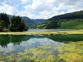
Are you only going to do one of these hikes? Then choose to explore this valley, a pure marvel! To start with, the Gorges du Doubs, which are full of sunny green beauty here. Then there are the light-filled forests towards Roche Guillaume and the mountain pastures, which overlook the valley. And the highlight: the Gorges de la Ronde, wild, lush and tropical in appearance, framed by high rocks, a world of stones, moss and ferns.
On Les Roches via Vacherie Dessus (Swiss Jura)
 8.79 mi
+1,467 ft
-1,463 ft
5h 20
Moderate
Departure from Chevenez (Canton of Jura)
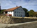
This is a beautiful hike that has the advantage of being in Switzerland, where hunting is closed on Sundays.
The upper part of the route is on a wide ridge with sunny pastures and a picnic area with two tables.
There are a few viewpoints on the north side overlooking the L'Ajoie plain with the Vosges mountains in the background.
On the other side, you can see the Haut-Doubs and the Jura mountains, including the famous Chasseral.
In between, there is plenty of nature to enjoy, with a good portion of the walk taking place in the shade of the trees, which is very pleasant in hot weather.
On the hills above Saint-Ursanne
5.46 mi
+860 ft
-853 ft
3h 15
Moderate
Departure from Seleute (Canton of Jura)
Discover Seleute, a small village nestled in the heart of the Swiss Jura, on a minor road serving small hamlets and farms on the hills above Saint-Ursanne, with beautiful views. Part of this walk takes place on roads.
Circular loop in the Clos du Doubs
 13.05 mi
+2,185 ft
-2,175 ft
7h 55
Moderate
Departure from Saint-Ursanne (Canton of Jura)
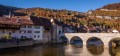
This hike begins in the magnificent medieval town of Sainte-Ursanne on the banks of the Doubs. I suggest you walk in the Clos du Doubs region, in the heart of the Swiss Jura. We will first head up to the hills, to the villages of Montenol and Epauvillers. The panoramic views here are stunning. You will gradually descend towards the Doubs, which winds its way between pastures and forests. The sound of the water, the tinkling of cow bells and the scents of the countryside will transport you to another world...
A circular route through the Val d’Ajoie and the Faux d’Enson, starting from Damvant
10.40 mi
+1,598 ft
-1,614 ft
6h 10
Moderate
Departure from Damvant (Canton of Jura)
Starting from the centre of Damvant, this figure-of-eight route follows the French-Swiss border, running alongside the Prehistoric Park and the Reclère Caves. The route passes through the charming village of Roche d’Or before climbing up to La Faux d’Enson and its panoramic tower. Return via the ridge forming the border before passing through the two Swiss farms at La Vaux and Montavon and returning via the entrance to the Reclère Prehistoric Park and Caves. In fine weather, there are stunning views as far as the Bernese Alps from the Faux d’Enson observation tower, as well as across the Doubs valley on the French side whilst following the border on the return journey.
The Réclère Caves (Swiss Jura)
 9.52 mi
+1,476 ft
-1,470 ft
5h 40
Moderate
Departure from Damvant (Canton of Jura)
Circular hike (figure of 8) with a shared section to the Réclère caves.
A visit to Saint-Ursanne
 2.35 mi
+453 ft
-433 ft
1h 30
Easy
Departure from Saint-Ursanne (Canton of Jura)
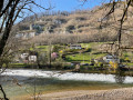
Starting from a free car park near the village, you’ll discover the town of Saint-Ursanne, the banks of the Doubs and the surrounding hills.
Saint-Ursanne - Glovelier
 10.76 mi
+2,014 ft
-1,795 ft
6h 40
Moderate
Departure from Saint-Ursanne (Canton of Jura)
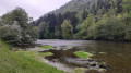
During this fourth stage, you will walk along the banks of the Doubs to Tariche. You will cross the Doubs on a self-service boat. Then you will follow a ridge overlooking the Delémont valley and the Doubs. You will take the very pleasant Combe du Bé to reach Glovelier.
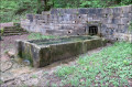
The Tante Airie cave and the Blamont fountains
 3.31 mi
+525 ft
-545 ft
2h 00
Easy
Departure from Blamont (Doubs)
A walk along the water, springs and fountains in the valleys surrounding the promontory of the ancient castle of Blamont. Discover the cave of Tante Airie, the legendary Mother Christmas of the Pays de Montbéliard.
A varied route on the Circuit des Bornes starting from Blamont
10.81 mi
+1,982 ft
-2,001 ft
6h 40
Moderate
Departure from Blamont (Doubs)
The section of the Circuit des Bornes between Blamont, Pierrefontaine-lès-Blamont and Villars-lès-Blamont takes in heritage sites, numerous water fountains, the Tante Airie cave, gun emplacements near Fort du Lomont, and then runs alongside the Franco-Swiss border with its boundary markers, as well as the source of the Creuse and its wash house. There may be views of the Chasseral and the Bernese Alps in good weather,