A visit to Saint-Ursanne

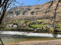
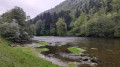
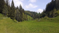
Starting from a free car park near the village, you’ll discover the town of Saint-Ursanne, the banks of the Doubs and the surrounding hills.

Details

7279859
Creation:
Last update:
Last review:
  • Walking
    Activity: Walking
  • ↔
    Distance: 2.35 mi
  • ◔
    Average duration: 1h 30 
  • ▲
    Difficulty: Easy

  • ⚐
    Back to start: Yes
  • ↗
    Ascent: + 453 ft
  • ↘
    Descent: - 433 ft

  • ▲
    Highest point: 1,726 ft
  • ▼
    Lowest point: 1,421 ft

Photos

Description of the walk

Car park near the Tourist Office, on the banks of the Doubs.

(S/E) From the car park, head for the road and turn left onto it, heading towards the roundabout.
When you reach the roundabout, take the bridge on the left, crossing the road.
Once you’ve crossed the Doubs, turn onto the first small path on the right, which leads down to a dirt car park. Carry on straight ahead, following the Doubs.

A little further on, at the junction of two paths (not shown on the map) near the watermill, turn left and continue along the river.
Carry on straight ahead until you reach a small street lined with symmetrical houses, the Clos de la Gindrée. At the end of this street, turn right.

(1) On your right is the Saint-Jean Bridge. Cross it and enter the old town. Walk a few steps until you find yourself facing the grand collegiate church.
Turn right, then immediately left to enter the collegiate church’s cloister. Once you’ve walked through it, head back the way you came.
Once in front of the collegiate church, carry on straight ahead alongside it, then take the first right to find the entrance to the monument.

(2) You can visit the collegiate church. On leaving, turn left then right. Go through the exit gate of the old town, then turn right onto Rue de la Cousterie.
After walking a good hundred metres, take the small path on the right leading to some steps, which you should then climb.

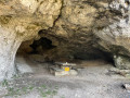
(3) You have now reached the Hermitage. After exploring the site, continue along the path, passing through a gate on the cliffside. Here begins a trail where you can read the legend of Saint-Ursanne from the information plaques dotted along the route.
Do not take the paths leading down to the town.

Walk past the cave and continue uphill to the next junction. Turn right to begin the descent.
Carry on straight ahead until you reach the Route de la Gare, which you should follow in the same direction, heading uphill.

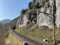
(4) Walk past the station. A little further on, the road bends to the left. Look out for a small path branching off to the right, which begins a descent beneath the railway viaduct. Take this path.
At the bottom of the stairs, turn right onto the pavement of the Route des Rangiers.
At the roundabout, go left (going round the roundabout as there is no direct pedestrian crossing) and head for the car park (S/E).

Waypoints

  1. S/E : mi 0 - alt. 1,430 ft - Maison du Tourisme car park - Doubs (rivière)
  2. 1 : mi 0.7 - alt. 1,424 ft - Pont Saint-Jean de Saint-Ursanne
  3. 2 : mi 0.94 - alt. 1,457 ft - Collégiale de Saint-Ursanne
  4. 3 : mi 1.15 - alt. 1,539 ft - Ermitage et Chapelle de Saint-Ursanne
  5. 4 : mi 1.9 - alt. 1,660 ft - Gare de Saint-Ursanne (Jura, Suisse)
  6. S/E : mi 2.35 - alt. 1,430 ft - Maison du Tourisme car park

Notes

? Starting from Saint-Ursanne station: the circular route is the same! Simply set off from (4) and go straight on at the roundabout a few hundred metres after you set off.

This walk does not require any special equipment.

Worth a visit

(2). Allow about a quarter of an hour to visit the Saint-Ursanne Collegiate Church
The Old Town also offers plenty to explore and places to eat! Why not enjoy an ice cream by the cool fountain in the village centre...
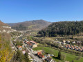
There are some lovely viewpoints between (3) and (4).

Reviews and comments

4.8 / 5
Based on 2 reviews

Reliability of the description
5 / 5
Ease of following the route
5 / 5
Route interest
4.5 / 5
User 10605838

Overall rating : 5 / 5

Date of your route : Jul 27, 2026
Reliability of the description : ★★★★★ Very good
Ease of following the route : ★★★★★ Very good
Route interest : ★★★★★ Very good
Very busy route : No

A lovely walk that takes you around Saint Ursanne (including the abbey) and the town, and gives you an insight into the life of Saint Ursanne.
Stunning panoramic views over the town’s hills.
It’s a short walk, but the climb up to the heights, with its many steps, is challenging for older people.

Machine-translated

User 27132752

Overall rating : 4.7 / 5

Date of your route : Aug 25, 2025
Reliability of the description : ★★★★★ Very good
Ease of following the route : ★★★★★ Very good
Route interest : ★★★★☆ Good
Very busy route : Yes

A lovely short hike in the hills above Saint-Ursanne.

Be warned, although the hike is classified as "easy", it is quite steep, so you will need to be reasonably fit and wear good walking shoes.

Machine-translated

Other walks in the area

For more walks, use our search engine .

The GPS track and description are the property of this route's author. Please do not copy them without permission.