The Pond and the Boulet Canal

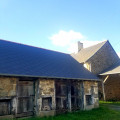
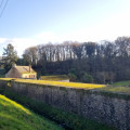
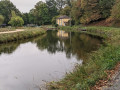
This walk will take you on a journey of discovery through a rich environment of flora and fauna linked to the presence of the Étang de Boulet. The Étang and the Boulet canal form part of the heritage of the water supply infrastructure for the Ille and Rance Canal and are inextricably linked to the rich history of navigation along this route.

Details

3184730
Creation:
Last update:
Last review:
  • Walking
    Activity: Walking
  • ↔
    Distance: 9.57 mi
  • ◔
    Average duration: 4h 35 
  • ▲
    Difficulty: Moderate

  • ⚐
    Back to start: Yes
  • ↗
    Ascent: + 194 ft
  • ↘
    Descent: - 207 ft

  • ▲
    Highest point: 331 ft
  • ▼
    Lowest point: 197 ft
  • ⚐ Country: France
  • ⚐ City: Feins (35440)
  • ⚑
    Start/End: N 48.328522° / W 1.641285°
  • ❏
    IGN map(s): Ref. 1217SB
  • Hour-by-hour weather

Photos

Description of the walk

Car park next to the church.
For the entire route: YellowPR® signposts

(S/E) Turn left onto Rue de Dingé. Cross Rue de Montreuil and, almost directly opposite, turn right onto Rue des Cours Boulet. The street continues as a footpath. At the Fork in the road, turn right until you reach the road.

(1) Turn right towards La Poultière, then, after barely 200 m, take the path on the left. It leads onto a road.

(2) Turn right and keep right at the Y-junction. Continue to the D12 county road near La Maquerais. Turn left and, 100 metres further on, turn right heading north-west. On your right, you can see two bodies of water and the Ruisseau de la Maquerais.

(3) At Château Meslet, continue northwards along the road to the Boulet-Prioul wayside cross.

(4) See practical information
Take the path on the right. After a right-hand bend, follow the path to the left. Ignore the path on the left leading to the Ferme de la Boirie and continue along the path which leads to the access road to the farm. Turn right.

(5) Follow the Chaussée du Boulet to the left, which runs alongside the departmental road. Then follow it for a few metres to pass the tip of the pond and turn left before the house. This is the start of the Boulet water channel.
Follow the channel almost to its end, where it joins the departmental road.

(6) Turn right, cross the D20 with care and follow it to the right for about 200 metres.
Follow a path on the left which passes La Foutelais; then, when you reach a road, first turn right then left to set off along a north-easterly path.

(7) Turn right onto the road and then turn right onto the track just after a house. Facing south, it leads to the banks at the tip of the pond.

(8) Turn left and follow the banks of the Étang du Boulet as closely as possible. Ignore any roads, tracks and paths on your left.

(9) Continue to the right to cross the stretch of water: on your right is the Étang du Boulet and on your left the Étang du Pont au Marquis. Continue to the right to reach the observatory.

(10) Reach the road. Turn right and, as soon as possible, take the path on the right to continue along the banks of the lake. It is advisable to follow the paths signposted with a blue dragonfly on several occasions. Pass the water sports centre and walk alongside the leisure park, keeping the lake on your right at all times.

(11) At the U-turn, take the Chemin des Tilleuls on the left. It leads to Feins, first turning left then right. Curiously, a second path runs alongside it for the entire length.
Turn right onto Rue de Marcillé and follow it to the church to return to the car park (S/E).


Waypoints

  1. S/E : mi 0 - alt. 331 ft - Car park next to the church.
  2. 1 : mi 0.44 - alt. 308 ft - La Poultière – road on the right
  3. 2 : mi 1.04 - alt. 272 ft - Road on the right
  4. 3 : mi 2.49 - alt. 213 ft - Château Meslet – road on the left
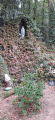
  5. 4 : mi 2.79 - alt. 197 ft - Boulet-Prioul Calvary. Before the - La Rigole de Boulet
  6. 5 : mi 3.53 - alt. 259 ft - Chaussée de Boulet – turn left
  7. 6 : mi 4.51 - alt. 223 ft - End of the watercourse – on the right
  8. 7 : mi 5.12 - alt. 246 ft - Le Breil – turn right
  9. 8 : mi 5.62 - alt. 240 ft - Bank of the - Étang du Boulet
  10. 9 : mi 7.04 - alt. 236 ft - Between two ponds – on the right
  11. 10 : mi 7.65 - alt. 233 ft - The observatory - Étang du Boulet
  12. 11 : mi 9.02 - alt. 233 ft - Path on the left
  13. S/E : mi 9.57 - alt. 331 ft - Car park next to the church.

Notes

At (4), by turning left, you can follow the shorter alternative route ofthe PR® which leads to (6) but which therefore avoids the entire section running alongside the watercourse.

Worth a visit

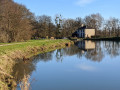
The Étang du Boulet: Covering 150 hectares, the Étang du Boulet is the largest navigable body of water in Ille-et-Vilaine. It is home to flora and fauna that are now rare and protected, which you can discover via the interpretive trail created around the edge of the lake.

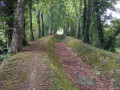
The Boulet Canal: Originally, this watercourse was used to supply water to the Ille and Rance Canal. Today, an underground pipeline fulfils this function. What remains is a perfectly signposted route with no changes in elevation. The path, shaded by beech, ash and oak trees, reveals a highly diverse rural heritage.
A veritable ecological corridor, the Boulet watercourse is home to a rich and distinctive variety of plant and animal life.

Always be cautious and plan ahead when you're outdoors. Visorando and the author of this route cannot be held responsible for any accidents occurring on this route.

The GR® and PR® markings are the intellectual property of the Fédération Française de Randonnée Pédestre.

Reviews and comments

4.6 / 5
Based on 3 reviews

Reliability of the description
4.7 / 5
Ease of following the route
4.3 / 5
Route interest
4.7 / 5
muche63
muche63

Overall rating : 4.7 / 5

Date of your route : Mar 24, 2025
Reliability of the description : ★★★★★ Very good
Ease of following the route : ★★★★★ Very good
Route interest : ★★★★☆ Good
Very busy route : No

The route is very pleasant and can be enjoyed all year round. For my part, I extended it to make it 10 km.

Machine-translated

domivasseur2935
domivasseur2935

Overall rating : 4.7 / 5

Date of your route : Nov 26, 2023
Reliability of the description : ★★★★★ Very good
Ease of following the route : ★★★★☆ Good
Route interest : ★★★★★ Very good
Very busy route : No

The route is magnificent and offers plenty of varied and interesting views. It was just as well we had the route description and the Visorando map, as the signposting is very worn, or even non-existent.

Machine-translated

Laurence44810
Laurence44810

Overall rating : 4.3 / 5

Date of your route : Sep 06, 2020
Reliability of the description : ★★★★☆ Good
Ease of following the route : ★★★★☆ Good
Route interest : ★★★★★ Very good
Very busy route : Yes

A very pleasant walk. The path along the watercourse is a little gem, lined with magnificent trees. I highly recommend it!

Machine-translated

Other walks in the area

For more walks, use our search engine .

The GPS track and description are the property of this route's author. Please do not copy them without permission.