Country:
 City:
City:


Park in the car park at Place de l’Église in Feins.
The route is signposted with “24” signs and yellow markings, which are sometimes poorly maintained and therefore not very visible.
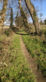
(S/E) Head north along Rue de Marcillé. Once you have passed a right-hand bend, take Chemin des Tilleuls on the left, then turn right onto the first path.
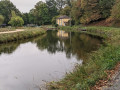
(1) Pass a gate on your right and carry on straight ahead. The track widens when you reach the Étang du Boulet, which you should follow on the left. Ignore the turn-offs to the left and continue until you reach the Chaussée de Boulet.
(2) Follow the D20 to the left for 150 m and turn right towards La Boirie. Before reaching the farm, turn left onto the path heading south. Continue along this path until it joins another path. Follow this to the right until you reach a road.
(3) Turn left and head towards Château Meslet. At the bend, turn right. Further on, cross the Ruisseau de la Maquerais and, at the road, turn left for 100 metres then continue to the right. After ignoring a path on the right, you’ll reach Lande Basse.
(4) Turn right and head south to reach the hamlet of La Marre. Follow the road to the right and, before the hamlet of Haut Épinay, continue to the left and enter Montreuil-sur-Ille via Rue du Presbytère.
(5) Follow Avenue Alexis Rey to the right. After the town hall and the post office, turn left. Continue along the path that extends from there and cross the River Ille. At the end of the path, turn right onto Rue Aristide Tribalet, then left onto Rue des Chênes.
(6) After thethird house, turn right and, 30 metres further on, take the path on the left. At the end of this path, turn left.
(7) Take Rue des Écoles on the right. Turn right into thefirst street and immediately follow the path as it continues to go round the back of the houses. At the end, continue to the left.
(8) Leave the road and take a path on the right. Walk alongside the field on your right. Cross a small road and carry on almost straight ahead.
Red and white markings forthe GR® 37 – Yellow markings for route 24
(9) Ignore the path on the right (where theGR® 37ends). At the end of the path, turn left and carry on straight ahead along the road. At the junction, carry on straight ahead along the path.
(10) At Bellevue, turn left before the building. At the end of the path, turn right. When you reach a Fork in the road, keep to the right.
(11) At a left-hand bend, carry on straight ahead. Continue until you reach a small road.
Yellow markings for route 24
(12) Let theGR® head off to the right and take the path opposite (shown on IGN maps at a high zoom level). After crossing the road, it leads to La Provôtais. Continue to the right, skirting the Aubigné lake for a short while, until you reach Rue des Graviers. Follow it to the left for a few dozen metres.
(13) Turn left onto Rue du Bain and follow it as it winds its way until you reach the “Café du Village”. Continue left onto Rue d’Orgères (D221). At the bend, turn right towards Le Chauchis, then left until you reach La Croix. Before the building, turn left and continue northwards.
(14) Turn left towards the lake, cross the Ruisseau du Pont Colin and reach the D91. Cross it and carry on straight ahead. Ignore the access path to La Boulayère on the left and turn right heading north.
(15) Ignore the alternative route which continues straight on. Turn right towards Le Feuil. Turn left and carry on straight ahead at the junction. After 100 metres, keep right and then turn left about 250 metres further on.
At Mare Piron, follow the road to the left for 100 m and turn right.
(16) Please note: the path, which is usually blocked by a rope that must be put back in place after you have passed, leads onto a wider track. Cross over and take the barely visible path opposite, which branches off to the right and is also blocked by a rope, which must also be put back in place. Very soon, the path makes a first turn right then left and widens, then leads to Rue des Écoles in Feins.
Turn left, walk past the town hall and head towards Place de l’Église (S/E).

 Visorando Member

 Association / Club / Walk leader
 Easy
Easy