


Refine your search for walks in Puy-Guillaume
Puy-Guillaume walks


 The Étang des Grands Graviers and Puy-Guillaume
 Visorando Member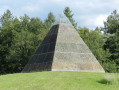
 4.05 mi
 +89 ft
 -89 ft
 1h 55
1h 55
 Easy
Easy
 Departure from Puy-Guillaume (Puy-de-Dôme)
A short walk through Puy-Guillaume, offering a chance to discover the town and its proximity to the sediment-laden rivers that enabled it to flourish through the establishment of its glassworks.
Les Bois Noirs on the heights of Châteldon
6.87 mi
+1,063 ft
-1,050 ft
4h 05
 Moderate
Departure from Châteldon (Puy-de-Dôme)
Moderate
Departure from Châteldon (Puy-de-Dôme)
Hike in the northern foothills of Livradois, known as the Bois Noirs, starting from Châteldon, a village with some beautiful medieval houses.
From Vauziron to La Chasserelle
 5.17 mi
+896 ft
-896 ft
3h 10
Moderate
Departure from Châteldon (Puy-de-Dôme)
5.17 mi
+896 ft
-896 ft
3h 10
Moderate
Departure from Châteldon (Puy-de-Dôme)
After a bit of effort due to the initial climb, you’ll be rewarded with magnificent panoramic views of the Bois Noirs and the Chaîne des Puys.
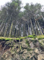
In the heart of the Bois des Gris in Chateldon
 3.89 mi
+653 ft
-643 ft
2h 20
Easy
Departure from Châteldon (Puy-de-Dôme)
3.89 mi
+653 ft
-643 ft
2h 20
Easy
Departure from Châteldon (Puy-de-Dôme)
A pleasant circular loop through the woods, lost in the middle of nowhere. Dogs can be walked off-lead. Just take care at the start and finish. A bit of a climb but also suitable for cycling. Apart from the walk back to the starting point, there are absolutely no roads to cross on the walk.
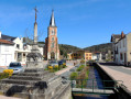
Circular route around the village of Mariol
 12.65 mi
+1,867 ft
-1,864 ft
7h 25
12.65 mi
+1,867 ft
-1,864 ft
7h 25
 Difficult
Departure from Mariol (Allier)
Difficult
Departure from Mariol (Allier)
A lovely walk starting from Mariol, which follows the valley of the Darot stream, passes near Arronnes and Le Sichon, then returns to the ridges and ends with a beautiful panoramic view, with the Allier valley in the foreground and the Chaîne des Puys in the background.
Circular Vieux Saint-Sylvestre - Saint-Priest-Bramefant
7.72 mi
+436 ft
-453 ft
3h 55
Moderate
Departure from Saint-Sylvestre-Pragoulin (Puy-de-Dôme)
A pleasant circular starting from Vieux Saint-Sylvestre, heading to Saint-Priest-Bramefant through the Bois Brun forest and back. Very little tarmac and beautiful scenery on a clear day. An easy hike.
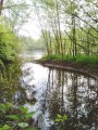
Left bank of the Allier in the Saint-Priest-Bramefant plain
 5.93 mi
+16 ft
-16 ft
2h 45
Easy
Departure from Saint-Yorre (Allier)
5.93 mi
+16 ft
-16 ft
2h 45
Easy
Departure from Saint-Yorre (Allier)
A very pleasant walk to do alone or with the family. If you enjoy observing nature and listening to its calm, you will be in your element. You will walk at varying distances from the course of the River Allier and its former meander, skirting a magnificent stretch of water with a variety of flora and fauna. Part of the route runs through cultivated land. There is no tarmac except for a few metres at the finish.
The Gourcet and Sichon valleys
9.79 mi
+1,257 ft
-1,247 ft
5h 35
Moderate
Departure from Busset (Allier)
Hike not far from Vichy in the rolling countryside bordering the Sichon Valley, in the foothills of the Livradois-Forez Massif.
André Monnot Trail and Vichy parks
7.74 mi
+33 ft
-98 ft
3h 35
Moderate
Departure from Saint-Yorre (Allier)
A hike dedicated to water. Flowing water, Ruisseau des Andraux, Allier. Water to drink, Saint-Yorre bottling plant, Source des Célestins. Water with healing properties, Hall des Sources and Grand Établissement Thermal de Vichy. And, depending on the weather, perhaps water falling from the sky?This hike can also be done as a round trip, difficulty: difficult (24 km).
Le Gourcet stream route
 8.09 mi
+1,030 ft
-1,030 ft
4h 35
Moderate
Departure from Saint-Yorre (Allier)
8.09 mi
+1,030 ft
-1,030 ft
4h 35
Moderate
Departure from Saint-Yorre (Allier)
A very pleasant route in all seasons. You’ll walk through wooded sections at the bottom of the valley, accompanied by the babbling of the stream, as well as open sections offering views of the Monts Dômes to the west and the Montagne Bourbonnaise to the east.The sections near the monument to the 11 Martyrs of La Goutte Grandval and Busset Castle lend this route a historical charm.
Coupe-Gorge and Fonds de Fer route
 6.05 mi
+843 ft
-823 ft
3h 30
Easy
Departure from Saint-Yorre (Allier)
6.05 mi
+843 ft
-823 ft
3h 30
Easy
Departure from Saint-Yorre (Allier)
A lovely walk for those who enjoy combining walking with nature observation. Starting from Saint-Yorre, walk through the pleasant undergrowth following the course of the Andraux stream, then around the Coupe-Gorge and Fonts de Fer stream basins. Open views over the Monts Dômes, the Vichy plain and the Vernet hill.
The fortress of the cutlers
3.47 mi
+715 ft
-689 ft
2h 15
Easy
Departure from Thiers (Puy-de-Dôme)
Thiers is a city of challenges. In this grandiose and isolated location in the heart of Auvergne, the inhabitants of Thiers have had to contend with a turbulent river, the Durolle, and the steep slopes of its gorges. Over time, thanks to numerous developments, this partially tamed river has ensured the industrial prosperity of the town, which is known as the cutlery capital of France.
Thiers - Les Quatre Vents
 Association / Club / Walk leader11.38 mi
+1,998 ft
-1,526 ft
7h 00
Difficult
Departure from Thiers (Puy-de-Dôme)
Association / Club / Walk leader11.38 mi
+1,998 ft
-1,526 ft
7h 00
Difficult
Departure from Thiers (Puy-de-Dôme)
This first stage of the Chemin de Sainte-Agathe gives us the opportunity to take different PR®® trails. We pass through charming little hamlets: Lamouroux, Sardier, Grand Cognet, Laurençon and cross a few streams. Beautiful trees line the route, as well as numerous views of the Chaîne des Puys.From the village of Vollore-Ville, passing close to the castle, we descend towards the plain and reach the Gîte des Quatre Vents via the hamlet of Sauvetat.
The Path of Saint Agatha
 60.70 mi
+10,633 ft
-10,335 ft
5 days
Difficult
Departure from Thiers (Puy-de-Dôme)
60.70 mi
+10,633 ft
-10,335 ft
5 days
Difficult
Departure from Thiers (Puy-de-Dôme)
The route (a circular route) passes through the following villages: Thiers, Vollore-Ville, Augerolles, Olmet, Olliergues, Marat, Le Brugeron, La Renaudie, Vollore-Montagne, La Chambonie, and Sainte-Agathe. It passes through the municipalities of Escoutoux, Aubusson, Saint-Pierre-la-Bourlhonne and Celles-sur-Durolle.
The legend of Saint Agathe will inspire walkers along the route, much like other well-known trails (the Way of St James, the Stevenson Trail, etc.)
The Valley of the Waterwheels in Thiers
 1.40 mi
+400 ft
-417 ft
1h 00
Easy
Departure from Thiers (Puy-de-Dôme)
1.40 mi
+400 ft
-417 ft
1h 00
Easy
Departure from Thiers (Puy-de-Dôme)
A trail themed around cutlery. As you follow the Durolle, you’ll step back in time as you discover the waterwheels, a type of mill powered by the river’s flow. They reveal the valley’s rich industrial past. The arrival of electrification in the 20th century eventually brought an end to these waterwheels.
The Culhat circular loop
 4.77 mi
+98 ft
-105 ft
2h 15
Easy
Departure from Culhat (Puy-de-Dôme)
4.77 mi
+98 ft
-105 ft
2h 15
Easy
Departure from Culhat (Puy-de-Dôme)
Route around Culhat (pronounced Kuya) in the Limagne plain, which runs along the banks of the Allier. Hike to be done from autumn to spring as there is little shade on the route.
Around Molles
5.99 mi
+823 ft
-823 ft
3h 30
Moderate
Departure from Molles (Allier)
Hike route starting from Molles, a village at the foot of the Bourbonnais mountains, 17km east of Vichy.
The Jolan route
 5.36 mi
+531 ft
-558 ft
2h 55
Easy
Departure from Nizerolles (Allier)
5.36 mi
+531 ft
-558 ft
2h 55
Easy
Departure from Nizerolles (Allier)
This hike starts in Nizerolles, a small village at the foot of the Monts de la Madeleine. It takes you across the River Jolan three times and partly follows the Tacot de la Montagne Bourbonnaise platform, the former departmental railway line that linked Vichy and Laprugne until 1949.