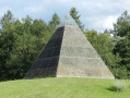
Via the Bois Brun

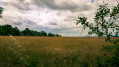
A walk through the hills above Saint-Priest-Bramefant in the Bois Brun, ideal in fine weather with some lovely views on the way back. The woods are private property; you must stay on the authorised paths. 

Details

n°72668279
Creation:
Last update:
Last review:
  • Walking
    Activity: Walking
  • ↔
    Distance: 5.30 mi
  • ◔
    Average duration: 2h 45 
  • ▲
    Difficulty: Easy

  • ⚐
    Back to start: Yes
  • ↗
    Ascent: + 344 ft
  • ↘
    Descent: - 377 ft

  • ▲
    Highest point: 1,385 ft
  • ▼
    Lowest point: 1,024 ft

Description of the walk

Park in the car park at the Roger Breysse sports hall, Route de Vichy, in Saint-Priest-Bremefant. 

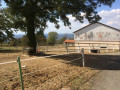
(S/E) Turn right as you leave the car park, then turn left onto Rue des Sequelles. Walk uphill following the road, past the 200-year-old oak tree, until you reach a junction.

(1) Carry straight on along the track until you reach the edge of the Bois Brun.

(2) Turn left and enter the woods. Follow the track until you reach a star-shaped junction. 

(3) Turn onto thefirst track on the right and continue along it. You’ll soon come within sight of the buildings at a place called Les Bénédins. 

(4) Turn right onto the wide track that descends into the Bois Raigner. Continue straight on, passing the Bois Menu farm on your left, and carry on along the edge of the woodland until you reach the 323-metre mark.

(5) Turn right to re-enter the woods and emerge at the T-junction with Rue des Gilberts, opposite a housing estate.

(6) Turn right and stay on the tarmac road, passing the water tower on your right, then head straight down, keeping to Rue des Gilberts, to return to the sports hall car park (S/E). 

Waypoints

  1. S/E : mi 0 - alt. 1,056 ft - Gym car park
  2. 1 : mi 0.52 - alt. 1,198 ft - Junction, go straight on
  3. 2 : mi 0.86 - alt. 1,204 ft - Junction, go straight on
  4. 3 : mi 2.32 - alt. 1,368 ft - Star-shaped junction, turn right
  5. 4 : mi 3.34 - alt. 1,240 ft - Right-hand bend
  6. 5 : mi 3.94 - alt. 1,217 ft - Right-hand bend
  7. 6 : mi 4.56 - alt. 1,224 ft - Rue des Gilberts
  8. S/E : mi 5.3 - alt. 1,024 ft - Gym car park

Worth a visit

The 200-year-old oak tree before (1).

Reviews and comments

4 / 5
Based on 2 reviews

Reliability of the description
4.5 / 5
Ease of following the route
4.5 / 5
Route interest
3 / 5
User 9770233

Overall rating : 4.3 / 5

Date of your route : Jul 27, 2026
Reliability of the description : ★★★★★ Very good
Ease of following the route : ★★★★★ Very good
Route interest : ★★★☆☆ Average
Very busy route : No

The walk through the forest is a bit monotonous and very long. The upside is that it’s nicely shaded. Best done in autumn to see if you can find any mushrooms 😊

Machine-translated

Patoche 50
Patoche 50

Overall rating : 3.7 / 5

Date of your route : Jul 07, 2025
Reliability of the description : ★★★★☆ Good
Ease of following the route : ★★★★☆ Good
Route interest : ★★★☆☆ Average
Very busy route : No

Nothing particularly interesting, apart from the fact that 70 per cent of the route is in the shade, which is perfect for hot weather.

Machine-translated

Other walks in the area

For more walks, use our search engine .

The GPS track and description are the property of this route's author. Please do not copy them without permission.