Circular route around the village of Mariol

A lovely walk starting from Mariol, which follows the valley of the Darot stream, passes near Arronnes and Le Sichon, then returns to the ridges and ends with a beautiful panoramic view, with the Allier valley in the foreground and the Chaîne des Puys in the background. 

Details

n°73807076
Creation:
Last update:
Last review:
  • Walking
    Activity: Walking
  • ↔
    Distance: 12.65 mi
  • ◔
    Average duration: 7h 25 
  • ▲
    Difficulty: Difficult

  • ⚐
    Back to start: Yes
  • ↗
    Ascent: + 1,867 ft
  • ↘
    Descent: - 1,864 ft

  • ▲
    Highest point: 1,952 ft
  • ▼
    Lowest point: 984 ft

Photos

Description of the walk

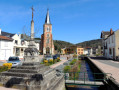
 Park in the car park, near Mariol church and alongside the Darot.

(S/E) Take Rue des Combes, which follows the River Darot, and stay on this road. Pass the road crossing the River Darot on your right and reach a Fork in the road directly beneath a power line.

(1) Take the path on the left and carry on straight ahead, avoiding the many paths branching off to the right or left, until you reach a hairpin bend.

(2) Follow the path down to the right, turn onto the track leading off to the left and wade across the Darot. Continue until you reach a good track.

(3) Turn right onto this path, which climbs, and continue until you reach a T-junction. 

(4) Turn right, then take the road on the left before the hamlet of Les Murs du Temple and come out onto the D43.

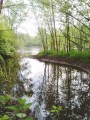
(5) Make the first turn left then right to cross this road and take the forest track. Continue to the Étang de Malforêt. Walk along its right-hand side and pass the old inn.

(6) Take the path on the right, then turn left onto a path that climbs steeply due north to join a road.

(7) Follow it to the left, then turn right for about 60 metres. In the hamlet of Maison Neuve, turn left towards the hamlet of Le Faure. Cross the Bois Chatelard and arrive at a road.

(8) Cross the road, take the path opposite into the Bois de Louche and continue to its end.

(9) Turn left onto the path that climbs and rejoins a road.

(10) Follow it to the left, pass through the hamlet of Les Fours and reach a Fork in the road shortly after the end of the path.

(11) Take the road on the right. At the next crossroads, you’ll cross the GR®463; carry on straight ahead along the small road.

(12) Turn left onto the road leading to the hamlet of Les Morands and head down to a small pond.

(13) After the pond, take the path on the right, continue to the hamlet of Les Nérons and turn left onto the D175.

(14) Turn right and carry on for about 600 m, ignoring a path on the left.

(15) Turn left towards the hamlet of Les Grenettes, then Les Blettières, and walk through this hamlet.

(16) Carry on to the left until the next junction.

(17) Take the path leading down to the right, pass near the hamlet of Les Bruyères and join the road leading downhill. Continue to the next road on the left.

(18) Turn onto this small road and arrive at the entrance to Mariol.

(19) Turn right onto Rue de la Randière, which goes round the school, and arrive at the car park near the church (S/E).

Waypoints

  1. S/E : mi 0 - alt. 984 ft - Car park near the church - Gare de Mariol
  2. 1 : mi 0.52 - alt. 1,086 ft - Hairpin bend
  3. 2 : mi 2.3 - alt. 1,677 ft - Junction. Towards the ford at - Darot (cours d'eau) - Affluent de l'Allier
  4. 3 : mi 2.94 - alt. 1,745 ft - Junction: good path
  5. 4 : mi 3.29 - alt. 1,883 ft - T-junction
  6. 5 : mi 3.63 - alt. 1,870 ft - D43
  7. 6 : mi 4.91 - alt. 1,522 ft - Étang de Malforêt (Arronnes)
  8. 7 : mi 5.59 - alt. 1,880 ft - Road junction
  9. 8 : mi 7.18 - alt. 1,486 ft - Cross the road
  10. 9 : mi 7.6 - alt. 1,499 ft - Junction at the edge of the woods
  11. 10 : mi 8.08 - alt. 1,693 ft - Road junction
  12. 11 : mi 8.71 - alt. 1,860 ft - Fork
  13. 12 : mi 9.1 - alt. 1,827 ft - Junction towards Les Morands
  14. 13 : mi 9.47 - alt. 1,765 ft - Pond
  15. 14 : mi 9.87 - alt. 1,808 ft - D175
  16. 15 : mi 10.21 - alt. 1,775 ft - Route to Les Grenettes
  17. 16 : mi 11.24 - alt. 1,657 ft - Junction after Les Blettières
  18. 17 : mi 11.59 - alt. 1,562 ft - Junction
  19. 18 : mi 12.3 - alt. 1,145 ft - Road on the left
  20. 19 : mi 12.49 - alt. 1,010 ft - Rue de la Randière
  21. S/E : mi 12.65 - alt. 984 ft - Car park near the church - Gare de Mariol

Always be cautious and plan ahead when you're outdoors. Visorando and the author of this route cannot be held responsible for any accidents occurring on this route.

The GR® and PR® markings are the intellectual property of the Fédération Française de Randonnée Pédestre.

Reviews and comments

4.1 / 5
Based on 3 reviews

Reliability of the description
4.7 / 5
Ease of following the route
3.7 / 5
Route interest
4 / 5
domivero79
domivero79

Overall rating : 4.7 / 5

Date of your route : Sep 17, 2026
Reliability of the description : ★★★★★ Very good
Ease of following the route : ★★★★☆ Good
Route interest : ★★★★★ Very good
Very busy route : No

A lovely walk with pleasant paths
Thank you

Machine-translated

Catherine Manin
Catherine Manin

Overall rating : 4 / 5

Date of your route : Sep 13, 2026
Reliability of the description : ★★★★★ Very good
Ease of following the route : ★★★★☆ Good
Route interest : ★★★☆☆ Average
Very busy route : No

A lovely walk that takes you along long paths through the woodland, with the only slight downside being quite a few small country roads (though they’re not busy, at least on Sundays).
Didn’t come across anyone on the paths.
The walk took 5 hours 25 minutes without a break; the elevation gain is reasonable but should still be taken into account. The last 7 kilometres allow you to ease off a bit.

Machine-translated

nom
nom

Overall rating : 3.7 / 5

Date of your route : Mar 21, 2026
Reliability of the description : ★★★★☆ Good
Ease of following the route : ★★★☆☆ Average
Route interest : ★★★★☆ Good
Very busy route : No

A pleasant spring walk, but I don’t understand why it’s described as ‘difficult’.
We know the distance and elevation gain before setting off, which are average for any fit hiker.
And there are NO difficulties whatsoever: the paths are good, with no stones or other obstacles. The two streams are easy to cross in March.
It took me 5 hours 30 minutes, taking my time and including breaks.

Machine-translated

Other walks in the area

For more walks, use our search engine .

The GPS track and description are the property of this route's author. Please do not copy them without permission.