


Refine your search for walks in Petite-Île
Petite-Île walks


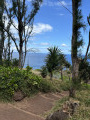
 The Beach and the Piton de Grande Anse
 Visorando Member
 1.59 mi
 +262 ft
 -262 ft
 1h 00
 Easy
 Departure from Petite-Île (Réunion)
Grande Anse beach is renowned for being almost perfectly suited to a family picnic. For tourists, it also offers the chance to enjoy a fairly short, relaxing discovery walk with a lovely view from the top of the piton.
Beach, shaded areas, picnic spots and viewpoints overlooking the sea or the beach: the epitome of Réunion’s hospitality!
Piton de Mont-Vert
1.07 mi
+351 ft
-351 ft
0h 50
 Moderate
Departure from Saint-Pierre (La Réunion) (Réunion)
Rising to an altitude of 636 metres, the Piton de Mont Vert is an iconic peak in the south of the island. It is an ancient crater dating back 30,000 years! Visible for kilometres around, it is criss-crossed by several kilometres of footpaths. Winding through a beautiful forest, these paths are the best way to discover the flora and fauna of this piton. The climb is sometimes steep but only for short stretches.
Piton de l’Entonnoir
0.47 mi
+246 ft
-246 ft
0h 25
Easy
Departure from Saint-Joseph (La Réunion) (Réunion)
Piton de l’Entonnoir is best known as a paragliding launch site. There are a few footpaths leading up to it. It offers a remarkable view of the south of the island! Guava enthusiasts will find plenty to enjoy on this very short walk. It is therefore strongly recommended that you combine this walk with another. The route is less than a kilometre long and is suitable for families with children.
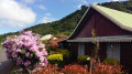
Margosiers Circular
 6.56 mi
+2,867 ft
-2,874 ft
5h 30
 Difficult
Departure from Saint-Joseph (La Réunion) (Réunion)
A pretty circular above Saint-Joseph offering magnificent views of Grande Anse and the villages of Plaine des Grègues with their turmeric crops.
Part of the Sentier des Foulées de la Fraise
 4.57 mi
+1,198 ft
-1,217 ft
3h 10
Moderate
Departure from Saint-Pierre (La Réunion) (Réunion)
This walk is part of the Sentier des Foulées de la Fraise trail. It is also a section of the Grand Raid. As you pass by the pastures, you’ll also have the chance to enjoy beautiful views towards the west and south. This section follows the Sentier des Foulées de la Fraise trail between Domaine Vidot and the first strawberry field. Fairly easy, although with a few steep steps, it is possible to continue much higher up towards Notre-Dame de la Paix.
The Ligne d’Équerre from Bérive
5.71 mi
+1,476 ft
-1,480 ft
3h 55
Moderate
Departure from Le Tampon (Réunion)
La Ligne d’Équerre is a small hamlet situated at an altitude of around 900 metres. Just a short walk from the village lies a beautiful forest criss-crossed by a number of paths. This guide takes you along these paths, starting from Bérive via the Piton Nathalie trails. There are plenty of scenic viewpoints along this circular route, which follows tracks for part of the way, as well as roads winding through crops and sugarcane fields.
Piton Babet
0.92 mi
+354 ft
-338 ft
0h 45
Easy
Departure from Saint-Joseph (La Réunion) (Réunion)
Piton Babet is an iconic peak in the commune of Saint-Joseph. It is named after the former mayor, who is buried at the summit of the peak. This walk is very short and can easily be combined with another hike, such as Piton de l’Entonnoir. The sound of the waves will never cease. Just before the start of the climb, don’t miss the Caverne des Hirondelles. It’s also possible to walk all the way round the piton, but this has the drawback of passing through built-up areas.
Bassin Dix-Huit and the Terre Rouge circular loop
2.69 mi
+299 ft
-289 ft
1h 30
Moderate
Departure from Saint-Pierre (La Réunion) (Réunion)
Bassin Dix-Huit (or Bassin 18) is one of the best-known pools in the south. Several legends circulate about it. The approach is very short but quite technical: best avoided with children, which explains its ‘medium’ difficulty rating. The pool is deep and the water is beautifully clear! To extend the walk, this route suggests completing a circular route at Pointe du Bois de Buis. This section, which follows the coast and offers some lovely views, presents no difficulty whatsoever.
Circular loop at Pointe de Langevin
0.93 mi
+36 ft
-36 ft
0h 25
Easy
Departure from Saint-Joseph (La Réunion) (Réunion)
This route offers a circular path at Pointe de Langevin on a very popular, high-quality trail. Lovers of rugged landscapes will delight in the spectacle of the sea crashing against this rugged coastline. It is also possible to take a dip in the pools of the Langevin River.
Mouton Park from Langevin
7.63 mi
+997 ft
-1,001 ft
4h 25
Moderate
Departure from Saint-Joseph (La Réunion) (Réunion)
Langevin is best known for its river. However, there are several trails that allow you to walk circular routes through the sugarcane fields. This walk takes you round the Papangues and Lambert peaks, passing through the village of Parc Mouton. When the sugarcane is cut, the views take in the whole of the ‘Sud Sauvage’ and the southern slopes of the Piton de la Fournaise massif, as well as the heights of Saint-Joseph.
Walk at Le Tampon
 3.38 mi
+587 ft
-587 ft
2h 05
Easy
Departure from Le Tampon (Réunion)
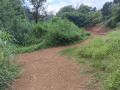
A short family walk there and back with a few variations, either along the Rivière d’Abord or alongside the sugarcane fields. On the riverside path, you can admire the pools carved into the rock.
La Mare via the Forêt des Hauts de Mont Vert
 3.66 mi
+545 ft
-535 ft
2h 10
Easy
Departure from Saint-Joseph (La Réunion) (Réunion)
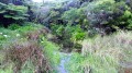
La Mare is a very small lake surrounded by arum plants, situated in the hamlet of the same name in the hills above Petite-Île. This walk, starting from the D36, passes through the beautiful Forêt des Hauts de Mont Vert, offering stunning views of the south of the island at the end of the route, as well as of the Rivière des Remparts, whilst following a well-maintained track lined with arums. It is possible to extend the walk to the Relais de Petite Île or to the Domaine Vidot.
Terre Rouge, Cap Jaune and the Plateau
 1.79 mi
+161 ft
-138 ft
1h 00
Easy
Departure from Saint-Joseph (La Réunion) (Réunion)
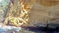
Located in the south of the island, Cap Jaune is a natural curiosity that is a must-see if you come to Vincendo. This site owes its name to its yellow colour! The trail runs along the coastline and offers superb panoramic views! It also crosses landscapes specific to the Wild South (jagged landscapes, vackoas, volcanic rocks, blowholes, etc.).
Moderator's note added on 21/07/2021: There have been a few changes to the terrain since this hike was published. See reviews.
The Ouaki circular route
 3.27 mi
+630 ft
-653 ft
2h 05
Easy
Departure from Saint-Pierre (La Réunion) (Réunion)
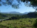
A relatively easy route with a picnic by the water’s edge.
 From Bois d’Olives to the Bras de Pontho viewpoint
 13.55 mi
+1,801 ft
-1,814 ft
2 hrs
Moderate
Departure from Saint-Pierre (La Réunion) (Réunion)
Bras de Pontho is a small village situated at an altitude of 600 metres. Just behind its church, it offers a stunning view over the Bras la Plaine, which is far less well-known than the one at Bois-Court. This route, comprising two circular loops, starts at Bois-d’Olives and leads to the Bras de Pontho viewpoint, passing via the Bras de la Plaine Bridge, the Pouzzolane cliffs and the Parc des Palmiers.