La Mare via the Forêt des Hauts de Mont Vert

La Mare is a very small lake surrounded by arum plants, situated in the hamlet of the same name in the hills above Petite-Île. This walk, starting from the D36, passes through the beautiful Forêt des Hauts de Mont Vert, offering stunning views of the south of the island at the end of the route, as well as of the Rivière des Remparts, whilst following a well-maintained track lined with arums. It is possible to extend the walk to the Relais de Petite Île or to the Domaine Vidot.

Details

659792
Creation:
Last update:
Last review:
  • Walking
    Activity: Walking
  • ↔
    Distance: 3.66 mi
  • ◔
    Average duration: 2h 10 
  • ▲
    Difficulty: Easy

  • ⚐
    Back to start: Yes
  • ↗
    Ascent: + 545 ft
  • ↘
    Descent: - 535 ft

  • ▲
    Highest point: 5,341 ft
  • ▼
    Lowest point: 4,931 ft

Photos

Description of the walk

Access:

From Le Tampon: Head towards Bérive via the D3 (Route Hubert Delisle). Follow this road until you reach the junction with the D36 (impossible to miss as a sign points towards Notre-Dame de la Paix). Follow the D36 until you see the sign on the right indicating the entrance to the Forêt des Hauts de Mont Vert.

From Bourg-Murat: Head down the N3 (Route des Plaines) towards Le Tampon. Follow this road until you reach the junction with the D36 (impossible to miss as there is a sign pointing towards Notre-Dame de la Paix). Follow this road until you see the sign on the left, in a bend, indicating the entrance to the Forêt des Hauts de Mont Vert.

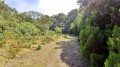
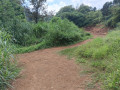
(S/E) Take the track that starts behind the barrier. From there, it’s simple: follow the track to the start of the path towards Petite-Île, marked by an ONF sign. The track climbs gently, crosses a stream and leads straight into the lush Forêt des Hauts de Mont Vert. Like any forest in the island’s highlands, it is lush and green, with arums, mosses, Jupiter’s beard, highland tamarinds, fanjans, branles and other plants endemic to Réunion; combined with the mist, it evokes a mysterious forest straight out of Tolkien’s novels. Here and there, along the edge of the track, you can spot very recent plantations of endemic trees

(1). The fact that the track begins to descend indicates that we will soon be skirting the Rivière des Remparts. However, the track never comes within 10 metres of the riverbank. One can make out the riverbank through the lush vegetation. Paths to the left of the track allow you to get as close as possible. You’ll then be treated to some lovely views of Grand Coude, the Trous de Cissia and the upper reaches of the Rivière des Remparts, which are well worth the detour. The path then descends more and more steeply and includes sections that can be slippery in wet weather. You’ll spot a few arums here and there along the path.

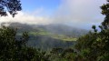
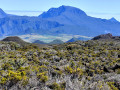
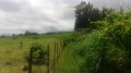
(2) You’ll reach the first clearing and the first bench after about 40 minutes’ walk. Leave the edge of the rampart and head south-west towards La Mare. From this point onwards, fields of arums and meadows follow one after another and the slope becomes steeper. Enjoy the panoramic views of Piton des Neiges and the south-west of the island.

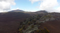
(3) After walking for about 2.8 kilometres, leave the inconspicuous path on your right that leads to the Domaine Vidot and turn left onto the track. As you follow this path for the first few metres, you’ll have the chance to enjoy some beautiful views over the Plaine des Caffres region and the south of the island.

(4) After about an hour’s walk, you’ll reach the famous little pond, which no doubt takes its name from the locality of the same name. As with the Piton de l’Eau, it is surrounded by arums and is at its most beautiful when they are in bloom, although it is not an exceptional spot. This is also the start of the path leading to the Relais de Petite-Île, marked by an ONF sign. Return to the starting point via the same route (S/E).

Waypoints

  1. S/E : mi 0 - alt. 5,240 ft - D36
  2. 1 : mi 0.51 - alt. 5,295 ft - Start of the route along the rampart
  3. 2 : mi 1.29 - alt. 5,200 ft - Bench, first meadow
  4. 3 : mi 1.79 - alt. 4,938 ft - Path to the Domaine Vidot
  5. 4 : mi 1.82 - alt. 4,931 ft - La Mare, path towards the Relais de Petite-Île
  6. S/E : mi 3.66 - alt. 5,240 ft - D36

Notes

Do the walk in the morning
You can extend the route by continuing to the Domaine Vidot (turn right at (3)) and on to the Relais de Petite-Île (turn left at (4)): see both via this link
A kiosk and tables are available further upstream on the D36 (follow this road up to the next sign indicating the Forêt de Notre-Dame de la Paix and the viewpoint of the same name. Take the path that starts to the left of the road and follow it to the picnic area)

Worth a visit

Places to visit:
The Hauts de Mont Vert Forest.
La Mare (4)
The village of Notre-Dame de la Paix (from the starting point, head up the D36 to the village)
The Notre-Dame de la Paix viewpoint and its botanical trail (from the starting point, head up the D36 to the next signpost indicating the Forêt de Notre-Dame de la Paix and the viewpoint of the same name. Take the path that starts to the left of the road, cross a picnic area, then at the next junction turn right onto the botanical trail and continue straight on to the viewpoint. See both at this link

Enjoy the various panoramic views

Reviews and comments

5 / 5
Based on 2 reviews

Reliability of the description
5 / 5
Ease of following the route
5 / 5
Route interest
5 / 5
Kty974
Kty974

Overall rating : 5 / 5

Date of your route : Jan 05, 2026
Reliability of the description : ★★★★★ Very good
Ease of following the route : ★★★★★ Very good
Route interest : ★★★★★ Very good
Very busy route : Yes

A very pleasant and easy hike.
Beautiful views.

Machine-translated

Jamath
Jamath

Overall rating : 5 / 5

Date of your route : Mar 07, 2023
Reliability of the description : ★★★★★ Very good
Ease of following the route : ★★★★★ Very good
Route interest : ★★★★★ Very good
Very busy route : No

A very well-maintained, pleasant path with a rich variety of flora. The pond is currently dry, but can be recognised by the arum plants and the wooden bridge when it is flooded. The route is partly shaded and not very busy. Ideal for a walk with children.

Machine-translated

Other walks in the area

For more walks, use our search engine .

The GPS track and description are the property of this route's author. Please do not copy them without permission.