Country:

 City:


Warnings: this extremely difficult hike absolutely requires the use of an ice axe. The northern exit point is off the trail and difficult to find; you must memorise or take note of the visual landmarks (see practical information) to locate it.
(S/E) From the Pré Orcel car park, head up to the small fountain visible from the forest track and turn left (southwards) onto the correct path, which enters the forest following the contour line. White Rectangles and ‘Nature Reserve’ signs line the path.
(1) Leave the path leading to the Pas de la Rousse on your right and continue south. The path descends by a good hundred metres.
(2) A yellow sign marks the junction with a path ascending from the forest road. It points towards Fourneau and Grand Manti. Continue southwards along the path, which now remains level and crosses several streams. After a larger stream, the path climbs slightly up a ridge.
(3) Do not follow the path that descends again, but turn right, heading due west, onto a track that climbs up this ridge (a faint handwritten inscription on a white strip indicates the Pas du Fourneau).
Make sure you stay on the ridge by following the white markings, as the track is invisible in many places.
On emerging from the forest, the track and the white markings disappear. The route crosses scree and is marked by orange or salmon-coloured circles. It heads towards a rocky cirque beneath the Pas du Fourneau, which you must not enter. On several occasions, you will need to use your hands on the rock to make progress.
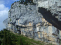
Beneath an overhanging rock – known as the ‘Caïman’ – the ‘path’ takes a hairpin bend due north up steep grassy slopes. It passes beneath the base of the rock to go round it on the right (north) and joins a gully with grassy ledges interspersed with small rocky outcrops (each less than 1.50 metres high).
Climb up this gully on the left, heading west again and then south-west, scaling the rocky ledges. Use your ice axe to secure yourself on the slippery earth sections. You’ll emerge onto a slightly less steep grassy slope overlooking the Rocher du Caïman (the one you’ve just gone round).
Continue south-west along a relatively well-marked path to a narrow ravine containing a rock marked with a small salmon-orange circle. Climb due west up this ravine, which features a few short sections of easy scrambling. If, instead of climbing up this ravine, you continue along the sling for less than 10 metres, you’ll see some beautiful rocks overhanging the valley. In this case, turn back to return to the ravine and head up it.
Exit the ravine on the right, after a few grassy ledges interspersed with easy rock sections, using your ice axe for support.
(4) A small cairn marks the exit from the Pas du Fourneau and your arrival on the ridge. Head right (north) along this ridge, following the orange-salmon-coloured markers. If in doubt, always choose the path closest to the ridge. Pass through a forest of burnt pine trees at the edge of the ridge.
(5) After a short grassy plateau, you’ll reach the Pas de la Rousse (where you can descend; see alternative routes during the hike). Make a note of this point as the route will return here for the descent.
Continue northwards along the ridge to reach mountain pastures with sheep. The path veers right, heading due east, before turning north again, then descends north-westwards until it reaches the Charmille rocks to the north, where a painted cross marks the border with Savoie.
(6) Below this cross, take the path leading uphill (north) then pass to the left of the rocks to follow a path heading towards the Croix de l’Alpe and its pass, both clearly visible.
(7) There is no need to climb up to the cross or cross the pass; continue north-north-east, ascending very slightly towards the ridge line. You will then come to a line of wooden posts and follow the path, now marked with blue dots.
After heading generally north-north-east, this path veers left towards the north-west before descending towards the Col de Belles Ombres.
(8) At the pass, head towards the rock marking the crossing on the eastern flank of the ridge and go through the wire fence beneath this rock, then turn immediately left (without descending) and take the path beneath the rocky ridge heading north-east.
This path turns into a spectacular ledge that runs directly beneath the Griffes de l’Ours and then beneath the Rochers de l’Alpe.
(9) Ignore the ‘normal’ exit from the ridge walk (Yellow Circle and blue arrow on a rock) and continue along the ridge walk, passing under a tree trunk. From here, the ridge walk becomes less distinct as it is rarely used.
Carry on along the path until you almost come up against impassable cliffs.
(10) The path then descends steeply to the right before heading due north again. Shortly afterwards, the ground becomes very damp and a large yellow sign (“EAU”) indicates the presence of a spring.
The path becomes less and less distinct and disappears into a jumble of tree trunks and moss-covered rocks. Climb over the trunks to head leftwards up towards a gap in the cliffs. If you go too far, you will inevitably come up against sheer cliffs overlooking the Porte de l’Alpette path. In this case, turn back about fifty metres and look for the way up.
(11) An uprooted tree trunk beneath steep slopes of clay and grass marks the path to follow. Climb up, making a small hairpin bend, then head due south through the rock and grass to haul yourself up onto a system of sharp limestone pavement.
(12) Step onto the top of the sharp limestone pavement and follow the ridge line to the left (south). As soon as the opportunity arises, turn right to follow the natural terrain and descend from this sharp limestone pavement towards the Alpette meadow to the west, visible through the forest (approximately 2 hours 30 minutes from the Pas de la Rousse).
Once on the Alpette meadows, head south-south-west, keeping as close as possible to the edge of the forest, which you’ll keep on your left. This allows you to pass through a series of tiny, idyllic valleys off any marked path and automatically emerge onto theGR®9trail coming from the Col de l’Alpette. Follow this path for less than 300 metres (it is circular and turns to the right into the forest) and, as soon as the vegetation allows, leave the path to the left to reach some meadows crossed by a low barbed-wire fence. Climb over it and follow the edge of the forest on your left once more, this time heading south-south-east.
Continue along the edge of this woodland until you reach the open meadows beneath the rounded summit of the Croix de l’Alpe. Go round this summit to the right (west) to join the path climbing from the Pratcel valley to the Col de l’Alpe (7).
Do not cross the pass, but look out to the east for the gap in the Charmille rocks that you passed on the way there (6), and head towards it by following the contour lines (a line running eastwards then southwards).
Rejoin the path you took on the way up from the Croix de Savoie (6) to reach the Pas de la Rousse.
(5) At the pass, turn left onto the well-marked path signposted in blue, descending due east towards the Trou de la Rousse and rejoining (1) the path taken on the outward journey. Turn left onto this path and follow it northwards back to the starting point (S/E).

 Visorando Member
 Moderate

 Difficult
 Tourism professional