


Refine your search for walks in Col de l'Alpe
Col de l'Alpe walks


 The Cross on the Alp
 Visorando Member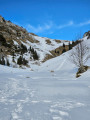
 6.30 mi
 +2,838 ft
 -2,822 ft
 6 hrs
6 hrs
 Difficult
 Departure from Saint-Pierre-d'Entremont (Savoie) (Savoie)
A lovely with snowshoes, with a beautiful view of the Alpine peaks at its height. Note that this hike can be done in all seasons.
 Le Pinet then La Croix de l'Alpe
 8.70 mi
+3,360 ft
-3,360 ft
6h 55
Difficult
Departure from Entremont-le-Vieux (Savoie)
8.70 mi
+3,360 ft
-3,360 ft
6h 55
Difficult
Departure from Entremont-le-Vieux (Savoie)
From the small hamlet of La Plagne, summit of Le Pinet (1,867m), beautiful view to the west, then summit of La Croix de l'Alpe (1,821m) via the Chalets de l'Alpe.
Col de l'Alpe via Sainte-Marie-du-Mont
3.34 mi
+1,365 ft
-1,352 ft
2h 45
 Average
Departure from Sainte-Marie-du-Mont (Isère)
Average
Departure from Sainte-Marie-du-Mont (Isère)
This short hike leads to the Col de l'Alpe via the path used by cows going up and down from the mountain pasture.
Around the Cirque de Saint-Même
 8.20 mi
+3,970 ft
-3,983 ft
7h 15
Difficult
Departure from Saint-Pierre-d'Entremont (Savoie) (Savoie)
8.20 mi
+3,970 ft
-3,983 ft
7h 15
Difficult
Departure from Saint-Pierre-d'Entremont (Savoie) (Savoie)
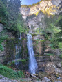
From the Cirque de Saint-Même and its waterfalls, across the Hauts de Chartreuse plateaus via 3 Pas to the Croix de l’Alpe (1,821 m).Stunning views.
⚠️ This route is partly unmarked, unmaintained and presents significant risks. Hikers undertake this route at their own risk. Please follow the official marked trails.
From the Pas de la Rousse to the Col de Belles Ombres via the Croix de l'Alpe
 4.34 mi
+2,333 ft
-2,320 ft
4h 00
Difficult
Departure from Sainte-Marie-du-Mont (Isère)
4.34 mi
+2,333 ft
-2,320 ft
4h 00
Difficult
Departure from Sainte-Marie-du-Mont (Isère)
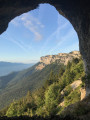
A circular route along the eastern ridge of the Hauts de Chartreuse, combining a variety of terrain (rocks, forests, mountain pastures) with stunning views across the Alps. Can be completed in half a day, preferably in the morning.
Please note: read the information regarding the difficulties in the ‘Practical Information’ section carefully.
Walks near Col de l'Alpe
Aulp du Seuil Hut – Pravouta Hut
6.81 mi
+2,815 ft
-3,009 ft
8 hrs
 Very difficult
Departure from Saint-Bernard (Isère) (Isère)
Very difficult
Departure from Saint-Bernard (Isère) (Isère)
Day2 of this trip via the Col de Bellefont to reach the Dent de Crolles plateau.Descent via the pass above the Trou du Glaz, then down to the Col des Ayes and up the Roc d’Arguille to the Col de Pravouta and the hut of the same name.
⚠️ 27/11/2025: Route modified following a rockfall. It is no longer possible to take the path via the Trou du Glaz (5). The area remains particularly dangerous due to the high risk of further rockfall and falling boulders. Following this incident, the municipality of Saint-Pierre de Chartreuse has issued a by-law to close several hiking trails (for walking, snowshoeing and ski touring). For an ascent of the Dent de Crolles, it is possible to take the route via the Pas de l’Oeille.
You can also go via the Guiers waterfalls to reach (E).
Col de Bellefont via Le Chaos and back via the Col de Saulce
6.85 mi
+3,720 ft
-3,678 ft
6h 25
Difficult
Departure from Saint-Pierre-de-Chartreuse (Isère)
A beautiful, wild hike in the heart of the Chartreuse and on the edge of its nature reserve. The route starts in the woodland, to the sound of the waterfall and the source of the Guiers, climbs up the cliff face, crosses the wild and rugged Chaos de Bellefont, passes through mountain pastures, and reaches the ridge with its stunning views.
Le Pal de Fer
1.43 mi
+2,001 ft
-0 ft
2h 25
Average
Departure from Crolles (Isère)
An original outing that allows you to discover the superb work carried out here for the construction of the Touvet funicular railway. The ascent is on foot and the descent, to relieve the knees, is by funicular.
(Please note): This route is currently closed. See explanations here
(Comment from a hiker) dated 18 June 2023: small difficult section: crossing the scree slope where you need to use two ropes to reach the path in the forest.
Cabane de Pravouta - La Plagne
15.41 mi
+4,469 ft
-6,211 ft
12 hrs
Very difficult
Departure from Saint-Pierre-de-Chartreuse (Isère)
Third and final day of this trip to the Chartreuse to collect the car.
From Col du Coq to Sainte-Marie-du-Mont
 14.29 mi
+4,423 ft
-5,938 ft
10h 25
Very difficult
Departure from Saint-Pancrasse (Isère)
14.29 mi
+4,423 ft
-5,938 ft
10h 25
Very difficult
Departure from Saint-Pancrasse (Isère)
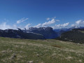
The route runs mainly through the Chartreuse Natural Park, passing through the massif's iconic passes and mountains. The route combines fairly steep climbs, passages through plateaus, mountain pastures and a village.
La Grande Montagne
7.50 mi
+2,182 ft
-2,051 ft
5h 20
Average
Departure from Chambéry (Savoie)
This walk combines a variety of points of interest, starting from Les Éléphants, Chambéry’s iconic monument, before heading towards the Charmettes neighbourhood, dear to Jean-Jacques Rousseau. Further up lies the Grande Montagne, which, whilst nothing like high mountains, nevertheless offers panoramic views of distant mountain ranges.
The first section follows theGR®96route.
Manival - Côte Bonne
 4.52 mi
+1,434 ft
-1,421 ft
3h 20
4.52 mi
+1,434 ft
-1,421 ft
3h 20
 Easy
Departure from Saint-Ismier (Isère)
Easy
Departure from Saint-Ismier (Isère)
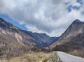
Footprints in the snow for this walk, which can be enjoyed in the summer sun or in the shade of oak and fir trees...
Tour of the two highest peaks in the Chartreuse
 17.39 mi
+6,673 ft
-8,005 ft
7 hrs
Very difficult
Departure from Sarcenas (Isère)
17.39 mi
+6,673 ft
-8,005 ft
7 hrs
Very difficult
Departure from Sarcenas (Isère)
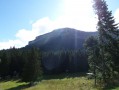
Chamechaude (2,082 m) and the Dent de Crolles (2,062 m) are the two highest peaks in the Chartreuse; allow for a walk of around 30 km – fancy a go?
From the Lodge de la Martinette to the Refuge de l’Oule via Lac du Léat
8.13 mi
+4,619 ft
-2,129 ft
7h 45
Very difficult
Departure from La Ferrière (Isère) (Isère)
A very physically demanding day, with very steep slopes right from the start that give you almost no respite until you reach the refuge. But from the Refuge de la Grande Valloire onwards, the views are magnificent.
From the Oule refuge to the Chalet du Bout via the Col Morétan and the Aup Bernard
8.43 mi
+4,075 ft
-5,548 ft
8 hrs
Very difficult
Departure from Pinsot (Isère)
This long route will take you up and down two mountain passes (Morétan and Vay), through the Morétan Lakes valley, and across the wild, unmarked foothills leading to the Col du Vay. You’ll then begin a long, dizzying descent along a balcony path between the Chalet du Vay and l’Aup Bernard, finally arriving – after one last rather steep climb – at a very pretty spot in the middle of which stands the Chalet du Bout, the perfect place to spend the night.
Please note: this hike involves crossing two snowfields as well as a steep, exposed descent.