


Refine your search for walks in Pas de l'Infernet (1692m)
Pas de l'Infernet (1692m) walks


 Tour of the Font d'Urle Plateau, from Puy de la Gagère to Serre de Montué
 Visorando Member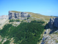
 10.21 mi
 +2,467 ft
 -2,441 ft
 6h 50
6h 50
 Difficult
 Departure from Bouvante (Drôme)
This long circular route covers the different areas of the Font d'Urle Plateau and its pastures, mainly following the ridges that connect its two extreme peaks, the Puy de la Gagère and the Serre de Montué. It allows you to visit the main sites characteristic of this karstic landscape: the karstic cave des Cloches, the Double Arche, the Grotte du Berger and the Glacière de Font d'Urle.
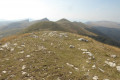
Serre de Montué ridges and Urle cliff ridges from Font d'Urle
 7.07 mi
+1,670 ft
-1,660 ft
4h 40
7.07 mi
+1,670 ft
-1,660 ft
4h 40
 Moderate
Departure from Bouvante (Drôme)
Moderate
Departure from Bouvante (Drôme)
A very beautiful hike on the ridges of Font d'Urle: peaks of Vercors, Dévoluy, Mont Ventoux and Mont Blanc on a clear day. Beautiful panorama of the magnificent and very rugged cliffs of Font d'Urle.
Please note: During the summer months, there are numerous herds and patous (shepherd dogs).
Even dogs on a leash are prohibited by the department from 1 June to 30 October.
Close the gates to the animal enclosures securely.
Route around the Serre de Montué
 12.07 mi
+1,998 ft
-2,021 ft
7h 15
Moderate
Departure from Bouvante (Drôme)
12.07 mi
+1,998 ft
-2,021 ft
7h 15
Moderate
Departure from Bouvante (Drôme)
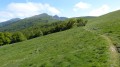
A day at altitude at the Pas de l'Infernet, followed by a descent into the cool undergrowth of Tubanet, Malatra and the Col de la Rama, continuing with a refreshing dip in the Burdour cave and finishing on the grassy slopes of the Chaud Clapier ski runs.
Font d’Urle via Saint-Julien-en-Quint and back via the Plateau d’Ambel
18.52 mi
+4,659 ft
-4,656 ft
8 hrs
 Very difficult
Departure from Saint-Julien-en-Quint (Drôme)
Very difficult
Departure from Saint-Julien-en-Quint (Drôme)
A lovely circular walk to the Font d’Urle ski resort in the Quint Valley, partly through woodland, and back via the Plateau d’Ambel with magnificent views of the Vercors Dévoluy.
Crossing the Ambel d’Omblèze plateau to Font d’Urle
18.98 mi
+5,430 ft
-5,430 ft
10 hrs
Very difficult
Departure from Omblèze (Drôme)
This traverse of the Ambel plateau is magnificent. The beauty of the scenery is simply sublime.You can see all the surrounding mountain ranges (Vercors, Dévoluy, Écrins) and even Mont Blanc on a clear day.On the other side, there are views of the Massif Central and the Rhône Valley.It is possible to complete the hike over two days thanks to the two unstaffed mountain huts.
 Tubanet Hut – Hollowed-Out Tree Trunk Serving as Drinking Trough
16.91 mi
+4,396 ft
-4,511 ft
10 hrs
Very difficult
Departure from Omblèze (Drôme)
Stage4 sets off from the Cabane de Tubanet and returns to the high plateaus of the Vercors at the Cabane des Bachassons above Saint-Agnan-en-Vercors.A very long day. It is the longest of the tour.
Walks near Pas de l'Infernet (1692m)
From Bouvante le Haut to the Ambel Farm
 9.15 mi
+2,927 ft
-843 ft
6h 45
Moderate
Departure from Bouvante (Drôme)
9.15 mi
+2,927 ft
-843 ft
6h 45
Moderate
Departure from Bouvante (Drôme)
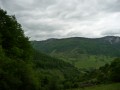
The route starts from the village of Bouvante-le-Haut with its distinctive double wash house. The climb up to the Ambel plateau takes you through a succession of refreshing forests, unique woodlands, flower-filled meadows and breathtaking scenery at the Col de la Bataille.
From the Ambel Farm to Bouvante le Haut
 8.42 mi
+860 ft
-2,966 ft
6 hrs
Very difficult
Departure from Omblèze (Drôme)
8.42 mi
+860 ft
-2,966 ft
6 hrs
Very difficult
Departure from Omblèze (Drôme)
Pastoral plateau, undergrowth, flower-filled meadow. A varied and very pleasant route offering the chance to encounter a rich and unspoilt flora. This route features a very steep descent for the return to Bouvante le Haut via the Col de Rioupeysson.
From Léoncel to the Druise car park via the Croix d'Ambel
 12.86 mi
+3,314 ft
-4,364 ft
8h 50
Difficult
Departure from Léoncel (Drôme)
12.86 mi
+3,314 ft
-4,364 ft
8h 50
Difficult
Departure from Léoncel (Drôme)
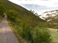
Second stage of the Omblèze circular route in the Southern Vercors. This mountainous stage begins with a long climb to the Pas du Grand Échaillon, which continues up the Ravin de Pissenible to reach the Col de la Bataille and its viewpoint. The path, which is almost level on the flank of the Roc de Toulau, then climbs to the panoramic viewpoint at the Croix d'Ambel, before descending after the Pas de Garde to the viewpoint at Pierre Plate and crossing through Omblèze. It climbs to the Col des Ayes and then continues to the Col d'Anse, from where it descends to the hamlet of Ansage before reaching the car park
From the Druise Waterfall to Léoncel via the Gueulards Canyon
 8.99 mi
+2,300 ft
-1,220 ft
6h 10
Moderate
Departure from Omblèze (Drôme)
8.99 mi
+2,300 ft
-1,220 ft
6h 10
Moderate
Departure from Omblèze (Drôme)
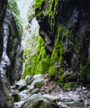
First stage of the circular route around Omblèze in the Southern Vercors. This route begins with a visit to the Chute de la Druise, one of the most beautiful waterfalls in the Vercors, which plunges 70 metres from the bottom of a narrow gorge. After passing through the Gervanne Gorge, you come to the charming little Pissoire Waterfall, followed by a crossing of the Gueulards Canyon, a unique geological feature that inspires both unease and delight, before reaching the small, isolated village of Léoncel and its 12th-century abbey, with its old-world charm, which offers hospitality in a discreet manner.
Jasse du Play shelter - Pré Peyret hut
7.16 mi
+512 ft
-528 ft
3h 45
Moderate
Departure from Gresse-en-Vercors (Isère)
The fourth stage of this crossing is also the least physically demanding. Very flat and short, it takes you across vast meadows. But you can spice it up with the Grand Veymont option.
From the Jasse du Play to the Baraque du Pison
 Association / Club / Walk leader
 9.47 mi
+735 ft
-928 ft
5h 00
Moderate
Departure from Gresse-en-Vercors (Isère)
9.47 mi
+735 ft
-928 ft
5h 00
Moderate
Departure from Gresse-en-Vercors (Isère)
The second stage of the Vercors crossing. Less elevation gain than the previous day, but still a good distance. However, we’re now properly entering the Vercors plateau, and a map, a compass and a good sense of direction are essential, especially when it’s foggy!
Pré Peyret – Col de Vassieux Hut
10.33 mi
+2,047 ft
-2,818 ft
5 hrs
Difficult
Departure from Gresse-en-Vercors (Isère)
The second stage of our Corrençon–Ambel–Corrençon circular route set off from the Cabane de Pré Peyret towards the Col du Rousset and then on to the Cabane du Col de Vassieux.
Pré Peyret Shelter - Chatillon-en-Diois
 12.95 mi
+1,962 ft
-5,259 ft
7h 40
Difficult
Departure from Gresse-en-Vercors (Isère)
12.95 mi
+1,962 ft
-5,259 ft
7h 40
Difficult
Departure from Gresse-en-Vercors (Isère)
The fifth and final stage of this journey through the Vercors. We set off to tackle the Glandasse, with superb views of the high plateaus, the Veymont, Mont Aiguille and the Drôme Provençale.
From the Baraque du Pison to the Cabane de l’Essaure
 6.53 mi
+1,234 ft
-889 ft
4h 05
Moderate
Departure from Romeyer (Drôme)
6.53 mi
+1,234 ft
-889 ft
4h 05
Moderate
Departure from Romeyer (Drôme)
This is the third stage of this Vercors traverse. We’re now reaching the southern part of the Vercors plateau, where the terrain and vegetation make navigation very tricky, but the scenery becomes absolutely stunning!
Cabane des Aiguillettes - Corrençon-en-Vercors
15.15 mi
+666 ft
-3,110 ft
7h 35
Difficult
Departure from Gresse-en-Vercors (Isère)
The fourth and final day of the circular route leading from the L'Aiguillette hut at the foot of the Grand Veymont to the car park at the Corrençon-en-Vercors ski stadium, where we will have left a car.