Pré Peyret – Col de Vassieux Hut

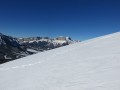
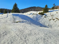
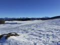
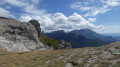
The second stage of our Corrençon–Ambel–Corrençon circular route set off from the Cabane de Pré Peyret towards the Col du Rousset and then on to the Cabane du Col de Vassieux.

This walk is part of a multi-day hike: Totalité de la Boucle Corrençon - Ambel

Details

21743
Creation:
Last update:
Last review:
  • Snowshoeing
    Activity: Snowshoeing
  • ↔
    Distance: 10.33 mi
  • ◔
    Duration according to the author: 5 hrs 
  • ▲
    Difficulty: Difficult

  • ⚐
    Back to start: No
  • ↗
    Ascent: + 2,047 ft
  • ↘
    Descent: - 2,818 ft

  • ▲
    Highest point: 5,476 ft
  • ▼
    Lowest point: 4,088 ft

Description of the walk

(S) From the Pré Peyret hut, take the mainGR® trail and follow it all the way to the Col du Rousset.

(1) Do not descend into the resort but follow the contour line (this is theGR®) to reach a small pass at the foot of the But de la Neve (you are just above the Col du Rousset tunnel).
Descend to reach the road (which is just below) via a descending traverse. Leave the road and take a path on the right (signposted for a via ferrata); follow a good, sloping path carved into the cliff face to reach a pasture with signposts at the small pass.

(2) Turn left and climb towards the Chironne rocks and the ridge, crossing out from beneath the summit.

(3) Follow a well-marked, clear track along the ridge.
Caution here: this entire section is close to the edge; take care of the ledges and, if visibility is poor, allow for a safety margin by keeping slightly lower down on the right-hand side.
Pass beneath the But de l’Aiglette to the large meadow, the upper part of which forms the Col de Vassieux.

(4) Continue to follow the ridge; shortly afterwards, a well-marked path branches off horizontally to the right, leading in 5 minutes to the Col de Vassieux refuge (E), today’s destination.

Waypoints

  1. S : mi 0 - alt. 5,249 ft - Cabane de Pré Peyret
  2. 1 : mi 4.87 - alt. 4,708 ft - Col de Rousset
  3. 2 : mi 7.06 - alt. 4,472 ft - Bergerie de Chironne
  4. 3 : mi 8.39 - alt. 5,046 ft - Beneath the Rochers de Chironne
  5. 4 : mi 10.13 - alt. 4,436 ft - Col de Vassieux (1333m)
  6. E : mi 10.33 - alt. 4,465 ft - Col de Vassieux Mountain Hut

Notes

This hut is similar to the one at Chamailloux.
Please note that in summer there is a good spring a quarter of an hour’s walk ahead of the Cabane Forestière du Plainet (closed).

This stage is short and easy; I set off at 7.00 am and arrived around 12.30–1.00 pm.

As a reminder, the regulations for the Hauts-Plateaux du Vercors Nature Reserve impose the following main restrictions:
- Dogs are prohibited, even when kept on a lead
- Flying at an altitude of less than 300 metres is prohibited (therefore, drones and paragliders are prohibited)
- Fires are prohibited
- Deliberately disturbing wildlife is prohibited (take care not to disturb marmots and ibex, amongst others)
- Picking plants is prohibited
- Camping is prohibited, but bivouacking is permitted from 5.00 pm to 9.00 am
- Littering is prohibited (including in the shelters open to all!)
These strict regulations are necessary to protect the species and habitats found in this wild and unspoilt area.

This route passes through a protected area, which may be subject to special regulations:

Always be cautious and plan ahead when you're outdoors. Visorando and the author of this route cannot be held responsible for any accidents occurring on this route.

The GR® and PR® markings are the intellectual property of the Fédération Française de Randonnée Pédestre.

Reviews and comments

4.8 / 5
Based on 2 reviews

Reliability of the description
5 / 5
Ease of following the route
5 / 5
Route interest
4.5 / 5
bernardino
bernardino ★

Great.

Machine-translated

catherine-berthelet@wanadoo.fr

Overall rating : 5 / 5

Date of your route : Feb 20, 2023
Reliability of the description : ★★★★★ Very good
Ease of following the route : ★★★★★ Very good
Route interest : ★★★★★ Very good
Very busy route : Yes

Out of the three of us, I was the only one with Visiorando, and luckily that meant we were able to go on the walk even in the fog.
I managed to persuade the other two people.

Machine-translated

sonducor
sonducor

Overall rating : 4.7 / 5

Date of your route : Feb 26, 2019
Reliability of the description : ★★★★★ Very good
Ease of following the route : ★★★★★ Very good
Route interest : ★★★★☆ Good

Completed on 23 February 2019 on snowshoes, in the opposite direction. Moderate difficulty. Very busy.

Machine-translated

Other walks in the area

For more walks, use our search engine .

The GPS track and description are the property of this route's author. Please do not copy them without permission.