Country:

 City:
City:


Omblèze Town Hall car park.
(S/E) Head due east, straight ahead, along the road that runs between two houses.
(1) At the signpost, turn left towards Tète de la Dame and follow the yellow and red markings ofthe GRP®® Grand Tour de la Gervanne.
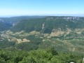
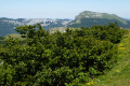
(2) Once you reach the halfway point up the slope, enjoy the view over the valley and continue climbing until you emerge from the forest.
(3) At the signpost for Les Sarnats, turn right towards Tête de la Dame along a steady climb.
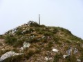
(4) At the summit of Tête de la Dame: 360° view. Head down, keeping to the left to follow a fence, and start walking along the meadow.
(5) At the signpost for Les Moutons, continue across the meadow, keeping to the right. Carry on straight ahead at the various junctions.
(6) At the Pas de la Ferrière, go through the gate and head uphill towards Font d’Urle via theGR®® 93.
(7) At the Col du Serre de Montue, head down towards Font d’Urle and make your way to the Pas de l’Infernet.
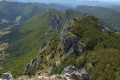
(8) You can climb up to the right onto the mountain to admire the cliffs, but take care.
(9) Turn back and head back to the Pas de l’Infernet.
(8) Head right towards Font d’Urle.
(10) Turn back, pass the Pas de l’Infernet and head for the Pas de la Ferrière.
(6) Follow theGR®® 93 to the right towards the Refuge de Tubanet.
(11) At the Pierre de l’Ours, continue along theGR®® 93 towards the Refuge de Tubanet.
(12) Just before the refuge, take theGR®®93to the left, which heads into the forest.
(13) At the signpost for Le Vernâtre, carry on straight ahead, still on theGR®® 93.
(14) At the Refuge d’Ambel, head up towards the Pas du Gouillat. TheGR®® 93turns due south.
(15) At the Pas du Gouillat, turn left onto theGRP®® towards Tête de la Dame for thesecond ascent.
(3) At Les Sarnats, carry on straight ahead along the path you took on the way there.
(4) When you reach the top of the Tête de la Dame atthe second cairn, turn immediately right off the marked trail onto a path that is barely visible at first to begin a fairly steep and difficult descent.
(16) At the Col des Teulières, turn right onto the path towards Omblèze (yellow and green markings). The descent is steep and slippery in wet or damp conditions until you reach the junction with a track.
(17) After a few metres on the track, turn right onto the small path. Rejoin the same track further down and continue descending.
(18) Go round Grange Neuve and reach the first signpost.
(1) Carry on straight ahead and you will eventually reach the car park (S/E).
 Visorando Member
 Difficult
 Moderate