Font d’Urle via Saint-Julien-en-Quint and back via the Plateau d’Ambel

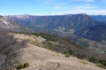
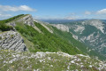
A lovely circular walk to the Font d’Urle ski resort in the Quint Valley, partly through woodland, and back via the Plateau d’Ambel with magnificent views of the Vercors Dévoluy.

Details

28093620
Creation:
Last update:
Last review:
  • Walking
    Activity: Walking
  • ↔
    Distance: 18.52 mi
  • ◔
    Duration according to the author: 8 hrs 
  • ▲
    Difficulty: Very difficult

  • ⚐
    Back to start: Yes
  • ↗
    Ascent: + 4,659 ft
  • ↘
    Descent: - 4,656 ft

  • ▲
    Highest point: 5,453 ft
  • ▼
    Lowest point: 1,686 ft

Description of the walk

Car park behind the church.

(S/E) Head due north on the D129.

(1) At the signpost for Villeneuve, keep left onto the D129.

(2) Leave the return route on your left. Continue along the D129. Much further on, pass Merclan and arrive at a car park.

(3) At the Route Forestière de Somme Longue, turn sharply left for about 100 m and take the small path on the right (marked in yellow and green).

(4) At the junction at the end of the forest track, carry straight on.

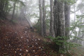
(5) At another junction on the track, take a path that climbs up to rejoin the track a little further up, until it becomes increasingly narrow and eventually turns into a footpath (continue to follow the yellow and green markings). Follow the winding path to reach the Pas d’Urle (Porte d’Urle on IGN maps).

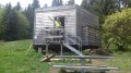
(6) Turn left towards the ski resort, heading due north. You’ll reach a car park. Continue straight on, past the mountain hut, and on to the Font d’Urle

(7) Then follow theGR®93straight ahead, heading due north, before turning west, then north-west towards the Pas de l’Infernet.

(8) Cross the small pass and begin the descent, staying on theGR®93, to the Pas de la Ferrière.

(9) Leave theGR®93, which branches off to the right, and head straight on along the narrow path (hard to spot at first) through the meadow. Much further on, you’ll reach the Pas d’Ambel.

(10) Continue straight on, staying on the ridge, until you reach the signpost for Les Moutons.

(11) Start climbing towards the Tête de la Dame.

(12) Just before the large cairn, take the small path on the left that leads down (caution: steep in places) and follow the ridge to the Col des Teulières.

(13) Turn left towards Saint-Julien-en-Quint (the descent is quite steep in places).
Head down this narrow path, which widens further on.

(14) Take a small path on the right marked by a small cairn and yellow and green markings. You’ll reach the D129a.

(15) Follow this road towards Saint-Julien-en-Quint.

(16) At Les Touzons, continue along the D129a. At Le Colombier, continue along the D129a to rejoin the road you took on the way there.

(2) Carry on straight ahead along this road and head for the car park behind the church (S/E).

Waypoints

  1. S/E : mi 0 - alt. 1,827 ft - Car park behind the - Église Saint-Julien ( Saint-Julien-en-Quint)
  2. 1 : mi 0.21 - alt. 1,824 ft - Signpost for Villeneuve
  3. 2 : mi 0.35 - alt. 1,824 ft - Common junction (out and back)
  4. 3 : mi 2.53 - alt. 2,201 ft - Serre Longue forest track
  5. 4 : mi 3.32 - alt. 2,792 ft - End of the forest track
  6. 5 : mi 4.31 - alt. 3,632 ft - Junction with a forest track
  7. 6 : mi 6 - alt. 4,885 ft - Porte d'Urle (1496m)
  8. 7 : mi 6.54 - alt. 4,741 ft - Font d’Urle
  9. 8 : mi 7.76 - alt. 5,354 ft - Pas de l'Infernet (1692m)
  10. 9 : mi 8.99 - alt. 4,760 ft - Pas de la Ferrière (1456m)
  11. 10 : mi 10.78 - alt. 4,560 ft - Pas d'Abel (1396m)
  12. 11 : mi 11.5 - alt. 4,623 ft - Les Moutons
  13. 12 : mi 12.83 - alt. 4,934 ft - Tête de la Dame (1506m)
  14. 13 : mi 14.25 - alt. 3,799 ft - Col des Teulières (1170m)
  15. 14 : mi 14.87 - alt. 2,477 ft - Small path to the right
  16. 15 : mi 15.67 - alt. 1,929 ft - Faucon
  17. 16 : mi 16.82 - alt. 1,690 ft - Les Touzons. Walk along the - Sure (affluent de la Drôme)
  18. S/E : mi 18.52 - alt. 1,824 ft - Car park behind the - Église Saint-Julien ( Saint-Julien-en-Quint)

Notes

You can get water at Font d’Urle (7).
Make sure you have good walking shoes.

Worth a visit

Grotte du Berger.
Font d’Urle station.
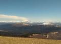
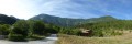
View of the Vercors (Grand Veymont), Glandasse and Dévoluy.

Always be cautious and plan ahead when you're outdoors. Visorando and the author of this route cannot be held responsible for any accidents occurring on this route.

The GR® and PR® markings are the intellectual property of the Fédération Française de Randonnée Pédestre.

Reviews and comments

4.8 / 5
Based on 2 reviews

Reliability of the description
5 / 5
Ease of following the route
5 / 5
Route interest
4.5 / 5
subwrcnico
subwrcnico

Overall rating : 5 / 5

Date of your route : Jun 14, 2025
Reliability of the description : ★★★★★ Very good
Ease of following the route : ★★★★★ Very good
Route interest : ★★★★★ Very good
Very busy route : No

A beautiful route that allows you to enjoy the Plateau d'Ambel and Font d'Urle, starting from St Julien en Quint (less crowded than the Col de la Bataille, for example, which is a real plus for me).
On a fairly hot day (32°C in St Julien en Quint), don't hesitate to take plenty of water with you as there is virtually no shade between the Tête de la Dame and the Porte d'Urle. I took 3 litres and it was just enough.
I did the circuit in the opposite direction to the description because I wasn't sure about going down from the Col des Teulières.
In the end, I think the direction suggested in the description allows you to enjoy the landscape more and avoids having to turn around regularly.
Conclusion: I highly recommend this hike, preferably on a day that is not too hot and if you are in good physical condition due to the length and elevation gain.

Machine-translated

Protee26
Protee26
• Edited:

Overall rating : 4.5 / 5

Date of your route : May 31, 2025
Reliability of the description : Not used / Not applicable
Ease of following the route : ★★★★★ Very good
Route interest : ★★★★☆ Good
Very busy route : No

Instead, we opted to do this hike over two days, camping in a tent near the Tubanet mountain hut. The first stage was 16.3 km and the second 14.2 km. Naturally, we were carrying a bit more weight (a 12 kg rucksack and 4 litres of water). Be warned: it gets very hot on the south-facing slopes, whether you’re going up or down.
A very beautiful hike, with varied scenery. The tarmac road at the start is a bit long, but the return journey is easier, with a stop at the river just before you arrive to cool off!

Machine-translated

Other walks in the area

For more walks, use our search engine .

The GPS track and description are the property of this route's author. Please do not copy them without permission.