Route around the Serre de Montué

A day at altitude at the Pas de l'Infernet, followed by a descent into the cool undergrowth of Tubanet, Malatra and the Col de la Rama, continuing with a refreshing dip in the Burdour cave and finishing on the grassy slopes of the Chaud Clapier ski runs.

Details

123026
Creation:
Last update:
Last review:
  • Walking
    Activity: Walking
  • ↔
    Distance: 12.07 mi
  • ◔
    Average duration: 7h 15 
  • ▲
    Difficulty: Moderate

  • ⚐
    Back to start: Yes
  • ↗
    Ascent: + 1,998 ft
  • ↘
    Descent: - 2,021 ft

  • ▲
    Highest point: 5,453 ft
  • ▼
    Lowest point: 3,799 ft

Photos

Description of the walk

Start from the village of Font d'Urle near the restaurant "Les Dryades" at the end of the village (plenty of parking available).

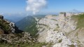
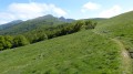
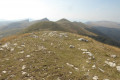
(S) Follow the road to the right when facing the restaurant, then further along the bend to the right, take the path straight ahead, climbing behind the houses; it is marked red and white and is theGR®93. Follow these markings until you reach “Paturage et refuge Tubanet”. Continue uphill along theGR®93path, which climbs through the meadow; there are sometimes several possible paths, but always head for the shepherd’s hut and pass to the left of it. Continue to the Pas de l’Infernet.

(1) Continue uphill, skirting the summit to the right. Then begin the descent, still following theGR®93, passing through the Pas de la Ferrière and heading right towards the Pierre de l'Ours.
Near the Pas de la Ferrière, you can see clearings in the forest on the lower slopes of Mount Malatra, where you can make out the observation huts used for deer rutting in October.
At first, the forest lies below, then gradually draws nearer until it is right beside you. Follow the edge of the forest, then turn right onto a steep descent and admire the vast Ambel meadow on your left. You’ll reach a junction of two paths on the right.

(2) Take the slightly ascending path on the far right (north-north-east, leaving the track to the Tubanet refuge). Continue to follow the correct track on level ground through the undergrowth, ignoring the paths joining from the left or right. You will notice signs on the trees to the left prohibiting access during the deer rutting season. Pass a barrier with a car park.

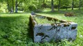
(3) At a crossroads of tracks ahead, take the one on the left leading to the Malatra clearing. You’ll notice a very old sign for “Malatra” high up on a tree on the right. At the clearing, admire the meadow and the imposing fountain structure (unfortunately without water!) – the picnic tables are a welcome sight at times.
Return to the track you came along and ignore the stony track branching off to the left; instead, take a path opposite (which looks like an old, abandoned track now overgrown with vegetation). Shortly afterwards, you’ll join and continue along a main track coming in from the right.

(4) “Carrefour de la Carrière” junction with a track coming from the right to the left, which you ignore to continue straight on. This track leads, further on with a right-hand bend, to the Col de La Rama. A very steep path branches off to the left, but follow the track to the right until you reach a major junction with a steep path climbing to the left, a flat track to the left, a stony path descending straight ahead and a flat track to the right.

(5) Follow the very stony path descending straight ahead into the forest. You will notice the “Sapin bronzé” and a stone engraving from 1666 along the way. This path leads to a main road, which you follow to the right for a good kilometre until a sharp left-hand bend towards the water pumping station.

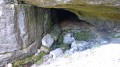
(6) Before the bridge, look out for the information about the “Grotte du Brudour” on the right at the start of a path. Follow this path along the left bank of the stream to admire the immense cave and the resurgence. Return to the bridge and cross it via the road on the right. Follow the road for 50 metres, then take a path on the right that climbs and passes above the cave on the right. Pass beneath the “Combe” ski lift on the right.

(7) Cut across and ignore a track coming from right to left and continue straight on. Pass beneath the “Cairn” ski lift on the right, then under a wooden footbridge and finally beneath the “Sharp Limestone Pavement” ski lift on the left.

(8) Cut across and ignore a track running from right to left and continue straight on along the grassy path climbing up the valley. Follow the valley, then halfway up the slope at a crossroads, veer slightly to take the path on the left. You will reach the village road; follow it to the right and then to the left to return to the starting point (E).


Waypoints

  1. S/E : mi 0 - alt. 4,741 ft - Start from the village of Font d'Urle
  2. 1 : mi 1.38 - alt. 5,358 ft - Pas de l'Infernet (1692m)
  3. 2 : mi 3.76 - alt. 4,383 ft - Junction of Ambel and Tubanet
  4. 3 : mi 5.18 - alt. 4,252 ft - Bout De Malatra crossroads
  5. 4 : mi 6.14 - alt. 4,268 ft - La Carrière crossroads
  6. 5 : mi 7.38 - alt. 4,193 ft - Crossroads - Col de la Rama (1277m)
  7. 6 : mi 9.02 - alt. 3,891 ft - Brudour Cave
  8. 7 : mi 10.45 - alt. 4,318 ft - Brudour South junction
  9. 8 : mi 11.11 - alt. 4,551 ft - Chaud Clapier junction
  10. S/E : mi 12.07 - alt. 4,741 ft - Car park in the village of Font d'Urle

Notes

No water sources: the Vercors is dry!
Be prepared for the coolness of the woodland.
Picnic tables at the Malatra clearing.
Standard hiking gear.

Worth a visit

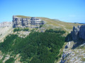
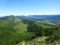
Peaks of the Serre de Montué.
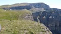
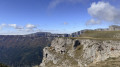
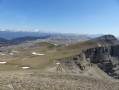
Plateau and cliffs of the Montagne d'Ambel.
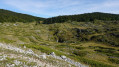
Beautiful meadow at the Malatra clearing.
The Burdour cave and resurgent spring.

Always be cautious and plan ahead when you're outdoors. Visorando and the author of this route cannot be held responsible for any accidents occurring on this route.

The GR® and PR® markings are the intellectual property of the Fédération Française de Randonnée Pédestre.

Reviews and comments

4.6 / 5
Based on 5 reviews

Reliability of the description
4.4 / 5
Ease of following the route
4.8 / 5
Route interest
4.6 / 5
craco.35
craco.35

Overall rating : 4.3 / 5

Date of your route : Aug 07, 2023
Reliability of the description : ★★★★☆ Good
Ease of following the route : ★★★★★ Very good
Route interest : ★★★★☆ Good
Very busy route : No

Hike completed on 6 August 2023. Temperature at the start at 8.20 am: 7°C; felt like close to 0°C at the Pas de l’Infernet. A lovely hike that we’ll do again in part, as there was too much fog at the start that day!!!! From the junction with the road, the climb up the tracks was a bit of a drag for us. Only the finish is truly beautiful, with the herds.
Thanks to the author for posting it; there’s something for everyone.

Machine-translated

gilbert.agnes@orange.fr
• Edited:

Overall rating : 4.3 / 5

Date of your route : Sep 04, 2020
Reliability of the description : ★★★★☆ Good
Ease of following the route : ★★★★☆ Good
Route interest : ★★★★★ Very good
Very busy route : No

The scenery on this hike was magnificent – thank you

We didn’t come across any other hikers that day

Machine-translated

schnogeloch
schnogeloch

Overall rating : 5 / 5

Date of your route : Aug 09, 2020
Reliability of the description : ★★★★★ Very good
Ease of following the route : ★★★★★ Very good
Route interest : ★★★★★ Very good
Very busy route : No

A lovely walk.
The first section is magnificent, up to Tubanet, and is best done early in the morning before it gets too hot.
The second part is shaded and pleasant, apart from the kilometre on the road which is overrun with deafening motorcyclists. There are lots of people at the Malatra clearing, due to easy access by road; but very few hikers on the trails.
Thanks to the author of this perfectly described hike.

Machine-translated

Christine B
Christine B

Overall rating : 4.3 / 5

Date of your route : Aug 29, 2015
Reliability of the description : ★★★★☆ Good
Ease of following the route : ★★★★★ Very good
Route interest : ★★★★☆ Good

A lovely walk. The route starts in the mountain pastures, offering fantastic scenery.
At point 5, the directions are unclear. Take the path on the right (leave the Chemin du Bachat on your left)
To avoid the road section, we took the GR, which led us to point 7

Machine-translated

poucette26
poucette26

Overall rating : 5 / 5

Date of your route : Jul 26, 2015
Reliability of the description : ★★★★★ Very good
Ease of following the route : ★★★★★ Very good
Route interest : ★★★★★ Very good

A lovely walk, which we’re going to do again as a round trip, sticking to the ridges all the way to the summit of Montué.

Machine-translated

Other walks in the area

For more walks, use our search engine .

The GPS track and description are the property of this route's author. Please do not copy them without permission.