


Refine your search for walks in Oreilla
Oreilla walks


 Le Pla and the Orri de l’Estanyol as seen from Oreilla.
 Visorando Member
 8.53 mi
 +3,491 ft
 -3,471 ft
 7h 00
7h 00
 Difficult
 Departure from Oreilla (Pyrénées-Orientales)
All in all, a fairly challenging hike, with a steady climb, which can be cut short at any time.
You need to reach the grassy ridge of the Serra (mountain) de Palmes and continue along this ridge as far as possible. It was clearly a heavily used area, judging by all the ruins of sheepfolds and huts we came across.
The Camí Ramader, the Refuge de la Mouline from Évol
 9.55 mi
+2,844 ft
-2,828 ft
6h 50
9.55 mi
+2,844 ft
-2,828 ft
6h 50
 Moderate
Departure from Olette (Pyrénées-Orientales)
Moderate
Departure from Olette (Pyrénées-Orientales)
From Évol, a beautiful circular hike via the Camí Ramader, to discover the landscape and the mountain space dedicated to pastoralism. The Ribera d'Évol valley is a mid-mountain area where man has tamed the steep slopes by building fetges (terraces) to prevent erosion and to grow some cereals. These large structures were built using locally available materials and blend perfectly into the landscape.
On the way back, there is a short track between (11) and (12) and between (15) and (16).
Chemin Vauban: from Olette to Sauto
10.54 mi
+4,596 ft
-1,398 ft
8h 50
Difficult
Departure from Olette (Pyrénées-Orientales)
This section of the Chemin Vauban links Olette to Sauto via a route that is much better signposted than the previous one. The route remains, however, long and challenging, with some steep ascents and descents, but in return offers sumptuous and varied scenery. In particular, it takes you through the villages of Canaveilles and Llar, before gaining altitude towards the Serre de Clavera, then beginning the final descent towards Sauto.⚠️ Warning: the route runs alongside and crosses a military firing range between (10) and (11). Before setting out on this route, it is essential to check the days and times of firing exercises to ensure that passage is permitted.
From Thuir-d'Évol to the Mouline refuge
 8.60 mi
+2,487 ft
-2,493 ft
6h 05
Moderate
Departure from Olette (Pyrénées-Orientales)
8.60 mi
+2,487 ft
-2,493 ft
6h 05
Moderate
Departure from Olette (Pyrénées-Orientales)
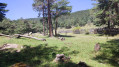
This is a very pleasant round trip hike in hot weather. Inspired by the Visorando publication of the loop entitled "Le Camì Ramader, le Refuge de la Mouline depuis Évol", it has the advantage of following the course of the Evol stream, allowing you to cool off regularly. Much of the route is through woodland, and the shade provided by the various trees, which change species as you climb, offers welcome respite from the heat.
Thuir d'Evol circular via La Mouline and Llobadibes
 11.87 mi
+3,166 ft
-3,163 ft
8h 15
Difficult
Departure from Olette (Pyrénées-Orientales)
11.87 mi
+3,166 ft
-3,163 ft
8h 15
Difficult
Departure from Olette (Pyrénées-Orientales)
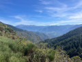
A beautiful hike with a steady climb to the Refuge de la Mouline along a well-marked trail that passes through increasingly beautiful scenery as you progress, often through woodland. After the refuge, the hike changes completely as you leave the pine forest, with a balcony walk offering impressive views of the Pyrenees mountain range, from Canigou to Cambre d'Aze. Although it does not present any technical difficulties, this hike is classified as difficult, partly because of its length but mainly because of the uncertainty in following the route after the Refuge de la Mouline, as the quality of the trail changes completely. It is essential to follow the Visorando trail to complete this circular hike off the beaten track, as it is well worth the effort. A GPS or the Visorando app is therefore strongly recommended.
Les Teixoneres
 9.78 mi
+3,399 ft
-3,379 ft
7h 30
Difficult
Departure from Olette (Pyrénées-Orientales)
9.78 mi
+3,399 ft
-3,379 ft
7h 30
Difficult
Departure from Olette (Pyrénées-Orientales)
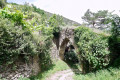
A hike with a challenging start. The climb through the forest is magnificent.
The route along the hills and the return leg offer views of a varied landscape.
Huts, an old castle and a listed village are all part of this walk.
This walk is accessible by public transport. See practical information.
This walk can be considered very difficult due to its length and steep sections.
The Chemin des Canons in Canaveilles
6.25 mi
+2,254 ft
-2,254 ft
4h 50
Moderate
Departure from Canaveilles (Pyrénées-Orientales)
A magnificent hike along a historic trail offering stunning views.
Loop in the Jujols Nature Reserve
 10.46 mi
+3,117 ft
-3,127 ft
7h 30
Difficult
Departure from Jujols (Pyrénées-Orientales)
10.46 mi
+3,117 ft
-3,127 ft
7h 30
Difficult
Departure from Jujols (Pyrénées-Orientales)
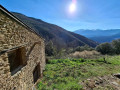
This is a lovely loop that allows you to explore the Jujols nature reserve, with superb views of the Conflent peaks. The hike faces south-east, is very sunny and sheltered from the tramontane wind, and crosses pastoral areas.
Shortcuts are possible on this loop (see description in the practical information section).
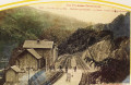
The natural pools of the hot springs at Thuès-les-Bains
 2.33 mi
+354 ft
-338 ft
1h 25
Moderate
Departure from Canaveilles (Pyrénées-Orientales)
2.33 mi
+354 ft
-338 ft
1h 25
Moderate
Departure from Canaveilles (Pyrénées-Orientales)
Tired of long Catalan hikes?Treat yourself to a relaxing afternoon with a hot outdoor bath in the heart of the Entre-Valls forest, with views of the foothills of the Estallades and El Fornas. All this is free of charge in natural pools at a public site, spotlessly clean, not far from the majestic arches of the Yellow Train railway bridge. Unforgettable memories!
Thués-Entre-Valls - Carança refuge
 5.40 mi
+3,832 ft
-653 ft
5h 50
Moderate
Departure from Thuès-Entre-Valls (Pyrénées-Orientales)
5.40 mi
+3,832 ft
-653 ft
5h 50
Moderate
Departure from Thuès-Entre-Valls (Pyrénées-Orientales)
This is the first stage of the Thués - Fillols loop, which takes you up the Carença Gorge to the refuge of the same name.
Thués-Entre-Valls – Fillols Route
34.29 mi
+14,088 ft
-14,383 ft
5 days
Moderate
Departure from Thuès-Entre-Valls (Pyrénées-Orientales)
A 5-day route in the Catalan Pyrenees, offering the chance to explore the stunning Carença Gorges before finishing with an ascent of the Catalan giant: the Canigou.
The Carança Gorges loop
 3.22 mi
+2,031 ft
-2,028 ft
3h 15
Moderate
Departure from Canaveilles (Pyrénées-Orientales)
3.22 mi
+2,031 ft
-2,028 ft
3h 15
Moderate
Departure from Canaveilles (Pyrénées-Orientales)
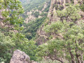
A lovely, short and very scenic route through the Carança Gorges. This walk offers multiple options up to the suspension footbridge, meaning you can do a circular route (and return to the starting point or switch to the other bank) at several points.Moderator’s note: some people have got lost on this hike; see reviews
The Carança Gorges in two days
18.92 mi
+5,935 ft
-5,906 ft
2 days
Difficult
Departure from Canaveilles (Pyrénées-Orientales)
Nestled in the heart of the Eastern Pyrenees, the Carançà Gorges offer an unforgettable adventure for hiking enthusiasts. This two-day route will take you through spectacular landscapes, suspended footbridges over the rushing torrent, vertiginous cornices and dense forests. On the first day, you will climb up the gorge to the Ras de la Carança refuge, before continuing on to the Estany de Carançà for a high-altitude bivouac. The next day, you will descend via a loop route through the heights, offering breathtaking views of the valley. A total immersion in unspoilt wilderness awaits you.
Carança Gorges
 11.45 mi
+5,282 ft
-5,282 ft
9h 50
Difficult
Departure from Canaveilles (Pyrénées-Orientales)
11.45 mi
+5,282 ft
-5,282 ft
9h 50
Difficult
Departure from Canaveilles (Pyrénées-Orientales)
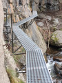
A magnificent hike between gorges and mountains. Aerial passages, footbridges and rope bridges are guaranteed on this route. Do not attempt this route in rainy or snowy weather.
Please note: the elevation gain is overestimated by the software. The total elevation gain is 1,100 metres.
Carançà Gorges - Abri de la Balmère AR (return via the upstream ledge)
 7.14 mi
+3,363 ft
-3,363 ft
6h 15
Difficult
Departure from Thuès-Entre-Valls (Pyrénées-Orientales)
7.14 mi
+3,363 ft
-3,363 ft
6h 15
Difficult
Departure from Thuès-Entre-Valls (Pyrénées-Orientales)
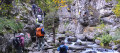
In summer, you will be looking for coolness and a few thrills: for you, there is a stream, gorges, undergrowth and a few fun passages on footbridges and monkey bridges (return trip). You can then return via a narrow ledge, which is not recommended for young children, people with poor footwear or those prone to vertigo.
(There is an alternative route via the downstream ledge, which is the most vertiginous).