Country:

 City:
City:


(S) From the village square in Olette, head west on the RD66 . Take great care, as thepavements are narrow. Further on, pass the sign for the Train Jaune station on your left and continue along the road to the petrol station.
Cross the road carefully to take the bridge on the right over the Cabrils (pedestrianised). At the junction, turn right despite the ‘Private property – keep out’ sign, then turn immediately left at the next junction and right again at the following one.
Follow this path uphill until you reach a track.
(1) Take the track to the right, then, at the next junction, follow it to the left. After the bend, leave this track and take the path that climbs to the left. You will then come to another track; take the middle route, to the left, to reach a water tower.
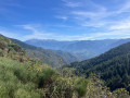
(2) Take the path that branches off to the left of the water tower and then walk along the balcony path, with lovely views over the Têt valley below, until you reach the entrance to Canaveilles.
(3) Keep to the left. A short climb leads to the church; then walk past the town hall before reaching the road.
(4) Then turn right onto the Chemin des Canons.
Now the going gets tough , with gradients exceeding 20 per cent in places. Fortunately, the panoramic views make the effort well worth it. In particular, you can spot the Séjourné Bridge and, with a bit of luck, the Train Jaune crossing it, as well as enjoying lovely views of the cliff-top road leading to the Gorges de la Carança.
As you climb, the village of Llar gradually comes into view. Carry on until you reach a junction marked by a sign pointing to the Chemin Vauban.
(5) Cross the track diagonally and continue up an ascending track to reach the entrance to the hamlet of Llar.
(6) Turn left, then, just before the church, take the path on the right leading up to the higher parts of Llar. Continue along the yellow-marked trail.
Please note: this section is particularly challenging, with an elevation gain of around 250 metres over just over a kilometre and gradients that can exceed 30 per cent.
After these particularly steep climbs, you’ll enter a wooded area where you’ll notice a radical change in vegetation, then continue until you reach a junction marked by a sign for the Chemin Vauban.
(7) Take the track that climbs to the left and head towards a junction of tracks marked by a sign for the Chemin Vauban.
(8) Take the track on the left and follow it all the way until you leave it at a sign pointing to a car park – unfortunately, this is the only sign at this point (elevation 1,717).
(9) Leave the track and take a faint path on the left which climbs through the undergrowth. After this initial section through the forest, you’ll come to a trail running along a ridge, offering beautiful panoramic views.
Continue round the Serra de Clavera until you reach a signpost indicating it. About 500 m further on, you’ll come to another signpost marking the Chemin Vauban.
(10) Begin the descent by leaving the track after 200 m and keeping to the left onto the Chemin Vauban, which leads to a track. Take this track to the left for a few metres.
(11) Leave this track to take the path descending to the right. Follow the yellow markings throughout the descent, which leads to the heights of Sauto, at the starting point of the section leading to La Llagonne (E).
 Visorando Member
 Moderate