Country:

 City:
City:


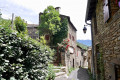
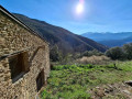
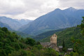
(S/E) Olette railway station car park. Head towards the underground recycling bins in the recycling area. Walk steeply uphill along the narrow street. Turn right then left almost immediately, climbing the steps. You’ll reach the N116 (Avenue du Général de Gaulle). Cross at the pedestrian crossing with care. Continue climbing steeply up the steps, then along a wide, very steep path. Pass close to a wall and a house painted burgundy. Join a wide tarmac road. Lovely view of the village and the surrounding mountains.
(1) At the fork, turn left onto the road. Walk past a block of flats on your left. Continue to the end of Rue La Fusterie. Head up towards the children’s playground. Walk along the right-hand side of it. Pass a drinking water reservoir on your right.
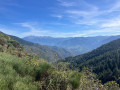
(2) Turn right, heading uphill into the forest. The path is very well marked. Pass an old canal and continue straight ahead, still heading uphill. There are some old, very sparse yellow markings remaining. The path then heads due north, climbing steadily. Continue uphill via numerous hairpin bends through this beautiful forest. Clearings offer views of the La Têt valley.
(3) Continue to the right, climbing.
(4) At the fork (1120m), stay on the path on the right as you climb.
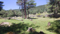
(5) Crossroads of paths and grassy tracks (altitude 1141m). Open area.
If necessary: the Refuge des Hautes Comeilles can be used as shelter; in this case, head left into the forest, heading due west.
Continue due north, straight ahead, to reach a grassy track, which continues to climb very steeply, making a sharp bend. At 1180m it joins a wide track which you must follow, veering right then left. At 1,250m, it heads up this grassy ridge, climbing steeply across open ground, north-north-west. I have placed cairns to help with navigation. Simply follow this wide track, which climbs steadily.
The view is 360°. The track is very well marked. You’ll reach Pla de La Roca, with an altitude of 1,371 metres.
(6) Continue to the right, due north, climbing towards a wide track suitable for vehicles.
(7) Turn left onto this wide track. You must now follow this track as it winds round the small peaks on your right. Pass above a large sheepfold on your right. You’ll arrive at a large, open, developed area.
(8) Coll Diagre, altitude 1,471 m. Water point provided. Ignore the various marked paths. Continue to the left. Carry on along the wide track on level ground.
(1,470 m). Pass a first valley where the Comall de Riell flows. The track now begins to climb.
(1,565 m) Pass another ravine through which the Comall dels Torrents flows.
Altitude 1,590 m. Ignore a track, closed off by a gate, which climbs to the right.
(1,630 m) Pass a final valley through which the Comall de Ponç flows.
(9) Turn left into the undergrowth, heading downhill.
Caution: Confusing area. Make sure you follow the yellow and white markings and the cairns.
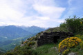
You’ll arrive in an open but scrubby area. On your right is a magnificent old stone sheepfold, in perfect condition. Cortal Llunyà, with an altitude of 1,612m. The view is magnificent.
A lovely spot for a lunch break or a rest.
It’s time to think about the return journey. The path leading down, clearly marked on the ground, heads west for 150 metres.
(1,540 m). Pass the valley floor and cross the Comall de Ponç. The path now heads south, south-east.
Note: The descent along the ridge is long and steep. Proceed at a leisurely pace. Do not hesitate to stop frequently to take in the magnificent scenery. Pass through damp areas and, on two occasions, near the ruins of old stone huts.
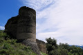
Pass a water channel (935m). Continue the steep descent. You will now have a view of the ruins of Évol Castle. Go round the ruins, which you can visit if you wish. But watch out for falling rocks. Join a wide track suitable for vehicles.
(10) Turn left onto this track and follow it for 150m.
(11) Turn right, going round the church of Sant Esteve. You’ll reach the tarmac road at a wide bend (car park).
(12) Turn left and head uphill along a wide path with steps, towards the church. Then go down the steps just after the cemetery gate. Do not go all the way down to the road, but stay on level ground along an old, small tarmac path that leads to the centre of the village. Walk through the listed village of Évol. Join the D4a, which descends towards Olette. Follow this road for 300 metres, until you reach a hairpin bend to the right.
(13) Leave the road. Head straight ahead, due south-east, along a wide track which climbs slightly for 50 metres and then descends. This is a narrower nature trail which will take you back to Olette. The view is magnificent. It is a cliff-top path overlooking the D4 on your right. The path turns due east as it reaches the top of Olette. From this point, the path descends much more steeply.
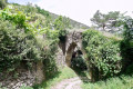
Cross a canal, now culverted. Turn right, continuing along the path which descends steeply. Pass under a huge stone archway through which the water that supplied Olette once flowed. Join a small street which descends steeply to the right, due south towards the village.
(14) Turn left onto the street towards the centre of the village of Olette. Cross the pedestrian crossing carefully opposite the bar and arrive at the church; turn right, down some very wide steps, heading towards the railway line. You’ll reach the station car park (S/E).



 Visorando Member
 Moderate