


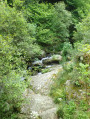
The stops are at the following mountain lodges:
- Carença Mountain Hut
- Mantet Lodge
- Mariailles Mountain Hut
- Cortalets Mountain Hut
Thués-Entre-Valls – Fillols Route


A 5-day route in the Catalan Pyrenees, offering the chance to explore the stunning Carença Gorges before finishing with an ascent of the Catalan giant: the Canigou.
Details
Creation:
Last update:
Last review:
-
 Activity: Walking
 -
 Distance: 34.29 mi
 -
 Average duration: 5 days
 -
 Difficulty: Average
 -
-
 Back to start: No
 -
 Ascent: + 14,088 ft
 -
 Descent: - 14,383 ft
 -
-
 Highest point: 9,052 ft
 -
 Lowest point: 2,510 ft
-
 Country:
France
Country:
France
-
 Area: Pyrenees
 -
 City:
Thuès-Entre-Valls (66360)
City:
Thuès-Entre-Valls (66360) -
 Start: N 42.523259° / E 2.222952°
 -
 End: N 42.561294° / E 2.410277°
 -


 Hour-by-hour weather
Photos

Stages of the route
This route needs several days, find the details below:
Notes
This route passes through multiple protected areas, which may be subject to special regulations:
- Réserve naturelle nationale de Mantet - more information
- Réserve naturelle nationale de Py - more information
- Réserve de chasse et de faune sauvage du Canigou (RCFS) - more information
- Réserve Naturelle Régionale de Nyer - more information
- Arrêté de Protection de Biotope, Rivière la Carança - more information
- Gypaète Barbu - Mariailles
Worth a visit
The region is brimming with places to visit, including:
Mont Louis
Font Romeu
Villefranche-de-Conflent and Fort Libéria
Saint Martin du Canigou
Vernet-les-Bains
Not to mention the lovely trip on the ‘Yellow Train’
Reviews and comments
4.6 / 5
Based on 3 reviews
Reliability of the description
4.3 / 5
4.3 / 5
Ease of following the route
4.7 / 5
4.7 / 5
Route interest
4.7 / 5
4.7 / 5

User 26311889
Overall rating : 5 / 5
Date of your route : Jul 15, 2025
Reliability of the description : ★★★★★ Very good
Ease of following the route : ★★★★★ Very good
Route interest : ★★★★★ Very good
Very busy route : No
Hello, I didn't do the last two stages with the Canigou, it was too much for me. I slept in my tent and ate in refuges the whole time without any problems. I did everything by public transport using the 560 bus from Perpignan ($1)
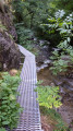
The first stage in the gorges is easy and truly remarkable with its footbridges and rope bridges (no equipment necessary). The refuge of the same name is set in a magnificent setting! But the packed lunch for the next day is really not worth it.
For the other stages, expect a lot of elevation gain with some very steep sections, but it's always beautiful and almost always next to a stream.
In general, I encountered fewer than 10 people on the trails.
Enjoy your hike!
The Quebecker who passed through here!
Machine-translated
nanou11400
Hello
I’d like to go on this hike next week. Where can I get water along the route? Thanks
Machine-translated
Yohh
Overall rating : 4.7 / 5
Date of your route : Aug 15, 2019
Reliability of the description : ★★★★☆ Good
Ease of following the route : ★★★★★ Very good
Route interest : ★★★★★ Very good
It was a lovely route, at least as far as Mantet, so we decided to call it a day in this charming village. We’d decided not to spend the nights in lodges or mountain huts, which obviously meant carrying heavy rucksacks (as we were sleeping in hammocks and under tarps); this made the route difficult, especially as we’d chosen this hike for its moderate difficulty. That said, waking up in the mountain pastures of the Pyrenees is priceless, and the Col du Pall offers a breathtaking panorama.
Machine-translated
Wijnhofen
Hello,
I’d like to do this route with a friend starting this Sunday (28/07/19), but if we take a tent and some food, is it possible to camp in the wild rather than paying for the mountain huts? We’re students and don’t have much money...
Machine-translated

randobrivet
Overall rating : 4 / 5
Date of your route : Nov 19, 2018
Reliability of the description : ★★★★☆ Good
Ease of following the route : ★★★★☆ Good
Route interest : ★★★★☆ Good
Looking ahead to 2019
Machine-translated

bernardino

Hello
Ideally, you should leave your car in the car park at Villefranche-de-Conflent station; when we did this route, parking was free. It’s a good idea to check whether this is still the case. Then take the little train to Thuets. For the return journey from Fillols to Villefranche, I think hitchhiking should at least enable one person to go and collect the car.
And best of luck with your preparations for this very enjoyable route.
Machine-translated
romain.dussurgey
Hello!
I’d really like to do this route this summer with two friends,
I’d like to know how we can get from the end point back to the starting point (we only have one car, which I think we’ll leave at the starting point).
Are there any trains or shuttle buses?
Kind regards.
Machine-translated
Other walks in the area
Thués-Entre-Valls - Carança refuge
 Visorando Member
5.40 mi
+3,832 ft
-653 ft
5h 50
Average
Departure from Thuès-Entre-Valls (Pyrénées-Orientales)
Visorando Member
5.40 mi
+3,832 ft
-653 ft
5h 50
Average
Departure from Thuès-Entre-Valls (Pyrénées-Orientales)
This is the first stage of the Thués - Fillols loop, which takes you up the Carença Gorge to the refuge of the same name.
Carançà Gorges - Abri de la Balmère AR (return via the upstream ledge)
 7.14 mi
+3,363 ft
-3,363 ft
6h 15
7.14 mi
+3,363 ft
-3,363 ft
6h 15
 Difficult
Departure from Thuès-Entre-Valls (Pyrénées-Orientales)
Difficult
Departure from Thuès-Entre-Valls (Pyrénées-Orientales)
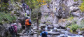
In summer, you will be looking for coolness and a few thrills: for you, there is a stream, gorges, undergrowth and a few fun passages on footbridges and monkey bridges (return trip). You can then return via a narrow ledge, which is not recommended for young children, people with poor footwear or those prone to vertigo.
(There is an alternative route via the downstream ledge, which is the most vertiginous).
Carança Gorges
 11.45 mi
+5,282 ft
-5,282 ft
9h 50
Difficult
Departure from Canaveilles (Pyrénées-Orientales)
11.45 mi
+5,282 ft
-5,282 ft
9h 50
Difficult
Departure from Canaveilles (Pyrénées-Orientales)
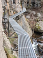
A magnificent hike between gorges and mountains. Aerial passages, footbridges and rope bridges are guaranteed on this route. Do not attempt this route in rainy or snowy weather.
Please note: the elevation gain is overestimated by the software. The total elevation gain is 1,100 metres.
The Carança Gorges loop
 3.22 mi
+2,031 ft
-2,028 ft
3h 15
Average
Departure from Canaveilles (Pyrénées-Orientales)
3.22 mi
+2,031 ft
-2,028 ft
3h 15
Average
Departure from Canaveilles (Pyrénées-Orientales)
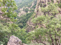
A lovely, short and very scenic route through the Carança Gorges. This walk offers multiple options up to the suspension footbridge, meaning you can do a circular route (and return to the starting point or switch to the other bank) at several points.Moderator’s note: some people have got lost on this hike; see reviews
The Carança Gorges in two days
18.92 mi
+5,935 ft
-5,906 ft
2 days
Difficult
Departure from Canaveilles (Pyrénées-Orientales)
Nestled in the heart of the Eastern Pyrenees, the Carançà Gorges offer an unforgettable adventure for hiking enthusiasts. This two-day route will take you through spectacular landscapes, suspended footbridges over the rushing torrent, vertiginous cornices and dense forests. On the first day, you will climb up the gorge to the Ras de la Carança refuge, before continuing on to the Estany de Carançà for a high-altitude bivouac. The next day, you will descend via a loop route through the heights, offering breathtaking views of the valley. A total immersion in unspoilt wilderness awaits you.
The natural pools of the hot springs at Thuès-les-Bains
 2.33 mi
+354 ft
-338 ft
1h 25
Average
Departure from Canaveilles (Pyrénées-Orientales)
2.33 mi
+354 ft
-338 ft
1h 25
Average
Departure from Canaveilles (Pyrénées-Orientales)
Tired of long Catalan hikes?Treat yourself to a relaxing afternoon with a hot outdoor bath in the heart of the Entre-Valls forest, with views of the foothills of the Estallades and El Fornas. All this is free of charge in natural pools at a public site, spotlessly clean, not far from the majestic arches of the Yellow Train railway bridge. Unforgettable memories!
The Chemin des Canons in Canaveilles
6.25 mi
+2,254 ft
-2,254 ft
4h 50
Average
Departure from Canaveilles (Pyrénées-Orientales)
A magnificent hike along a historic trail offering stunning views.
Le Pla and the Orri de l’Estanyol as seen from Oreilla.
 8.53 mi
+3,491 ft
-3,471 ft
7h 00
Difficult
Departure from Oreilla (Pyrénées-Orientales)
8.53 mi
+3,491 ft
-3,471 ft
7h 00
Difficult
Departure from Oreilla (Pyrénées-Orientales)
All in all, a fairly challenging hike, with a steady climb, which can be cut short at any time.
You need to reach the grassy ridge of the Serra (mountain) de Palmes and continue along this ridge as far as possible. It was clearly a heavily used area, judging by all the ruins of sheepfolds and huts we came across.
For more walks, use our search engine .
The GPS track and description are the property of this route's author. Please do not copy them without permission.

