


Refine your search for walks in Oberems
Oberems walks


 Gruben - Zinal
 Visorando Member
 12.78 mi
 +3,150 ft
 -3,629 ft
 8h 35
8h 35
 Difficult
 Departure from Oberems (Valais)
Another high-altitude stage with a stop in Saint-Luc, then transfer to Zinal by post bus.
Gruben - Grachen
 10.56 mi
+5,505 ft
-6,040 ft
9h 40
Difficult
Departure from Oberems (Valais)
10.56 mi
+5,505 ft
-6,040 ft
9h 40
Difficult
Departure from Oberems (Valais)
Today's stage is divided into three parts: on foot from Gruben to Jungu, by cable car from Jungu to Saint-Niklaus, and by bus from Saint-Niklaus to Grachen.
Gruben - Sankt Niklaus
 10.22 mi
+4,055 ft
-6,407 ft
8h 15
10.22 mi
+4,055 ft
-6,407 ft
8h 15
 Very difficult
Departure from Oberems (Valais)
Very difficult
Departure from Oberems (Valais)
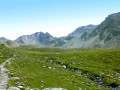
This thirteenth stage takes place in the high mountains and, depending on the season, may involve crossing snowfields. The trail is shared with the Apenpässe-Weg, marked with green vignettes No. 6. From the hotel, the trail climbs towards the Augstbordpass, crossing alpine pastures to Grüobu Oberstafel. Then the landscape becomes increasingly rocky until you reach the Augstbordpass. At the pass, you will have earned a well-deserved break. The descent continues through numerous scree slopes and rock fields, but the path is always well marked. From Abiheiji (Twraa Ridge), the route to Jungen is more pleasant and the path is often paved. From Jungen, there is still an 850-metre descent to Sankt Niklaus. (You can take the cable car to avoid this last descent.)
Grüben – Zinal
8.56 mi
+3,284 ft
-3,845 ft
6h 50
Very difficult
Departure from Oberems (Valais)
Stage2 of the northern section of the Tour du Cervin: this takes you to the Val d’Anniviers.NB: Originally, we had planned to walk all the way from Grüben to Zinal, but in two stages: stage 1 from Grüben to the Hôtel Weisshorn, and stage 2 from the Hôtel Weisshorn to Zinal. For financial reasons, this wasn’t possible; so we carried on to Saint-Luc, from where a bus service took us to Zinal.The first section (up to Meidu) does not follow the classic Tour du Cervin route; the section through the forest and mountain pastures between the end of the track and the buildings at Jäniltigu Oberstafil is no longer marked at all; that said, there are no particular difficulties: the track reflects the route I took, based on the path as shown on the maps and the terrain.
Topalihütte – Jungu
6.94 mi
+1,860 ft
-4,055 ft
4h 50
Difficult
Departure from St. Niklaus (Valais)
Jungu/Jungen (1,954 m) is a village situated above St-Niklaus. The journey is made by cable car. If the cable cars are not running, an intercom at the Jungu station allows you to contact the operator: payment is made at the bottom.The descent down the Wasulicke features several sections secured with fixed ropes and ladders, as the ground is quite unstable and sloping. The descent is currently not particularly exposed: a 45° slope, which allows for a fairly safe descent with the safety measures in place. There is currently no route across what remains of the glacier. This forms the second stage of the Tour du Cervin, passing through the western part of the Matter Vispa valley.
Hotel Weisshorn - Gruben
 6.57 mi
+1,932 ft
-3,586 ft
4h 40
Difficult
Departure from Saint Luc (Valais)
6.57 mi
+1,932 ft
-3,586 ft
4h 40
Difficult
Departure from Saint Luc (Valais)
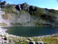
This twelfth stage takes place once again in the high mountains and, depending on the season, may involve crossing snowfields. The trail is shared with the Apenpässe-Weg, marked with green stickers no. 6. From the Hotel Weisshorn, descend to the Combavert barn. The ascent to the Meidpass begins on a good path that passes close to Lake Combavert. The route is pleasant until the junction with Lake Armina. The final climb is over scree. The descent, which is steep at first, becomes gentler as you approach Meidsee. Then scree and pastures alternate until you reach the hamlets of Oberstafel and Mittelstafel. A good path then descends to Meiden/Gruben.The Meidpass is the French/German linguistic border.
Hotel Weisshorn - Zinal
 7.43 mi
+1,217 ft
-3,396 ft
4h 30
7.43 mi
+1,217 ft
-3,396 ft
4h 30
 Average
Departure from Saint Luc (Valais)
Average
Departure from Saint Luc (Valais)
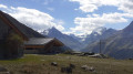
After a night in this historic hotel, the third stage will take you to Zinal, a traditional village in the Val d'Anniviers. You will soon discover the Weisshorn and Bishorn mountains. At the small Bella Vouarda pass, you can admire the so-called imperial crown with five peaks over 4,000 metres high. As you descend towards Zinal, you will follow the end of the famous Sierre-Zinal race, more commonly known as the "Race of the Five 4,000s".
Jungu – Grüben
7.79 mi
+3,848 ft
-4,318 ft
6h 55
Difficult
Departure from St. Niklaus (Valais)
The first of the three stages that make up the northern traverse of the massif from east to west.No particular difficulties: you just need to take care on the first section, which follows a narrow path along the cliff face. Fixed equipment (ropes) secures the most exposed sections.The route starts from the same cable car used on the previous stage to descend to St-Niklaus.
Saint Nicklaus - Gruben
 9.72 mi
+6,283 ft
-3,980 ft
8 hrs
Very difficult
Departure from St. Niklaus (Valais)
9.72 mi
+6,283 ft
-3,980 ft
8 hrs
Very difficult
Departure from St. Niklaus (Valais)
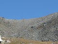
A beautiful mountain stage with a pass bearing the sweet name of Augstbordpass.
Sankt Niklaus - Zermatt
 12.37 mi
+2,178 ft
-541 ft
7h 35
Difficult
Departure from St. Niklaus (Valais)
12.37 mi
+2,178 ft
-541 ft
7h 35
Difficult
Departure from St. Niklaus (Valais)
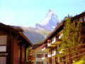
This fourteenth and final stage is the longest, but does not present any difficulties. The route from Sankt Niklaus to Zermatt is obvious. It follows the Matter Vispa, the river that flows down from Zermatt, and the rack railway line, which terminates in Zermatt. All the ingredients for a picture-postcard Swiss scene are there: the Matterhorn, glaciers, the torrent, churches with bulbous steeples, the little rack railway and the magnificent car-free village of Zermatt.
Bella Tola Hut - Gruben
 6.40 mi
+1,660 ft
-3,337 ft
4h 25
Average
Departure from Saint Luc (Valais)
6.40 mi
+1,660 ft
-3,337 ft
4h 25
Average
Departure from Saint Luc (Valais)
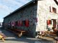
We started out in the Saint-Luc ski area before joining the Tour du Cervin trail to finish the stage in Gruben.
Saint-Luc - Hotel Weisshorn
 7.52 mi
+3,878 ft
-1,627 ft
6h 50
Difficult
Departure from Saint Luc (Valais)
7.52 mi
+3,878 ft
-1,627 ft
6h 50
Difficult
Departure from Saint Luc (Valais)
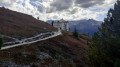
This second stage will take you to the Hotel Weisshorn, but not via the shortest route. Along the way, you will pass peaks such as the Rothorn, Bella Tola and the Aiguilles du Meiden. After Lake Armina, you will join Trail No. 6 (Chemin des Cols Alpins) at the foot of the Meidpass. After the descent to the Combavert mountain pasture, you will need to make one last effort to discover the Hotel Weisshorn, the pearl of the Val d'Anniviers.
Zinal - Arolla
 16.23 mi
+7,106 ft
-5,955 ft
8 hrs
Very difficult
Departure from Ayer (Valais)
16.23 mi
+7,106 ft
-5,955 ft
8 hrs
Very difficult
Departure from Ayer (Valais)
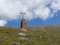
This is a long stage passing through two mountain passes, but it is shortened by the cable car connection from Zinal and the bus transfer between Villa Evolène and Arolla.
Please note: taking into account the cable car transport, the positive elevation gain is not 2,156 metres as indicated, but only 1,380 metres.
Zinal - Cabane de Moiry
 7.69 mi
+6,066 ft
-2,306 ft
8h 50
Difficult
Departure from Ayer (Valais)
7.69 mi
+6,066 ft
-2,306 ft
8h 50
Difficult
Departure from Ayer (Valais)
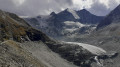
The Val d'Anniviers ends at the Zinal Glacier and the Moiry Glacier, separated by the Pigne de la Lé and the Garda Bordon. The route of this fourth stage will take you to the Cabane de Moiry, very close to the glacier of the same name. To avoid the long climb to Sorebois, take the cable car to the Weisshorn area. You will switch to the Moiry side and overlook this magnificent lake at an average altitude of 2,500 metres. Upon arrival at the Cabane de Moiry, you will be richly rewarded.
Herbriggen – Topalihütte
5.85 mi
+6,791 ft
-2,152 ft
7 hrs
Very difficult
Departure from St. Niklaus (Valais)
See the guide on route moderation.
The classic hike from Randa is very often closed. This hike starts at Herbriggen (accessible by train from Randa).The route is much steeper than the one starting from Randa; furthermore, once you reach Tälli, the ‘normal’ route is also closed due to rockfalls, and a new route has been marked out joining the alpine path linking the Topali Hut (Topalihütte) to the Barrhorn, which adds 400 metres of elevation gain. The difficulty rating is ‘very difficult’, to reflect the total duration of the hike, which takes into account the significant elevation gain covered in two main sections, and the steep nature of the first ascent. There are no technical difficulties other than the elevation gain (2,000 m elevation gain over 9.5 km).
Circular Illhorn loop starting from Chandolin
 6.69 mi
+2,848 ft
-2,835 ft
5h 35
Difficult
Departure from Chandolin (Valais)
6.69 mi
+2,848 ft
-2,835 ft
5h 35
Difficult
Departure from Chandolin (Valais)
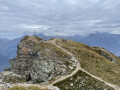
A circular walk leading to the summit of the Illhorn, from where you can enjoy panoramic views of the Valais and Bernese Alps, not to mention a breathtaking bird’s-eye view of the Rhône and Illgraben valleys.
Route to the Charles Kuonen footbridge
 3.97 mi
+2,215 ft
-2,211 ft
3h 45
Average
Departure from Randa (Valais)
3.97 mi
+2,215 ft
-2,211 ft
3h 45
Average
Departure from Randa (Valais)
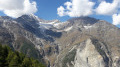
After passing through Swiss stone pine forests, this circular hike leads to an impressive record-breaker: the Charles Kuonen Footbridge, the longest pedestrian suspension bridge in the world.
Europahutte - Saint Nicklaus
 9.38 mi
+2,802 ft
-6,529 ft
6h 45
Difficult
Departure from Randa (Valais)
9.38 mi
+2,802 ft
-6,529 ft
6h 45
Difficult
Departure from Randa (Valais)
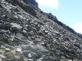
A new stage on the balcony at the foot of the great peaks separating the valleys of Zermatt and Saas Fee.
Europahütte - Europaweghütte
 6.95 mi
+3,107 ft
-3,392 ft
5h 55
Difficult
Departure from Randa (Valais)
6.95 mi
+3,107 ft
-3,392 ft
5h 55
Difficult
Departure from Randa (Valais)
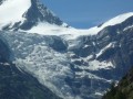
Due to the closure of the large Himalayan footbridge over the Grabengufer scree, it is necessary to take the emergency path down to Tasch and then undertake a remarkable climb to the alpine hamlet of Täschalp, where the Europaweghütte lodge is located.