


Refine your search for walks in Möhlin
Möhlin walks
 On the banks of the Rhine in Rheinfelden
 Visorando Member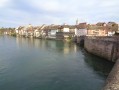
 5.93 mi
 +167 ft
 -171 ft
 2h 50
2h 50
 Easy
Easy
 Departure from Rheinfelden (Baden) (Regierungsbezirk Freiburg)
In 1805, Napoleon and Francis I of Austria imposed the border on the Rhine. Rheinfelden then became Rheinfelden Baden, a German industrial town, and Rheinfelden Argovie, a Swiss spa town.The route runs along the German bank, which is equipped with viewing platforms and benches, to the hydroelectric dam and then along the more wooded Swiss bank. Return via the historic town and its old bridge, the Altebrücke.
The two Rheinfelden, the Rhine Island and the hydroelectric power station
4.75 mi
+108 ft
-115 ft
2h 15
Easy
Departure from Rheinfelden (Baden) (Regierungsbezirk Freiburg)
A walk along the banks of the Rhine, close to the water’s edge and across the river. It runs from Germany to Switzerland via a bridge and an island, and from Switzerland to Germany via the Rheinfelden dam. There are numerous vantage points along the way, including a section through the old town of Rheinfelden (CH).
The twin towns: from the Old Bridge to the Roman ruins at Riburg
 8.81 mi
+285 ft
-295 ft
4h 20
8.81 mi
+285 ft
-295 ft
4h 20
 Moderate
Departure from Rheinfelden (Baden) (Regierungsbezirk Freiburg)
Moderate
Departure from Rheinfelden (Baden) (Regierungsbezirk Freiburg)
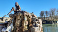
From the German bank, an easy walk along a path lined with statues and dotted with panoramic viewpoints, information boards and benches takes you to the oldest dam on the Rhine. From there, you cross over to the Swiss bank, which is more wooded with its cliff face running alongside the river, to reach the Roman ruins and the salt works at Riburg. Return via the historic Swiss town and its famous Markgasse, then across the Altebrücke – an old bridge steeped in history spanning the Iseli, which links the two Rheinfelden.
Nordschwaben, Hunzelbachtal and Hohe Flum
 4.26 mi
+423 ft
-404 ft
2h 20
Easy
Departure from Rheinfelden (Baden) (Regierungsbezirk Freiburg)
4.26 mi
+423 ft
-404 ft
2h 20
Easy
Departure from Rheinfelden (Baden) (Regierungsbezirk Freiburg)
The route is shaped like a figure of eight. The first part involves walking around the Hunzelbachtal via the sculpture trail, St Maurice’s Chapel and the remarkable little stream, 800 metres long, which disappears into a sinkhole (3 km route). In the second part, back in Nordschwaben, the walk heads to the highest point of the Dinkelberg, the Hohe Flum, at 535 metres. Here you can visit the tower with its panoramic view and the café-hotel-restaurant (closed on Thursdays and Fridays).
Eichener See and Wehrer Boden
3.53 mi
+417 ft
-407 ft
2h 00
Easy
Departure from Schopfheim (Regierungsbezirk Freiburg)
The route is largely in open country. The paths are wide and well signposted. On the way there, we’ll walk past Eichener See to see if it’s there, as it’s a seasonal lake. Information boards along the route and inside the shelter explain how this lake works. We will then cross a small wood and the Dinkelberg hills to the south of Eichener See before reaching the village of Eichen. We will cross the Dorfbach, which flows only through Eichen, and leave the village after a short walk through its eastern part.
Eichener See: in search of a lake that appears and disappears
3.96 mi
+302 ft
-318 ft
2h 05
Easy
Departure from Schopfheim (Regierungsbezirk Freiburg)
The main attraction is Eichener See. You’ll probably need to visit several times as it’s quite rare. It may appear once or twice a year; in some years, not at all. After a period of heavy rain, groundwater from a cavity 50 metres deep rises through the subsoil and fills the basin. It’s a magical spot. We’ll then head up into the hills north of the Dinkelberg.
From Steinen to Albbruck in the Black Forest
 101.23 mi
+17,323 ft
-17,313 ft
9 days
101.23 mi
+17,323 ft
-17,313 ft
9 days
 Difficult
Departure from Steinen (Regierungsbezirk Freiburg)
Difficult
Departure from Steinen (Regierungsbezirk Freiburg)
This nine-day route allows you to discover different aspects of the southern Black Forest.Starting from Steinen in the Kleines Wiesental, you will cross beautiful forests to reach the pretty village of Kandern. Then, for four days, you will follow the Schwarzwald Westweg trail, passing through the highest peaks of the Black Forest: Belchen, Feldberg and Herzogenhorn.You will also stop off at Titisee, a pleasant lakeside resort. The second part of the route is devoted to the Albsteig, a trail that follows the River Alb from its source at the foot of the Feldberg to Albbruck, where the River Alb flows into the Rhine. On the way, you will stop at Sankt Blasien, a remarkable town with a magnificent cathedral and cloister.
Steinen - Kandern
 10.34 mi
+1,450 ft
-1,365 ft
6h 00
Moderate
Departure from Steinen (Regierungsbezirk Freiburg)
10.34 mi
+1,450 ft
-1,365 ft
6h 00
Moderate
Departure from Steinen (Regierungsbezirk Freiburg)
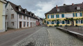
This first stage will take you from Steinen to Kandern. Starting from Steinen in the Kleines Wiesental, you will cross beautiful forests to reach the Black Forest trail: the Westweg Schwarzwald in the pretty village of Kandern.
From Rührberg in Germany to Sankt Chrischona in Switzerland
 3.06 mi
+374 ft
-344 ft
1h 45
Easy
Departure from Grenzach-Wyhlen (Regierungsbezirk Freiburg)
3.06 mi
+374 ft
-344 ft
1h 45
Easy
Departure from Grenzach-Wyhlen (Regierungsbezirk Freiburg)
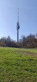
On the itinerary: a panoramic view, the highest point in the canton of Basel-Stadt, the tallest tower in Switzerland, an evangelical mission, two restaurants, the countryside and tranquillity close to the city. We first descend through woods and fields before climbing back up to the charming Bettingen district of Sankt Chrischona, at an altitude of 522 metres. Numerous paths and benches invite us to stroll around and discover this peaceful spot.
Wasserschloss and Erstelweg starting from Inzlingen
 3.25 mi
+420 ft
-404 ft
1h 50
Easy
Departure from Inzlingen (Regierungsbezirk Freiburg)
3.25 mi
+420 ft
-404 ft
1h 50
Easy
Departure from Inzlingen (Regierungsbezirk Freiburg)
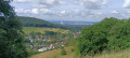
A pleasant little stroll through Inzlingen, going round the castle and then up towards the Eiserne Hand with a snack break in the shelter of the Buttenberg. Return via the Erstelweg and the sports facilities on the heights of Inzlingen.
Ruschbachtal and Saint-Chrischona starting from Wyhlen
 6.54 mi
+1,198 ft
-1,194 ft
4h 05
Moderate
Departure from Grenzach-Wyhlen (Regierungsbezirk Freiburg)
6.54 mi
+1,198 ft
-1,194 ft
4h 05
Moderate
Departure from Grenzach-Wyhlen (Regierungsbezirk Freiburg)
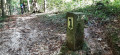
Discover the Ruschbachtal (Nature Reserve) with its pretty wild stream and waterfalls to reach Saint-Chrischona, a small hamlet in the Swiss canton of Basel-Stadt. It is situated at the highest point in the canton, 522 metres above sea level, and is home to Switzerland’s tallest television tower (250 m). From there, you’ll have a superb view of the Jura and the Alps.
Above Hägelberg: Schöne Aussicht and Saatschulhütte
 2.95 mi
+341 ft
-328 ft
1h 40
Easy
Departure from Steinen (Regierungsbezirk Freiburg)
2.95 mi
+341 ft
-328 ft
1h 40
Easy
Departure from Steinen (Regierungsbezirk Freiburg)
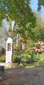
A walk mainly through woodland on the heights of Hägelberg. As the car park is situated almost at the highest point, the walk initially descends slightly towards the village across open ground, offering stunning views of the Alps in good weather. The paths are wide and signposted, except for the first section.
Hauingen Soormattbach Rechberg
4.16 mi
+633 ft
-640 ft
2h 30
Easy
Departure from Lörrach (Regierungsbezirk Freiburg)
Set amongst deep forests, clearings, sun-drenched pastures, streams and ponds, this route offers varied and contrasting landscapes. The paths are wide and signposted, except for the picturesque trail along the Soormattbach stream, between the start and the point (1). This walk is best undertaken in dry weather, as the Soormattbach stream, which we will follow, sometimes to the right, sometimes to the left, can burst its banks during rainy or stormy periods. To cross the village and reach the Schützenhaus restaurant as well as the Hauingen shooting club’s premises in the middle of the forest, we will walk along tarmac roads.
Rechberg via Dornhalde and Haberackerweg
 3.05 mi
+545 ft
-545 ft
1h 55
Easy
Departure from Lörrach (Regierungsbezirk Freiburg)
3.05 mi
+545 ft
-545 ft
1h 55
Easy
Departure from Lörrach (Regierungsbezirk Freiburg)
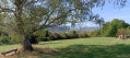
The route runs partly through woodland and partly through open countryside, and involves a steep climb up the Dornhalde slope. There are stunning views from this same slope towards Basel, Chrischona, the Wiese Valley and even the Alps, weather permitting. You can stop for a break halfway along the route at Café Hygge on the Rechberg.
 Outing in Sallneck
28.43 mi
+2,717 ft
-2,697 ft
5 hrs
Difficult
Departure from Lörrach (Regierungsbezirk Freiburg)
Departure from Haagen near Lörrach. A beautiful route through the Kleines Wiesental valley to Sallneck, with a detour via Raich. However, I would like to point out that there are gradients of 8% in some places.
Walk Z7 around Zell im Wiesental
 Tourist office
 2.68 mi
+410 ft
-410 ft
1h 35
Easy
Departure from Regierungsbezirk Freiburg
2.68 mi
+410 ft
-410 ft
1h 35
Easy
Departure from Regierungsbezirk Freiburg
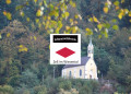
An entertaining walk to get a first impression of the town of Zell im Wiesental.
In the Black Forest around Sallneck
 6.07 mi
+1,316 ft
-1,312 ft
3h 55
Moderate
Departure from Kleines Wiesental (Regierungsbezirk Freiburg)
6.07 mi
+1,316 ft
-1,312 ft
3h 55
Moderate
Departure from Kleines Wiesental (Regierungsbezirk Freiburg)
A superb hike in the Black Forest mountains, 1 hour from Mulhouse, with rolling hills and extraordinary tranquillity.
Route of peat bogs in the Southern Black Forest near Todtmoos
5.27 mi
+554 ft
-531 ft
2h 55
Easy
Departure from Herrischried (Regierungsbezirk Freiburg)
A lovely walk through a pine forest, this outing will take you past the seven peat bogs along the path known as the “7 Moore Weg”.
Halfway 7 Moore
3.33 mi
+364 ft
-361 ft
1h 50
Easy
Departure from Herrischried (Regierungsbezirk Freiburg)
A large part of the 7 Moore walk is over regular (forest) roads. Because the entire walk was too long for our 12-year-old dog in the sweltering heat, we cut straight through the forest about halfway, following an ancient route (Kirchspielgrenzweg). This makes for a nicer walk through untrodden paths (yet maintained by the foresters).