Country:
 City:
City:


Start from the station car park, approx. €0.50/hour on weekdays (2021 prices): Bahnhofplatz 79618 Rheinfelden.
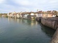
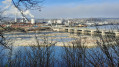
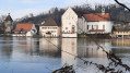
(S/E) Head towards the river in the opposite direction to the station. Cross Basler Strasse and turn left onto Therese Herzog Weg. Head towards the banks of the Rhine to pass by the hotel terrace. This offers a lovely view of the old bridge from the viewpoint by the strange sculpture by Luginsbühl, followed by that of the Saint Anne mermaid by the artist Roland Kistner. Walk back up towards the entrance to the bridge, which you’ll leave on your right as you head straight ahead.
(1) Slightly to the left, take the cul-de-sac Weinbergstrasse to reach Adelbergpark. There are lovely views of the opposite bank. Dotted with statues and benches, the path then climbs up through a vineyard.
(2) Head back down to the right through the trees towards Möhlin. You’ll pass the house of the artist Roland Kistner, whose sculptures adorn the path. Cross over the stream, then continue along the riverbank past the industrial estate. As you approach the hydroelectric dam, stop at the “Krafwerk Pavilion” and then at the viewing platforms to admire the fish passes and the “Gwild” (see Practical Information). Cross the bridge over the power station dam, the oldest in Europe.
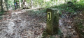
Signposting: Yellow Arrow or Yellow Diamond and “ViaRhenana” no. 60 (see Practical Information)
(3) On the Swiss bank, turn left, leave the tunnel on your right and continue along the riverbank, heading up into the forest via the path on the right which quickly leads to the edge of the woodland.
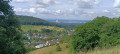
(4) Turn left onto the Grossgrütweg. After 400 m, a sign points to Roman ruins (a4th-century watchtower), a quiet and restful spot. Continue along the path and, after 50 m, head straight into the forest. The path runs along the riverbank and reaches a viewpoint overlooking the German shore and Beugen Castle before a bend to the right and a picnic area.
(5) The path moves away from the riverbank; just after this, turn left at the junction. Further on, the path rejoins the riverbank, then climbs up the cliff, heads east and passes through a beautiful oak forest. Ignore a path on the left leading to a fishing shelter and continue to a junction.
(6) A yellow arrow directs you back down to the riverbank (stairs). Carry on to the Riburg-Schwörstadt power station.
Cross the small road and continue between the riverbank and the woodland. At a junction, head uphill (via steps) to the right. At the top, turn left into the woodland. Keep to the left, running alongside the riverbank, until you reach a junction.
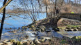
(7) Leave the path that turns right and head down to the left (Yellow arrow) along a footpath and some steps. You’ll reach the mouth of a small river (Bachtele). Cross thefirst footbridge to a lovely spot between the riverbank and a pond, then cross asecond one to climb a few steps leading to the Bürkli path.
(8) A lovely spot for a picnic (very busy on fine days). You are standing on the site of the ruins of a Roman fortified camp (3rd century) which housed one of the many watchtowers along the banks of the Rhine.
Continue along the main path to a car park, then follow the small road on the edge of the woodland to the right for about 300 m. A path branches off to the right into the forest.
(9) Head downhill to reach the end of the Riburg water treatment plant. Walk along the fence on your left, cross the track and then the footbridge over the Bachtele. Enter the forest straight ahead to reach a wide forest track. Follow it to the left until you reach the junction with a cycle path.
Signposting: Yellow Arrow or Yellow Diamond and “Route du Rhin” No. 2 (see Practical Information)
(10) Head due west along Waldrandweg at the edge of the forest, crossing a road. On your left you can see two enormous salt storage domes. Ignore the paths running at right angles until you reach a five-way junction opposite a small car park.
(11) Take the track on the left, heading towards the two old wooden drilling towers. Pass a farm and then the towers. At the junction, carry straight on until you reach the Meyer works at the Riburg Salt Works.
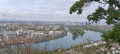
(12) Turn right, passing a composting plant on your left. At the junction, turn left and carry on to the saltworks railway line. Turn right onto Schwarzer Weg (or Salzweg) alongside the tracks. Pass a shelter. Further on, before a bend, turn right towards a viewing point, which offers a remarkable view of the Rhine and the German industrial riverbank.
(13) Then rejoin Schwarzer Weg, which links up with the “Via Rhenana” route. Pass a first large park, some luxury hotels and then the large Stadtpark and its sandy beach. Walk round the edge of the park, staying close to the riverbank (you can also walk through it) until you reach its main entrance on Herman Keller Strasse.
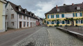
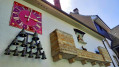
(14) Turn right towards the large medieval tower known as the “Stork’s Nest” (Storchennestturm), the gateway to the old town (note the enclosure with the little goats on the left). Walk under the tower and down Markgasse.
Two short detours are marked on the map and described in ‘During the walk’.
When you reach the town hall (Rathaus at No. 16), be sure to step into the inner courtyard (beautiful frescoes). At the end of the street, on the right, begins the famous Alte Rheinbrücke, adorned with statues and flags.
(15) The bridge is divided into two sections by a wooded island, the Inseli, which you can reach via the steps on the left for a picturesque walk there and back. Return to the bridge and, on the left, you’ll reach the German bank.
(1) Turn left onto Therese Herzog Weg, passing the Haus Salmegg restaurant, and head towards the car park (S/E).
 Visorando Member
 Easy
Easy