


Refine your search for walks in Miribel-les-Échelles
Miribel-les-Échelles walks


 Circular Dolmen Tour in Miribel-les-Échelles
 Visorando Member
 10.62 mi
 +2,096 ft
 -2,096 ft
 6h 45
6h 45
 Moderate
 Departure from Miribel-les-Échelles (Isère)
Set off to explore the geological features in the forest above Miribel-les-Échelles, heading towards the Col des Mille Martyrs. Numerous crosses – some recent, others ancient and steeped in history – dot this route. In other open areas, you’ll enjoy panoramic views of the Chartreuse mountains and the plain stretching towards Les Échelles and Saint-Laurent-du-Pont. To avoid roads as much as possible, you’ll take certain paths deep within the forest that aren’t always shown on the IGN map.
The Col des Mille Martyrs
 5.92 mi
+925 ft
-906 ft
3h 30
Moderate
Departure from Miribel-les-Échelles (Isère)
5.92 mi
+925 ft
-906 ft
3h 30
Moderate
Departure from Miribel-les-Échelles (Isère)
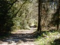
The Col des Mille Martyrs is a road pass well known to cyclists, but hikers are also familiar with it, as there are many paths criss-crossing the area.
The proposed walk takes place in a landscape of pastures and forests to the west of the Chartreuse Massif, offering panoramic views of the mountains.
The Grotte du Loup starting from Miribel-les-Échelles
2.70 mi
+564 ft
-587 ft
1h 45
 Easy
Departure from Miribel-les-Échelles (Isère)
Easy
Departure from Miribel-les-Échelles (Isère)
Here is a gentle stroll that will delight young and old alike in a very pleasant forest.
Above Miribel-les-Échelles
 5.85 mi
+856 ft
-856 ft
3h 25
Easy
Departure from Miribel-les-Échelles (Isère)
5.85 mi
+856 ft
-856 ft
3h 25
Easy
Departure from Miribel-les-Échelles (Isère)
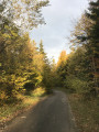
This circular forest loop is accessible in all seasons, even in snow, and takes you through several areas of the Miribel, Saint-Aupre and Rocharey forests, crossing two medium-altitude passes, the Mille Martyrs and the Pilori.
You can also enjoy some unobstructed views along the route.
Rocharay Trail
 Tourist office5.68 mi
+1,122 ft
-1,112 ft
3h 35
Moderate
Departure from Miribel-les-Échelles (Isère)
Tourist office5.68 mi
+1,122 ft
-1,112 ft
3h 35
Moderate
Departure from Miribel-les-Échelles (Isère)
This circular forest route, dotted with natural attractions and historic buildings, also offers, after a short round trip, a lovely view of the Grande Sure. A booklet dedicated to the heritage along this route is available.
The Belvédère de l'Ecolu
 4.36 mi
+1,194 ft
-1,188 ft
3h 05
Easy
Departure from Les Échelles (Savoie)
4.36 mi
+1,194 ft
-1,188 ft
3h 05
Easy
Departure from Les Échelles (Savoie)
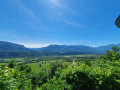
A pleasant walk in the woods overlooking the village of Les Échelles in Savoie.
Around the Carabotin woods
 5.46 mi
+932 ft
-928 ft
3h 20
Easy
Departure from Merlas (Isère)
5.46 mi
+932 ft
-928 ft
3h 20
Easy
Departure from Merlas (Isère)
A pleasant, easy walk that alternates between spruce forest and open stretches with views of the Dauphiné hills or the Chartreuse mountains.
On the lands of Béatrice de Savoie, starting from Les Échelles
2.78 mi
+505 ft
-518 ft
1h 45
Easy
Departure from Les Échelles (Savoie)
This route takes you through the lands of Béatrice of Savoy. From the commandery to the panoramic viewpoint at the Chapelle de la Madeleine, you’ll have the chance to discover the rich history of Les Échelles.
The Herrétang peat bogs and the Rocher de la Garde
7.29 mi
+1,001 ft
-988 ft
4h 15
Moderate
Departure from Saint-Laurent-du-Pont (Isère)
Explore the western part of the Herrétang peat bogs from its observation points, after following the cycle path uphill towards the Rocher de la Garde to enjoy its 360° panorama.
The Herretang bog
 3.58 mi
+10 ft
-10 ft
1h 40
Easy
Departure from Saint-Laurent-du-Pont (Isère)
3.58 mi
+10 ft
-10 ft
1h 40
Easy
Departure from Saint-Laurent-du-Pont (Isère)
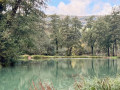
In Saint-Laurent-du-Pont, there is a 6 km flat walk along a wetland discovery trail.
Circular Écolu and Sainte-Madeleine Chapel
6.09 mi
+1,588 ft
-1,588 ft
4h 10
Easy
Departure from Saint-Pierre-de-Genebroz (Savoie)
A circular loop above Saint-Pierre-de-Genebroz with beautiful views.
Circular from Saint-Aupre
 7.53 mi
+1,598 ft
-1,591 ft
4h 50
Moderate
Departure from Saint-Aupre (Isère)
7.53 mi
+1,598 ft
-1,591 ft
4h 50
Moderate
Departure from Saint-Aupre (Isère)
A short, easy walk with some lovely views and a passage over the original Pont de Pierre Chave bridge.
Way of the Cross around Saint-Laurent-du-Pont
 5.21 mi
+289 ft
-259 ft
2h 40
Easy
Departure from Saint-Laurent-du-Pont (Isère)
5.21 mi
+289 ft
-259 ft
2h 40
Easy
Departure from Saint-Laurent-du-Pont (Isère)
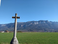
There are numerous crosses in the area around Saint-Laurent-du-Pont.
Here is a suggested route starting from the main church to see as many of them as possible, mainly in the plain.
La Grande Sure and the Chartreuse de Currière, starting from Saint-Laurent-du-Pont
 13.36 mi
+5,016 ft
-4,993 ft
10h 30
13.36 mi
+5,016 ft
-4,993 ft
10h 30
 Difficult
Departure from Saint-Laurent-du-Pont (Isère)
Difficult
Departure from Saint-Laurent-du-Pont (Isère)
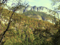
This circular walk is a variation on route no. 107635379, the Grande Sure, which is a return walk from Saint-Laurent-du-Pont. The ascent to the summit of the Grande Sure is the same, but this route differs in its return leg, which starts from the Col de la Sure, from where the path leads to the Col des Charmilles, descends the opposite slope, then crosses the Rochers des Agneaux before hurtling down a steep cirque and joining the Route Forestière de la Charmette, which leads to the magnificent Chartreuse de Currière. This route offers the advantage of a different return route with a similar elevation gain, despite being 2.8 km longer, but has the disadvantage of ending on a road.
La Grande Sure round trip from Saint-Laurent-du-Pont
 11.65 mi
+5,020 ft
-4,990 ft
9h 45
Difficult
Departure from Saint-Laurent-du-Pont (Isère)
11.65 mi
+5,020 ft
-4,990 ft
9h 45
Difficult
Departure from Saint-Laurent-du-Pont (Isère)
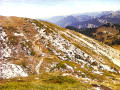
A lovely, shaded hike along steep slopes through the forest, passing through a cirque notable for its scree of dazzlingly white limestone. As you emerge from the forest, a superb view opens up over a grassy valley dotted with a few wooded areas and nestled between imposing rocky ridges. From the summit, you’ll enjoy a magnificent 360° panorama: to the east, from Mont Blanc to the Écrins via Belledonne and the Grandes Rousses; to the south, the Vercors; to the west, the Dauphiné Mountains; and to the north, the Chartreuse.
From distillery to distillery in Saint-Laurent-du-Pont
 8.19 mi
+781 ft
-804 ft
4h 25
Moderate
Departure from Saint-Laurent-du-Pont (Isère)
8.19 mi
+781 ft
-804 ft
4h 25
Moderate
Departure from Saint-Laurent-du-Pont (Isère)
The Fourvoirie site marks one of the entrances to the Chartreuse Desert. One of the bridges, built in the 13th century, gave its name to the village of Saint-Laurent-du-Pont. On the right bank of the Guiers Mort, the Carthusians once started a major metallurgical industry, which continues today in the Saint-Laurent plain. On the other bank, the monks established a distillery, which was destroyed by a landslide in 1935.
More walks in Miribel-les-Échelles
Select a point of interest below: