Country:

 City:
City:


Park in the small car park on Rue de la Poste, or in the one next to the pétanque court on Rue du Bourg.
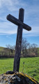
(S/E) From the car park on Rue de la Poste, head north up the street and take the first street leading down to the right. This leads onto a footpath. Take the Chemin de la Combette on the left; it passes a stone cross with the inscription ‘Credo’ carved into it. Join the Chemin du Château.
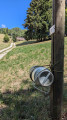
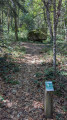
(1) First turn left then right, and set off along the path to the north (next to a cross). A sign bearing the inscription “Trou du Loup” is fixed to a post. Note that another path leads north-east towards Notre-Dame du Château.
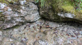
(2) The first point of interest you’ll come across is “Le Bassin Inachevé” at the bottom left. At the junction, continue to follow the signs for “Trou du Loup”.
(3) Take a round trip to the Trou du Loup cave, then head north again, passing the Croix des Combes. At the junction, stay on the main path as it descends, and after crossing the stone bridge, rejoin the Chemin des Roches.
(4) Follow it to the right, heading east. At the junction, keep to the right, then head up the lane to the north-east for a few metres.
(5) Then turn left onto the path running perpendicular to the road, which overlooks the houses. Continue along the main path, ignoring the side paths to the left and right, until you pass a bend to the left.
(6) Carry on straight ahead and join the D82k at the hamlet of Le Til.
(7) First turn left then right, and head up the Chemin du Til.
(8) At the end, turn slightly left onto the path that climbs through a wooded area; this joins the Michalière. Walk up the road opposite.
(9) After 100 m, turn left and head towards a crossroads with a mobile phone mast. Leave this on your right and continue to the Pierre à Mata crossroads at an elevation of 830.
(10) Turn right to descend to the Pierre à Mata via a steep path marked by a wooden sign.
(11) Then retrace your steps to the previous junction.
(10) Continue along the path to the right until you reach the Croix de Saint-Roch crossroads.
(12) Carry on straight ahead and, at the sign for “Le Grand Champ”, head down to the right and walk for 800 m.
(13) Head up the path on the left; this leads through the woods to the track that skirts the Bois de Carabotin. Follow it, ignoring a path on the left and then another on the right, until you reach the sign for “Bois de Carabotin”, then continue to the D28 at the Col des Mille Martyrs.
(14) Cross the D28 and head straight ahead; stop briefly at the Croix des Mille Martyrs, then continue to the junction.
(15) Take the path on the left, which descends through meadows towards the Route de la Combe. Turn left onto this road and, at its end, continue straight ahead for 50 metres.
(16) Take the path on the right. Be careful here, as this path leading down to the right is easy to miss. After 400 m, turn 90 degrees to the left; further on, leave the path leading uphill on the left and head down to the right to rejoin the Chemin du Pourcy.
(17) Follow it to the left; at the next junction, continue to the right onto the Chemin des Grangettes.
(18) At the junction, turn right twice towards the Source de l’Écuelle.
(19) Retrace your steps at the junction.
(18) Head up the path opposite on the right into the Miribel Forest, then turn right at the sign for “Dolmen de L’Antillière” and go straight on at the crossroads.
(20) Head downhill to the right at the next junction. After 200 m, a wooden sign points towards the dolmen; follow it.
(21) Once you reach the dolmen, turn right towards the Pierre des Sacrifices and then continue straight on. Pass a road on your left.
(22) Shortly afterwards, ignore the path straight ahead and, turning right, head towards the Dolmen de Pierre Aiguë.
(23) Take a short round trip to see it.
(23) On your return, carry on towards the Chemin de la Forêt and turn right onto it.
(25) At a place called Le Frou, take the slightly steep path to the left and you’ll reach Miribel a little further on. Head for Rue de la Poste and the car park (S/E).

 Visorando Member

 Easy
Easy 
 Tourist office