Country:

 City:


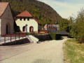
Start from the shaded car park on the east side of the church in Saint-Laurent-du-Pont.
(S/E) Walk up the eastern side of the church to the War Memorial.
(1) Opposite No. 173, cross the D520 road with care, first turn left then right, and follow Rue de la Carteronne. At the end, turn right onto Rue Paul Paturle and continue to a three-way junction.
(2) Keep left onto Chemin du Château and go round the cemetery on the right.
(3) At the junction, leave the tarmac and continue along the path opposite, which climbs into the forest until you reach a fork with a hairpin bend to the right.
(4) Carry on straight ahead, then turn right twice until you reach a track.
(5) Follow this track to the right for about 2.5 km, ignoring all adjacent paths, until you reach the start of a path on the left at a turning area (elevation 730).
(6) Leave the track and take the path on the left, heading due east. Keep to the right at the fork and continue to a flat area.
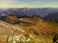
(7) Turn right for a round trip to the Rocher du Pin (elevation 1093).
(8) After taking in the view, return to the flat area.
(7) Carry on straight ahead for about a hundred metres until you reach a fork in the path.
(9) Turn right, ignore the first path on the left and you’ll reach a three-way junction.
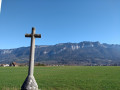
(10) Head up to the left, ignoring all the paths running at right angles, until you reach the Nonne viewpoint with its cross.
(11) After taking in the view, return by the same route as before until you reach the fork, before arriving at the flat stretch.
(9) Head north-east, taking thesecond path on the right, which is steep and winding. Further on, ignore the path on the left (Chemin du Folatier) and continue down to a track.
(12) Turn left and rejoin the route you have already taken.
(5) Take the path on the right, heading in the opposite direction to the way out, and carry on until you reach the three-way junction – which you spotted on the way up – after turning left twice.
(4) Carry on to the left, cross a bridge, then take the track on the right and head for the corner of the Saint-Laurent-du-Pont cemetery.
(3) Turn left and, following the route in the opposite direction to the outward journey, head back to the cathedral (S/E).
 Visorando Member
 Easy

 Tourist office

 Moderate