Country:

 City:
City:


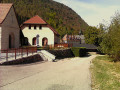
Cross Saint-Laurent-du-Pont towards Saint-Joseph-de-Rivière and turn right towards the Herrétang peat bogs. Park below the Chemin des Terpends in the field on the left before the bridge.
(S/E) Set off along the path that runs alongside the Canal de l’Herrétang on the left bank. The path follows the western part of the peat bogs. It runs mainly through woodland. You’ll pass three observation points in the peat bog wetland.
(1) At the third observation point, do not turn left towards the peat bogs (no dogs allowed); continue straight ahead towards the footbridge over the Canal de l’Herrétang.
(2) After crossing the footbridge, follow the cycle path to the left. Carry on straight ahead when it joins a small road. You’ll reach another junction with a road (a signpost on the left).
(3) Follow the road to the right for 500 m and take the path straight ahead which cuts across the bends in the road. You’ll come to a fountain.
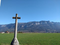
(4) First turn right then left, and take the path to the right of a cross. Then keep going to the right until you rejoin the road.
(5) Follow the road to the left as far as IGN point 533. At the bend in the road, follow the Rocher de la Garde route straight ahead. Reach it via the winding and fairly steep path, ignoring all the paths running perpendicular to it.
(6) Leave the return path on your right. Head up to the left. Caution: on the final section, take care as there are numerous sharp limestone pavements.
(7) The summit is marked by a cross and offers a 360° panoramic view of: the Chartreuse Massif, the plain of Saint-Étienne-de-Crossey, the hills of the Pays Voironnais and the town of Voiron. Descend for 100 metres via the same route you took on the way up.
(6)Then turn left, heading north, and carry on straight ahead, ignoring the side paths, until you reach the Bois de Plantimey.
(8) First turn right then left (under the power line) and go round the woods, reaching the hamlet of Le Perron whilst still ignoring the side paths. Take the road on the right.
(9) At the cross, take the path that descends to the left into the forest and joins a road at IGN elevation 452 (a place known as Les Côtes). Follow the road to the left for 600 m.
(10) At the second junction, turn sharp right onto the Chemin des Terpends and return to the car park (S/E).

 Visorando Member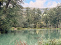
 Easy
Easy 
 Tourist office
 Difficult