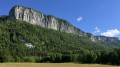
On the lands of Béatrice de Savoie, starting from Les Échelles

This route takes you through the lands of Béatrice of Savoy. From the commandery to the panoramic viewpoint at the Chapelle de la Madeleine, you’ll have the chance to discover the rich history of Les Échelles.

Details

25521375
Creation:
Last update:
Last review:
  • Walking
    Activity: Walking
  • ↔
    Distance: 2.78 mi
  • ◔
    Average duration: 1h 45 
  • ▲
    Difficulty: Easy

  • ⚐
    Back to start: Yes
  • ↗
    Ascent: + 505 ft
  • ↘
    Descent: - 518 ft

  • ▲
    Highest point: 1,749 ft
  • ▼
    Lowest point: 1,270 ft

Description of the walk

Park in the car park next to the Échelles church.

(S/E) Take the Chemin de Mandrin to reach Rue des Commandeurs. Turn right onto it, following the signs for Béatrice de Savoie, until you reach the Dépeigne house.

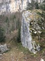
(1) Once in front of the house, take the path on your left to reach the Menuet hill. Walk briefly along a meadow to reach the stonemasons’ cross. The route then joins theGR®9trail, which heads into the Menuet Forest. The path climbs steeply to the Col de la Voûte.

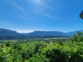
(2) Continue climbing, then turn right towards the Chapelle de la Madeleine. From here, you can enjoy views of the valley and the peaks of the Chartreuse.

(3) Retrace your steps and continue to the right along theGR®, then leave it on your left to join a path marked in yellow.

(4) Follow this path to the right, which will quickly take you to the foot of the hill and into the valley at a place called Combe Noire.

(5) Carry on until you reach the D921, which is open to traffic (take care), then, at the entrance to the village before the secondary school, take the path on your left to return to the village centre. Follow Rue de Lyon to the left for about twenty metres, then turn into Rue de l’Hôtel de Ville. Walk past the church on the left to find the car park on the left (S/E).

Waypoints

  1. S/E : mi 0 - alt. 1,299 ft - Église de l'Annonciation (Les Échelles)
  2. 1 : mi 0.12 - alt. 1,299 ft - The Dépeigne house
  3. 2 : mi 1.02 - alt. 1,614 ft - Col de la Voûte
  4. 3 : mi 1.15 - alt. 1,749 ft - Chapelle de la Madeleine (Saint-Pierre-de-Genebroz)
  5. 4 : mi 1.44 - alt. 1,614 ft - Junction with the yellow-marked route
  6. 5 : mi 1.98 - alt. 1,335 ft - Combe Noire
  7. S/E : mi 2.78 - alt. 1,299 ft - Église de l'Annonciation (Les Échelles)

Always be cautious and plan ahead when you're outdoors. Visorando and the author of this route cannot be held responsible for any accidents occurring on this route.

The GR® and PR® markings are the intellectual property of the Fédération Française de Randonnée Pédestre.

Reviews and comments

4.2 / 5
Based on 3 reviews

Reliability of the description
4.3 / 5
Ease of following the route
4.7 / 5
Route interest
3.7 / 5
yanncha
yanncha

Overall rating : 4 / 5

Date of your route : Jul 21, 2024
Reliability of the description : ★★★★☆ Good
Ease of following the route : ★★★★★ Very good
Route interest : ★★★☆☆ Average
Very busy route : No

A well-signposted route. Easy to follow. Please take care – it can be slippery in wet weather.
A stunning view of the Chartreuse peaks. The rest of the route is well sheltered.
It can be a good choice for a short hike in hot weather.

Machine-translated

Le P'tit Marcel
Le P'tit Marcel

Overall rating : 4.7 / 5

Date of your route : Apr 25, 2024
Reliability of the description : ★★★★★ Very good
Ease of following the route : ★★★★★ Very good
Route interest : ★★★★☆ Good
Very busy route : No

A lovely little shaded route. No particular difficulties.

Machine-translated

Olympus73
Olympus73

Overall rating : 4 / 5

Date of your route : Oct 16, 2023
Reliability of the description : ★★★★☆ Good
Ease of following the route : ★★★★☆ Good
Route interest : ★★★★☆ Good
Very busy route : No

The walk went well and was as described in the route guide.

Machine-translated

Other walks in the area

For more walks, use our search engine .

The GPS track and description are the property of this route's author. Please do not copy them without permission.