Refine your search for walks in Mercenac
Mercenac walks


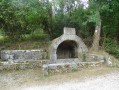
 Circular route between old wash houses and hamlets, passing through Bagert
 Visorando Member
 5.36 mi
 +719 ft
 -699 ft
 3 hrs
3 hrs
 Moderate
 Departure from Mercenac (Ariège)
A pleasant walk from one old wash house to another, along small roads with lovely views, a short stretch through the forest on a steep but well-maintained path to reach Bagert, and quiet paths through the cow pastures. Suitable for horse riding, accessible on foot; there is a tricky section by bike, but it can be avoided.
 Circular around the village of Bagert
 3.99 mi
+837 ft
-814 ft
2h 35
3.99 mi
+837 ft
-814 ft
2h 35
 Easy
Departure from Bagert (Ariège)
Easy
Departure from Bagert (Ariège)
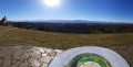
A family walk on wide, well-maintained and marked trails between forest and pastures with splendid views of the Pyrenees. The route can be done in both directions: the opposite direction to the one described is perhaps even more beautiful! The markings are easy to follow.
The Bourdaous trail from Cazavet
 Association / Club / Walk leader
 7.71 mi
+2,474 ft
-2,457 ft
5h 40
Moderate
Departure from Cazavet (Ariège)
7.71 mi
+2,474 ft
-2,457 ft
5h 40
Moderate
Departure from Cazavet (Ariège)
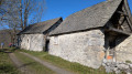
Discover the bourdaous, which are pastoral mountain hamlets, groups of barns and stables used in the past during the summer months. A bourdaou can also be an isolated barn with an adjoining hut, a very basic dwelling for shepherds. This route offers the chance to discover some of them, starting from Cazavet and climbing up to the Cours mountain pasture. The route passes by the summit of Roc de Maléchart, where a 360° view allows you to discover the Pyrenees mountain range.
Le belvédère du Couserans
 5.33 mi
+1,138 ft
-1,138 ft
3h 25
Moderate
Departure from Saint-Lizier (Ariège)
5.33 mi
+1,138 ft
-1,138 ft
3h 25
Moderate
Departure from Saint-Lizier (Ariège)
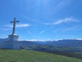
Winding through narrow streets and along footpaths, this route takes walkers from Saint-Lizier to Montcaliver, a viewpoint overlooking all the Couserans valleys and the splendid peaks dominated by the ‘Lord of the Couseran’: Mont Valier.⚠️ On 18 May 2026, a user reported:>Between the points (6) and (7), the route passes through private property.=> Route and description updated on 24 August 2026 by a moderator
From the Bishops’ Palace to the Marsan Chapel in Saint-Lizier
 2.91 mi
+397 ft
-420 ft
1h 40
Easy
Departure from Saint-Lizier (Ariège)
2.91 mi
+397 ft
-420 ft
1h 40
Easy
Departure from Saint-Lizier (Ariège)
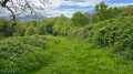
An easy walk, mostly in the shade. Mainly a dirt track, tarmac only in Saint-Lizier. You’ll enjoy superb views of the Pyrenees, the Bishops’ Palace and Saint-Lizier Cathedral.
Montégut-en-Couserans - Tuc de Casterot and Char de Lique via the three passes
 4.13 mi
+1,060 ft
-1,063 ft
2h 50
Moderate
Departure from Montégut-en-Couserans (Ariège)
4.13 mi
+1,060 ft
-1,063 ft
2h 50
Moderate
Departure from Montégut-en-Couserans (Ariège)
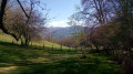
An accessible and charming hike with varied terrain and landscapes and panoramic views of over 180°.
The Aubert Waterfall from Saint-Girons
 6.83 mi
+1,394 ft
-1,401 ft
4h 20
Moderate
Departure from Saint-Girons (Ariège)
6.83 mi
+1,394 ft
-1,401 ft
4h 20
Moderate
Departure from Saint-Girons (Ariège)
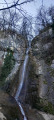
A circular from the centre to the Aubert Waterfall via Cap de la Bouiche. Beautiful view of Saint-Girons and the heights above Moulis.
Trémau sinkhole, starting from Saint-Girons
 6.96 mi
+1,138 ft
-1,138 ft
4h 10
Moderate
Departure from Saint-Girons (Ariège)
6.96 mi
+1,138 ft
-1,138 ft
4h 10
Moderate
Departure from Saint-Girons (Ariège)
This mostly shaded walk offers varied views of the valleys and hills at the foot of the Sourroque massif, with a wild feel in places, all close to Saint-Girons.
The Haut-Garonne foothills at Saleich
 8.55 mi
+2,047 ft
-2,028 ft
5h 45
Moderate
Departure from Saleich (Haute-Garonne)
8.55 mi
+2,047 ft
-2,028 ft
5h 45
Moderate
Departure from Saleich (Haute-Garonne)
This is a lovely walk that will introduce you to the first foothills of the Haute-Garonne Piedmont between Saint-Gaudens and Saint-Girons. With a touch of the mountains about it, this walk will take you from the Valattes Chapel, perched on a grassy promontory, to the Saleich State Forest, passing by the mysterious Laspugue Cave and the lush green meadows of Artigues.
Saleich loop via Urau and Castelbiague
 8.67 mi
+1,020 ft
-1,040 ft
4h 55
Moderate
Departure from Saleich (Haute-Garonne)
8.67 mi
+1,020 ft
-1,040 ft
4h 55
Moderate
Departure from Saleich (Haute-Garonne)
This easy hike is located on the border of Haute-Garonne and at the gateway to Ariège. You will walk along the foothills of the Pyrenees. Varied landscapes and architectural sites are waiting to be discovered on this interesting walk.
Circular Pré Carré and Artigues from Saleich
8.01 mi
+2,064 ft
-2,054 ft
5h 30
Moderate
Departure from Saleich (Haute-Garonne)
This hike takes place on good tracks and forest roads, through beautiful forests of beech, ash, chestnut, boxwood and other trees. The descent is mainly on less comfortable paths, which require a little more attention as they are less well-trodden. The yellow markings are good, but seem to have been scratched and partially erased between points (8) and (9). The route, which is mostly in the shade, can be done in any season. However, avoid periods of fog due to the reported problem of poor markings on part of the route.
Circular route starting from Marbois
3.54 mi
+584 ft
-568 ft
2h 10
Easy
Departure from Contrazy (Ariège)
A walk around Marbois, passing through the hamlets of Sarraillès, Tuque and Micha before returning to Marbois. Shaded forest tracks for the first half, followed by a mix of quiet tarmac roads and paths through fields for the second half of the route. Several lovely views from the heights over the surrounding countryside and the Pyrenean foothills.
The barns of Balagué
 4.12 mi
+1,316 ft
-1,316 ft
3h 00
Moderate
Departure from Balaguères (Ariège)
4.12 mi
+1,316 ft
-1,316 ft
3h 00
Moderate
Departure from Balaguères (Ariège)
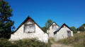
Sunshine, panoramic views of the Vallier massif and the Pyrenees, and barns are all on the agenda for this loop above the village of Balagué.
Circular route around Montardit
3.77 mi
+830 ft
-830 ft
2h 25
Easy
Departure from Montardit (Ariège)
This pleasant, short walk takes you along good paths through pretty hamlets and beautiful forests of chestnut, beech and oak trees. There are a few lovely views. It can be done in all seasons.
Circular route starting from Engomer
 3.12 mi
+1,325 ft
-1,316 ft
2h 35
Moderate
Departure from Engomer (Ariège)
3.12 mi
+1,325 ft
-1,316 ft
2h 35
Moderate
Departure from Engomer (Ariège)
A pleasant climb towards Compussan under the beech trees accompanies the summer pastures. It continues across high-altitude meadows and leads to the rocky massif of Cap de Broc with a beautiful view of the valley floor, returning via Alas and theGR®® which follows the Lez river a little higher up.
La Table des Quatre Seigneurs via the Crêtes trail from Ouerdes
8.92 mi
+1,982 ft
-1,972 ft
5h 50
 Difficult
Departure from Eycheil (Ariège)
Difficult
Departure from Eycheil (Ariège)
A very pleasant walk through beautiful forests along forest tracks and a few well-marked paths. A fairly difficult section that is fully roped off (to be avoided with dogs, otherwise you’ll have to carry them), with numerous short detours to see the entrances to chasms or viewpoints that are not to be missed. Beautiful beech woods and the regrowth of boxwood give this path a touch of magic. The app will be useful as numerous paths cross at various points.
The hills of Salies-du-Salat
4.77 mi
+554 ft
-554 ft
2h 40
Easy
Departure from Salies-du-Salat (Haute-Garonne)
Beautiful views of the Pyrenees and the Salies-du-Salat valley.
Pleasant, undulating paths.
Tour of the Garrié massif
 Local authority
 4.39 mi
+1,089 ft
-1,056 ft
3h 00
Moderate
Departure from Encourtiech (Ariège)
4.39 mi
+1,089 ft
-1,056 ft
3h 00
Moderate
Departure from Encourtiech (Ariège)
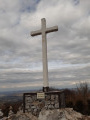
A route around the recently renovated and re-erected Croix de Garrié. The route begins in the shade, on a north-facing slope, and follows a gentle gradient for most of the way up this slope. Magnificent scenery on the south-facing slope with breathtaking views of the Pyrenees mountain range and Mont Valier in the foreground. And, before heading down towards the car park at the start, you cross the route to Cap de Garrié and its cross, which the more adventurous can reach in about ten minutes. The return descent is along a slightly steeper slope, but is completely safe, offering views of the Salat valley and the ruins of Encourtiech Castle.
This trail, recently renovated and signposted, was created under the supervision of the local council, which oversees and coordinates its regular maintenance.
Cap de Garrié
 1.70 mi
+978 ft
-978 ft
1h 40
Moderate
Departure from Encourtiech (Ariège)
1.70 mi
+978 ft
-978 ft
1h 40
Moderate
Departure from Encourtiech (Ariège)
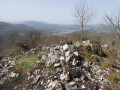
A viewpoint overlooking the neighbouring villages at your feet. Full view of the remains of the viscount's castle during the climb. At the summit, the Couserans Pyrenees stretch out before your eyes. A 300-metre climb on a well-marked, brand new footpath created in 2021 by the municipality of Encourtiech offers you a breath of fresh air in a splendid landscape.