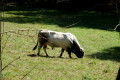
Circular route starting from Marbois

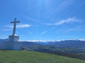
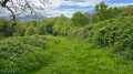
A walk around Marbois, passing through the hamlets of Sarraillès, Tuque and Micha before returning to Marbois. Shaded forest tracks for the first half, followed by a mix of quiet tarmac roads and paths through fields for the second half of the route. Several lovely views from the heights over the surrounding countryside and the Pyrenean foothills.

Details

103148543
Creation:
Last update:
Last review:
  • Walking
    Activity: Walking
  • ↔
    Distance: 3.54 mi
  • ◔
    Average duration: 2h 10 
  • ▲
    Difficulty: Easy

  • ⚐
    Back to start: Yes
  • ↗
    Ascent: + 584 ft
  • ↘
    Descent: - 568 ft

  • ▲
    Highest point: 2,185 ft
  • ▼
    Lowest point: 1,703 ft

Description of the walk

Park at the hamlet of Marbois, taking care not to obstruct traffic.

(S/E) Head south towards the last house in the hamlet and follow the path leading into the forest. You’ll reach the hamlet of Binnet at a three-way junction.

(1) Take the middle path opposite and continue on to Fouque until you reach a crossroads.

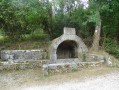
(2) Take the right-hand-hand path, following the sign for “Sarraillès via La Tuque”. Pass a hut and join a tarmac road.

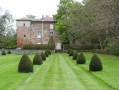
(3) Continue in the same direction, pass the Domaine de Saraillès and arrive at the junction.

(4) Cross the road and head back into the forest, following the path which curves sharply to the left before reaching Micha.

(5) Turn right onto the road leading down towards Marbois. Walk past the farm and continue for about 250 m.

(6) Leave the road on the right to follow the path running parallel to it. Then turn right towards the hamlet of Marbois and return to the car park (S/E).

Waypoints

  1. S/E : mi 0 - alt. 1,785 ft - Marbois hamlet
  2. 1 : mi 1.35 - alt. 1,949 ft - Binnet
  3. 2 : mi 1.66 - alt. 2,044 ft - Intersection – Sarraillès via La Tuque
  4. 3 : mi 2.1 - alt. 2,113 ft - Junction with tarmac track
  5. 4 : mi 2.24 - alt. 2,113 ft - Crossroads
  6. 5 : mi 2.8 - alt. 2,024 ft - Road junction
  7. 6 : mi 3.06 - alt. 2,057 ft - Start of the path
  8. S/E : mi 3.54 - alt. 1,801 ft - Marbois hamlet

Notes

There are no water sources along the route; bring a water bottle if it’s hot.

Worth a visit

Lovely views from the heights over the Pyrenean foothills and the surrounding valleys.

Other walks in the area

For more walks, use our search engine .

The GPS track and description are the property of this route's author. Please do not copy them without permission.