


Refine your search for walks in Les Salles-Lavauguyon
Les Salles-Lavauguyon walks


 The heritage of Les Salles-Lavauguyon
 Visorando Member
 6.60 mi
 +404 ft
 -377 ft
 3h 25
 Moderate
 Departure from Les Salles-Lavauguyon (Haute-Vienne)
An easy walk that will allow you to discover the heritage around Les Salles Lavauguyon.
Tour of Lake Mas Chaban starting from Massignac
 8.36 mi
+190 ft
-187 ft
4h 00
Moderate
Departure from Massignac (Charente)
This hike will take you around Lake Mas Chaban and offer beautiful views of Lake Chaban and a passage through the small village of Lésignac-Durand, where there is a church worth seeing.
The difficulty lies mainly in the length of the walk. In very wet weather, the path can be very muddy or even impassable.
The route can also be done in the opposite direction. Please note that the view is not clear between Valette and the starting/finishing point.
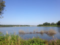
Around Lake Lavaud
 8.69 mi
+243 ft
-233 ft
4h 10
Moderate
Departure from Saint-Quentin-sur-Charente (Charente)
A very pleasant route, especially the last part where you walk along the lake.
Circular route around Saint-Quentin-sur-Charente and the Lavaud Dam
 5.24 mi
+315 ft
-299 ft
2h 40
 Easy
Departure from Saint-Quentin-sur-Charente (Charente)
A circular route around the village of Saint-Quentin-sur-Charente, which mostly follows wide paths and small grassy tracks suitable for mountain biking, with very few tarmac roads.
Le Clos du Boeuf in Laudonnie
 3.28 mi
+253 ft
-259 ft
1h 45
Easy
Departure from Vayres (Haute-Vienne) (Haute-Vienne)
You will walk along sunken paths, discover numerous viewpoints and pass small ponds teeming with wildlife. Herons, ducks, moorhens and teals have made their home in this peaceful spot. Heading back towards Laudonnie, after the last pond, on your left, you’ll pass the “Clos du Boeuf”, a small meadow where the farmer used to lead his animal – or, at best, his pair of oxen – for a well-deserved rest after long hours of walking.
The Banaret Circular Trail
6.87 mi
+554 ft
-571 ft
3h 40
Moderate
Departure from Bussière-Badil (Dordogne)
Welcome to the charming village of Bussière-Badil. This easy and enjoyable circular walk will allow you to explore the region’s rolling countryside. The route mainly follows shaded dirt tracks, with a few sections on small tarmac roads. You’ll be able to enjoy magnificent views of the surrounding hills and pass through unspoilt woodland. Get ready for a lovely day out in the countryside!
 Around Cussac
12.01 mi
+919 ft
-919 ft
1.5 hrs
Moderate
Departure from Cussac (Haute-Vienne) (Haute-Vienne)
This route incorporates several PDIPR (Departmental Plan for Walking and Hiking Routes) trails, allowing you to explore the Forest of Boubon and the surroundings of Cussac.
Circular route starting from Chabanais
8.25 mi
+374 ft
-381 ft
4h 05
Easy
Departure from Chabanais (Charente)
This walk will introduce you to the Chabanoise countryside and take you up to the heights of Chabanais via the small surrounding villages such as La Séchère and La Guéranchie, along varied paths alternating between woodland and plateau, allowing you to discover the beautiful landscapes of Charente Limousine.
The Good Fountains of Cussac.
 6.00 mi
+331 ft
-335 ft
3h 05
Easy
Departure from Cussac (Haute-Vienne) (Haute-Vienne)
This route will take you to the heart of Limousin villages, past oratories, good fountains and prayer trees, witnesses to ancestral spiritual activity. You are in the Périgord-Limousin Regional Nature Park.
From Saint-Estèphe to Piégut
 Association / Club / Walk leader
 8.47 mi
+548 ft
-548 ft
4h 20
Easy
Departure from Saint-Estèphe (Dordogne)
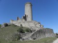
This hike will give you an insight into the life of the monks of the Order of Grandmont, who were only allowed to eat fish from the large pond at Saint-Estèphe. You will pass their priory, then the Menhir de Fixard and the Tour de Piégut with its history. You can also take an old Roman road and explore the discoveries of centuries past in the small villages you pass through.
The foothills of the Limousin, starting from Montbron
 10.44 mi
+771 ft
-771 ft
5h 30
Moderate
Departure from Montbron (Charente)
Montbron is a border village: to the west lies the Angoumois region with its limestone subsoil, and as soon as you cross the bridge over the Tardoire at the eastern exit of Montbron, you’re in the Limousin region with its rolling countryside, granite subsoil and Limousin cattle. This route takes you through some truly beautiful countryside.
The ponds and forest of Étagnac
7.95 mi
+466 ft
-453 ft
4h 05
Moderate
Departure from Étagnac (Charente)
Étagnac, its ponds and forest. Hike in the heart of nature and tranquillity on an unmarked route.
Assit Mill Trail
 Tourist office5.14 mi
+282 ft
-279 ft
2h 35
Easy
Departure from Manot (Charente)
This trail refers to the water mill built in the Middle Ages on the banks of the Vienne. You will follow the Vienne for much of the route. This gives you plenty of time to fully appreciate this river! If you see tourists in canoes or kayaks, don't be surprised! The Vienne is used for water sports.
Loop between Tardoire and the forests, starting from Vouthon
7.93 mi
+148 ft
-148 ft
3h 45
Moderate
Departure from Vouthon (Charente)
Vouthon is home to a 12th-century Templar church. The Tardoire river flows near this church and you will cross it several times. In places, you will walk along the platform of an old railway line. This walk will bring you closer to history and nature.
A circular route starting from La Guérillerie
7.06 mi
+528 ft
-509 ft
3h 40
Moderate
Departure from Chaillac-sur-Vienne (Haute-Vienne)
Walk around La Guérillerie. Few roads and magnificent paths, but be careful: the route is unmarked (there are two or three traces here and there; this route would benefit from being re-marked).
Tour of Navière island (Île de Chaillac)
 3.23 mi
+13 ft
-13 ft
1h 30
Easy
Departure from Saint-Junien (Haute-Vienne)
Discover an island in the middle of the Vienne River, offering a diversity of landscapes between meadows and woodlands, and an interesting heritage.A connection to nature with explanatory signs along the way.
Plaine de l’Essart Trail
5.24 mi
+167 ft
-190 ft
2h 35
Easy
Departure from Nieuil (Charente)
A relatively easy circular walk through the countryside.
The Malicherie Route
 8.57 mi
+404 ft
-410 ft
4h 20
Moderate
Departure from Chabrac (Charente)
This route, taking about half a day, winds through the peaceful, rolling countryside of Charente-Limousine in the southern part of the commune of Chabrac. Hamlets, meadows and typical farmhouses with small herds of Limousin cattle, woods, ponds and unobstructed views over the commune’s hills make for a charming, bucolic walk along little-used roads and paths. You can halve the distance by taking a shortcut between La Malicherie and La Gouie and walking only the eastern or western circular loop.
Circular route from Javerlhac to La Chapelle-Saint-Robert
 8.95 mi
+407 ft
-420 ft
4h 30
Moderate
Departure from Javerlhac-et-la-Chapelle-Saint-Robert (Dordogne)
A walk through the Périgord Vert, taking in farmland, footpaths, country lanes and typical villages.The route takes you through cultivated and wooded valleys.Please note: this walk is completely unmarked.Signposts for walkers and horse riders may provide some guidance.
The Virade circular route via La Chapelle Saint-Robert and Les Chenauds
 8.46 mi
+709 ft
-702 ft
4h 30
Moderate
Departure from Javerlhac-et-la-Chapelle-Saint-Robert (Dordogne)
A lovely walk, suitable for a half-day, through wooded countryside with large areas of farmland. Discover hamlets and farms along the way. The route follows paths, small farm tracks and quiet country lanes.
The route is marked in yellow, with plenty of signposts, but it is a circular route that intersects with or follows other suggested routes. The GPX track is essential; the route description may be helpful, and a base map could be useful for identifying hamlets and farms in the distance.