The Malicherie Route

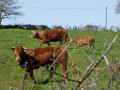
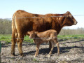
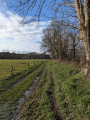
This route, taking about half a day, winds through the peaceful, rolling countryside of Charente-Limousine in the southern part of the commune of Chabrac. Hamlets, meadows and typical farmhouses with small herds of Limousin cattle, woods, ponds and unobstructed views over the commune’s hills make for a charming, bucolic walk along little-used roads and paths. You can halve the distance by taking a shortcut between La Malicherie and La Gouie and walking only the eastern or western circular loop.

Details

7430306
Creation:
Last update:
Last review:
  • Walking
    Activity: Walking
  • ↔
    Distance: 8.57 mi
  • ◔
    Average duration: 4h 20 
  • ▲
    Difficulty: Moderate

  • ⚐
    Back to start: Yes
  • ↗
    Ascent: + 404 ft
  • ↘
    Descent: - 410 ft

  • ▲
    Highest point: 873 ft
  • ▼
    Lowest point: 640 ft

Photos

Description of the walk

The walk starts from the car park behind Chabrac church. You can also park at the Chabrac rest area.

(S/E) Head down the road to Pontfaucher behind the church, take the first path on the right, then cross the D948. Take care when crossing this busy main road.

To do just the eastern circular route, continue along the Pontfaucher road to the village of La Gouie; then, at La Gouie, head down to the right onto the D29 (watch out for dangerous traffic in this hamlet), take the first road on the left to the hamlet of La Malicherie and turn left at the end of the road to reach La Macherie.

(1) Cross the small bridge over the Malicherie stream. Pass the old Chabrac wash house, situated on the right. Turn onto the first path on the right. Continue straight on until you reach the Route des Outres.

(2) Make a zigzag. Carry on to Vergnollet.

(3) Just before Vergnollet, turn right then left. Follow the road through the hamlet of Chadenat until you reach the D29.

(4) Cross this departmental road with care and turn onto the small road towards Les Mottes. On the Route des Mottes, there is an unobstructed view across the plains towards Chabrac to the north and Étagnac/Chabanais to the south. Continue to the D948.

(5) Take care when crossing the D948 again; make a zigzag turn and go round the Bière water tower. Take the first path on the left. Further on, head down to the right, towards the hamlet of La Malicherie.

(6) Take the path branching off to the right at the end of the hamlet. After another right-hand bend, cross the Ruisseau de la Malicherie and you’ll reach a crossroads.

To do only the western circular route, turn left in the hamlet and follow the road to La Gouie. At the junction, turn right onto the D29 (watch out for dangeroustraffic in this hamlet) and immediately left towards Pontfaucher. Continue until you reach the church at Chabrac.

(7) At the crossroads, turn left and follow the path through the woods into the commune of Étagnac. Continue until you reach the second crossroads.

(8) Take the second clear track on the left (the first is a dead end leading to a pond), heading towards Chabrac.

(9) At the 256-metre mark, turn right towards the hamlet of Gorce, then pass through it, keeping to the right. You’ll come to a path branching off to the left.

(10) Turn onto it and follow it to the hamlet of Le Querroy.

N.B.: The path to Le Querroy may be less well-maintained than the rest of the route and muddy in wet weather. In this case, head back up to Gorce and take a shortcut along the road.

(11) At Le Querroy, carry straight on along the road until you reach the 246 mark. Turn right to join the D29.

(12) Turn left onto the D29. Watch out for fast-moving vehicles on this short stretch of road. Just before La Gouie, turn right onto the road to Pontfaucher. Pass the Perrières ponds, go through Pontfaucher and then head towards the church at Chabrac (S/E).

Waypoints

  1. S/E : mi 0 - alt. 696 ft - Chabrac Church
  2. 1 : mi 0.53 - alt. 640 ft - Old wash house in Chabrac
  3. 2 : mi 0.9 - alt. 692 ft - Right-left zigzag
  4. 3 : mi 1.74 - alt. 732 ft - The hamlet of Vergnollet
  5. 4 : mi 2.6 - alt. 794 ft - Route des Mottes
  6. 5 : mi 3.36 - alt. 827 ft - D29, Right-left zigzag
  7. 6 : mi 4.07 - alt. 764 ft - The hamlet of La Malicherie
  8. 7 : mi 4.66 - alt. 804 ft - Chabrac–Étagnac crossroads
  9. 8 : mi 5.27 - alt. 873 ft - Crossroads between Étagnac and Chabrac
  10. 9 : mi 5.78 - alt. 846 ft - Gorce Trail
  11. 10 : mi 6.19 - alt. 820 ft - Chemin du Querroy
  12. 11 : mi 6.62 - alt. 758 ft - The hamlet of Le Querroy
  13. 12 : mi 7.38 - alt. 768 ft - D29 – La Gouie
  14. S/E : mi 8.57 - alt. 696 ft - Chabrac Church

Notes

There is a rest area available in Chabrac on the D948.
The paths on this walk are generally well maintained, except between Gorce and Le Querroy, where they are less passable in wet weather.

Worth a visit

Say hello (or rather ‘moo’) to the Limousin cows if they’re out and about.

Reviews and comments

4.4 / 5
Based on 3 reviews

Reliability of the description
4.7 / 5
Ease of following the route
5 / 5
Route interest
3.7 / 5
Veillon Sylvain
Veillon Sylvain

Overall rating : 4.7 / 5

Date of your route : Oct 20, 2023
Reliability of the description : ★★★★☆ Good
Ease of following the route : ★★★★★ Very good
Route interest : ★★★★★ Very good
Very busy route : No

A really lovely route, surrounded by cows! Brilliant!

Machine-translated

User 369011

Overall rating : 4 / 5

Date of your route : Mar 20, 2022
Reliability of the description : ★★★★★ Very good
Ease of following the route : ★★★★★ Very good
Route interest : ★★☆☆☆ Disappointing
Very busy route : No

Lovely paths, but nothing to see apart from meadows; not much to photograph,
no heritage sites or scenic viewpoints

Machine-translated

matmarlulu
matmarlulu

Overall rating : 4.7 / 5

Date of your route : May 13, 2021
Reliability of the description : ★★★★★ Very good
Ease of following the route : ★★★★★ Very good
Route interest : ★★★★☆ Good
Very busy route : No

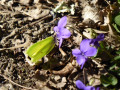
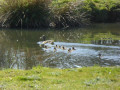
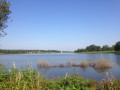
A lovely walk with rolling countryside and beautiful paths through the woodland, but too much road. A lovely spot for a picnic by the pond between Points 7 and 8, slightly off to the left of the path. Green and full of flowers in spring.

Machine-translated

Other walks in the area

For more walks, use our search engine .

The GPS track and description are the property of this route's author. Please do not copy them without permission.