


Refine your search for walks in Les Roches-de-Condrieu
Les Roches-de-Condrieu walks


 Les Roches Saint-Prim Pré Margot
 Visorando Member
 5.08 mi
 +778 ft
 -751 ft
 3h 00
 Easy
 Departure from Les Roches-de-Condrieu (Isère)
Easy route: Saint-Clair-les-Roches, the village of Saint-Prim, Pré Margot, Les Roches de Condrieu.
The Hauts des Roches de Condrieu
 7.37 mi
+869 ft
-860 ft
4h 10
 Moderate
Departure from Les Roches-de-Condrieu (Isère)
Starting from the river port at Les Roches-de-Condrieu, the path will take you from the lake up to the heights overlooking the Rhône valley. At certain points along the route, a bird’s-eye view of the river is sure to catch your eye. In Chonas-l’Amballan, you’ll pass by the foot of a Renaissance-style castle.
Between the plateau and the valley at the start of Les Roches-de-Condrieu
 5.45 mi
+791 ft
-771 ft
3h 10
Moderate
Departure from Saint-Clair-du-Rhône (Isère)
A very pretty little tour that allows you to discover the Rhône Valley and Pilat from a slightly different perspective than usual.
The hike is very accessible, even in bad weather. A good part of it is on tarmac roads.
Between Vérin and Condrieu
 1.53 mi
+243 ft
-243 ft
0h 55
Easy
Departure from Loire
A short walk of just over an hour to pass through the vineyards and enjoy the view over the branch of the Rhône.
On the heights of Condrieu, starting from Vérin
 8.25 mi
+1,033 ft
-1,030 ft
4h 40
Moderate
Departure from Loire
An easy walk in the countryside on the heights around Condrieu. This hike offers beautiful views of the Rhône valley and the Pilat mountains.
Tupin, Condrieu, Semons: between the Rhône and the vineyards
 6.95 mi
+548 ft
-528 ft
3h 40
Easy
Departure from Tupin-et-Semons (Rhône)
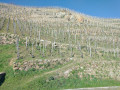
A hike with a very varied route.
Discover the Lônes with nature observatories in the protected area of Île du Beurre.
The banks of the Rhône (with the Port des Roches de Condrieu opposite) and a very pleasant arrival in Condrieu (restored residences).
Visit the old town of Condrieu, climb up to the village of Semons and enjoy the view over the market garden plain of Ampuis.
Descent into the vineyards of the Côtes Rôties to discover the intertwining terraces and low walls.
A viewpoint overlooking the Chartreuse de Sainte-Croix-en-Jarez
12.54 mi
+2,188 ft
-2,185 ft
7h 40
 Difficult
Departure from La Chapelle-Villars (Loire)
With easy and quick access from the A7 motorway coming from Lyon, La Chapelle-Villars is an ideal starting point for exploring the Pilat Massif. This route takes you to Sainte-Croix-en-Jarez and offers a beautiful view of the Chartreuse from the heights of Sainte-Croix.
Along the Rhône in Chavanay
 4.20 mi
+10 ft
-10 ft
1h 55
Easy
Departure from Chavanay (Loire)
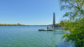
A stroll to enjoy the fresh air along the banks of the Rhône. There is no elevation gain; the path runs alongside the Viarhôna, the cycle route from Lake Geneva to the Mediterranean, before returning inland. The banks of the Rhône at this point are densely vegetated. It is a peaceful, easy walk.
The vineyards of Ampuis
 4.36 mi
+837 ft
-814 ft
2h 45
Moderate
Departure from Ampuis (Rhône)
A short hike to discover the vineyards of Ampuis, with superb views of the terraced vineyards and the Rhône valley.
From the vineyards of Côte-Rotie to Grand-Bois
8.19 mi
+1,302 ft
-1,286 ft
4h 55
Moderate
Departure from Ampuis (Rhône)
The famous Côte-Rôtie vineyards, laid out in terraces supported by low stone walls, will enchant you at the start and end of this hike. The rest of the hike takes place in a rural and wooded setting, along good paths and a few sections of quiet roads.
Sumptuous views of the Rhône Valley, the Pilat Massif and the entire Alpine range (weather permitting).
On the descent back, the Château d'Ampuis will stand before you.
In Ampuis, between the Rhône, vineyards and forests.
 11.14 mi
+1,677 ft
-1,670 ft
6h 35
Moderate
Departure from Ampuis (Rhône)
Discover the fantastic vineyards on the slopes of Ampuis. With beautiful forests in the hinterland, then a return to the Rhône river with magnificent views of the Pilat massif, the Alps and the Rhône valley.
Chavanay to Crêt de la Perdrix circular loop
 23.87 mi
+4,426 ft
-4,416 ft
More than 12 hrs
 Very difficult
Departure from Chavanay (Loire)
This long circular path starts in Chavanay, a village on the banks of the Rhône, and heads towards the highest point of the Pilat. The path begins by climbing through the vineyard-covered slopes of the Rhône valley, then crosses a plateau used for livestock farming and crops between the hamlets of La Ribaudy and Beautin, before crossing the foothills of the Pilat to the hamlet of Pataud. From there, the route climbs the wooded slope of the Crêts du Pilat and reaches the Col du Gratteau, then the Col de l’Œillon, from where it follows the Crêts ridge to reach the Col de la Perdrix. On the return journey, it descends through the woods on the southern slope and, via Chaumienne, reaches Saint-Sabin, then Véranne. It crosses the fields and orchards of the plateau, passing through Goëly and Bessey, before descending into the Rhône valley at the Grande Gorge and, via the Petite Gorge, returns to Chavanay.
Numerous signposts mark the route.IBP 140: estimated duration 13 hours for a hiker of average fitness.
A round trip to Le Crêt de l’Œillon from Chavanay
 16.74 mi
+4,137 ft
-4,114 ft
11h 20
Difficult
Departure from Chavanay (Loire)
This round-trip walk starts in Chavanay, a village on the banks of the Rhône, and ends at the Crêt de L’Œillon. The path climbs through the vineyard-covered slopes of the Rhône Valley, then crosses a plateau used for livestock farming and crops between the hamlets of La Ribaudy and Beautin, before crossing the foothills of the Pilat to reach the hamlet of Pataud. From there, the route climbs the wooded slope of the Crêts du Pilat, runs alongside the Trois Dents peak and, after a rocky outcrop, reaches the Col de l’Œillon and then the Crêt de l’Œillon.
From Chavanay to Malleval
 9.20 mi
+1,371 ft
-1,388 ft
5h 25
Moderate
Departure from Chavanay (Loire)
Walk through the orchards of Chavanay. Best done in April when the fruit trees are in bloom. As a bonus, you'll see the charming village of Malleval and the Epervier valley.
Please note: read carefully at marker No. 8
Chavanay - Bourg-Argental
 14.77 mi
+2,707 ft
-1,558 ft
9h 10
Difficult
Departure from Chavanay (Loire)
Eleventh stage of the Way of St James. This stage is the first in the Massif Central and crosses the Pilat Regional Nature Park. In the foothills of the Rhône Valley, it allows you to gain some altitude.
Circular between La Ribaudy and Pélussin
 7.07 mi
+1,158 ft
-1,155 ft
4h 15
Moderate
Departure from Chavanay (Loire)
The route of this hike will take you from the hamlet of La Ribaudy to the village of Pélussin. Sometimes along wooded paths, sometimes across fields, you will reach the valley of the Rivière du Régrillon. You will cross the Pélussin Viaduct, the former Tacot railway line.
Le Crêt de la Magdeleine in Longes
 4.67 mi
+673 ft
-692 ft
2h 45
Easy
Departure from Longes (Rhône)
Walk in the hills above Longes with magnificent panoramic views of the Alps, the Pilat massif and the Monts du Lyonnais. Car park with a beautiful table and two magnificent wooden deckchairs from which to admire the Rhône valley and the Alps.