Refine your search for walks in Les Noës
Les Noës walks
 La Verrerie-Le plateau
 Visorando Member
 3.06 mi
 +312 ft
 -322 ft
 2 hrs
 Easy
 Departure from Saint-Nicolas-des-Biefs (Allier)
A short route for a first taste of the Verrerie plateau on snowshoes.
 Walk in Saint-Haon-Châtel via Saint-Haon-le-Vieux
 3.83 mi
+636 ft
-607 ft
2h 20
Easy
Departure from Saint-Haon-le-Châtel (Loire)
The walk takes you through Saint-Haon-le-Vieux along the Chemin Rouge, then on to the site of Saint-Haon-le-Châtel, a veritable open-air museum where you can relive ten centuries of civilisation with its remains of high walls, 17 towers and 4 gates. These fortifications were built in the mid-14th century to protect the town from bands of looters. A magnificent village where every street is worth exploring.
A view of the Roannais region from the Croix du Sud
5.42 mi
+1,102 ft
-1,119 ft
3h 25
 Moderate
Departure from Ambierle (Loire)
Just above Saint-Haon-le-Vieux and Saint-Haon-le-Châtel. Starting from the Croix du Sud, a walk through beautiful woodland with views of the Roannais region at several points. The paths are generally easy, with a few stony sections. The walk climbs slightly for a quarter of the route, after the turning point at the quiet hamlet of Combejardin. It remains an accessible walk for amateurs, and can be shortened by taking a different route.
The GPX track may prove useful.
From Saint-Haòn-le-Châtel to leat
 Association / Club / Walk leader10.63 mi
+2,461 ft
-1,348 ft
7h 00
 Difficult
Departure from Saint-Haon-le-Châtel (Loire)
Morning: crossing the northern part of the Roanne coast vineyards, with little elevation gain, and two beautiful historic villages: Saint-Haon-le-Châtel and Ambierle, with a rich heritage open to visitors. The afternoon is more challenging with the climb to leat (altitude 765 m) through meadows and forest. Most of the route is on dirt tracks with no traffic.
From the Loge des Gardes to Point du Jour
 11.96 mi
+1,368 ft
-2,044 ft
6h 40
Moderate
Departure from Laprugne (Allier)
Departure from the Loge des Gardes sports centre. Start the day in the beautiful beech undergrowth of the Assise State Forest, above 1,000 metres altitude, before descending to the more open plateaus of La Tuilière and Cherier, with beautiful views. End at the Refuge du Point du Jour lodge (overnight stay and meals made with farm produce) (altitude 870 metres).
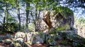
From Pierre Châtel to the Druidic Stone
 12.38 mi
+2,664 ft
-2,671 ft
8h 00
Difficult
Departure from Saint-Nicolas-des-Biefs (Allier)
This hike takes us through the woods of Pierre Châtel (Saint-Nicolas-des-leat) to the Druidic Stone (Loge des Gardes). The return journey takes us through isolated hamlets and farms.
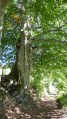
The wind turbines around Saint-Nicolas-des-leat
 6.81 mi
+994 ft
-981 ft
4h 00
Moderate
Departure from Saint-Nicolas-des-Biefs (Allier)
This hike takes us on a journey between modernity (the wind turbines) and the past (the old glassmakers' village, the Château des Hormières) and offers beautiful views of the surrounding valleys.
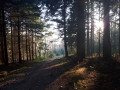
Pierre Châtel - Allée des Sorcières
 2.88 mi
+600 ft
-587 ft
1h 50
Moderate
Departure from Saint-Nicolas-des-Biefs (Allier)
This short hike takes you past two remarkable sites: the Pierre Châtel with a beautiful view from its summit and the mysterious "Allée des Sorcières" (Witches' Alley) with its twisted beech trees.
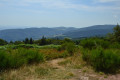
Peat bog on the Verrerie plateau
 4.34 mi
+476 ft
-453 ft
2h 25
Easy
Departure from Saint-Nicolas-des-Biefs (Allier)
This walk takes us through woods to the Verrerie plateau and its peat bog.
Roannaise coast and mountains
50.15 mi
+7,923 ft
-7,907 ft
4 days
Difficult
Departure from Cherier (Loire)
A 4-day hiking tour from lodge to lodge in the Monts de la Madeleine (low mountain range) west of the town of Roanne. Immerse yourself in nature, often still wild, by taking as many small paths as possible.
From Point du Jour to Saint-Haon-le-Châtel
 14.49 mi
+1,686 ft
-3,130 ft
8h 10
Difficult
Departure from Cherier (Loire)
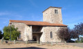
Departure from a high point in the Monts de la Madeleine, in Cherier, at a place called Le Point du Jour (870 m, 14-bed stopover lodge with meals) to descend to the Côte Roannaise, cross its vine-covered hillsides and arrive at the medieval village of Saint-Haon-le-Châtel (14-bed stopover lodge with meals). This route gives priority to small paths with no motor vehicle traffic and beautiful views of the Roanne plain.
From Cherier (Le Point du Jour) to the campsite at Saint-Just-en-Chevalet
13.04 mi
+1,788 ft
-2,667 ft
7h 35
Difficult
Departure from Cherier (Loire)
First stage of a 5-day route through the Monts de la Madeleine, the Bois Noirs and the northern Livradois. Most of the day is spent on the lovely paths of the commune of Cherier, offering a range of views from the tops of its hills, amidst unspoilt countryside. At the end of the route, the path descends to Saint-Just-en-Chevalet, after passing through the charming hamlet of Fonthieur.
The Gorge du Désert, starting from Saint-Alban-les-Eaux
 2.72 mi
+636 ft
-614 ft
1h 50
Easy
Departure from Saint-Alban-les-Eaux (Loire)
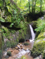
Starting from the village of Saint-Alban-Les-Eaux, known for its carbonated springs, this route passes via La Madone and the Montouse Dam before continuing on to the Gorge du Désert. It allows you to reach the waterfall without too much difficulty and then return to the village via Le Châtelus.
The Gorge du Désert and the Châtelus from Saint-Alban-les-Eaux
 4.32 mi
+1,181 ft
-1,161 ft
3h 00
Moderate
Departure from Saint-Alban-les-Eaux (Loire)
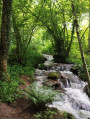
Starting from the village of Saint-Alban-les-Eaux, known for its sparkling mineral springs, this route passes via La Madone and the Montouse Dam to reach the Gorges du Désert and the waterfall. Views from Le Châtelus and the viewpoint on the way back.
Between Ambierle and Les Servajeans
 6.75 mi
+1,138 ft
-1,129 ft
4h 05
Moderate
Departure from Ambierle (Loire)
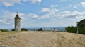
Enjoy a lovely walk above Ambierle through fields and forests. Discover its magnificent church with its polychrome tiles.
From leats to Loge des Gardes
12.97 mi
+2,382 ft
-1,342 ft
8h 00
Difficult
Departure from Saint-Bonnet-des-Quarts (Loire)
This stage crosses the highest villages in the Monts de la Madeleine, at an altitude of around 1,000 metres, and allows you to visit two major tourist attractions in St-Nicolas-des-Leat (03): the Allée des Géants and the Pierre Châtel. Most of the route is through deciduous forest, home to mushrooms. The stage ends at the Loge des Gardes sports resort, where accommodation is available (hotel-restaurant).
The Michonnette route starting from Les Moulins Cherier
 6.53 mi
+1,312 ft
-1,329 ft
4h 10
Moderate
Departure from Cherier (Loire)
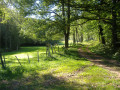
Explore three hamlets to the south and east of the village of Cherier: Le Bouchet, Tour and Mézire. The route follows the valleys of the Isable and the very pretty Michonnette valley, a small stream renowned for its trout and crayfish. There are beautiful viewpoints at the Croix du Bouchet and above Mézire. The elevation changes are quite steep: a 100-metre climb to reach the Croix du Bouchet and, in particular, the ascent of the ‘Trapillon’, which has been fitted with 35 steps.
 The Monts de la Madeleine near Cherier
 16.13 mi
+2,484 ft
-2,470 ft
4 hrs
Difficult
Departure from Cherier (Loire)
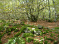
A very varied route linking two villages, climbing to the highest point (1,155 m), alternating between long, steady climbs and flat, rolling sections at altitude, with stunning views. Red mountain bike markings on a white background.
Circular loop starting from Les Moulins Chérier
 11.13 mi
+1,696 ft
-1,680 ft
6h 35
Moderate
Departure from Cherier (Loire)
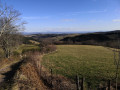
A beautiful walk alternating between open views and paths along the Isable river.
Les Monts de la Madeleine (Villemontais)
 5.59 mi
+1,188 ft
-1,188 ft
3h 35
Easy
Departure from Villemontais (Loire)
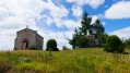
Walk through the Monts de la Madeleine between Villemontais and Chérier.
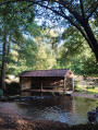
The washhouse route in Saint-Bonnet-des-Quarts
 5.26 mi
+719 ft
-715 ft
3h 05
Easy
Departure from Saint-Bonnet-des-Quarts (Loire)
A route through woods and along paths, starting from the small village of Saint-Bonnet-des-Quarts.
Laprugne – Saint-Victor-Montvianeix
12.93 mi
+2,195 ft
-2,169 ft
7h 50
Difficult
Departure from Laprugne (Allier)
Third stage of the Rez de Sol circular route, straddling the Monts de la Madeleine, the Bois Noirs and the northern Livradois. There is a stark contrast as you cross from the Allier into the Puy-de-Dôme: from pretty mid-mountain hamlets as far as Lavoine, then a landscape dominated by forests cascading down deep gorges from which a few hilltop villages emerge, seeming timeless, towards St-Victor-Montvianeix (a very extensive commune covering 4,500 ha). An optional detour takes you to the Rez de Sol (1.6 km). Omitting this route reduces the length of the stage by the same distance.