The washhouse route in Saint-Bonnet-des-Quarts

A route through woods and along paths, starting from the small village of Saint-Bonnet-des-Quarts.

Details

61222226
Creation:
Last update:
Last review:
  • Walking
    Activity: Walking
  • ↔
    Distance: 5.26 mi
  • ◔
    Average duration: 3h 05 
  • ▲
    Difficulty: Easy

  • ⚐
    Back to start: Yes
  • ↗
    Ascent: + 719 ft
  • ↘
    Descent: - 715 ft

  • ▲
    Highest point: 2,021 ft
  • ▼
    Lowest point: 1,430 ft

Photos

Description of the walk

The route starts in Saint-Bonnet-des-Quarts; park in the town hall car park.

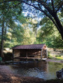
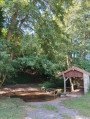
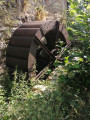
(S/E) Leave the car park and turn right, then right again at the Fork in the road towards the wash house, which is the junction of this circular route.

(1) Cross the River Teyssonne via the bridge and turn left until you reach a junction.

(2) Turn right towards Bois Tercier.

(3) Continue straight on towards the south-east.

(4) Turn right onto Chemin du Portier. At the next junction, turn right again.

(5) Pass through the hamlet of Le Portier, continuing straight on along a track.

(6) Pass through the hamlet of Le Verger until you reach a Black Cross, then, at the electricity pylon at the Fork in the road, turn left to join the Route de la Croix du Sud (D41). Turn slightly right and follow it for several hundred metres.

(7) Leave the road, turn left onto a grassy track and head straight on.

(8) At the Le Royer junction, turn right towards Saint-Bonnet-des-Quarts.

(9) At another Black Cross, cross the road and take the path opposite.

(10) Before the bridge, turn right and pass through the hamlet of La Garde to reach the Chemin des Rivières; cross the bridge to return to the wash house.

(1) Cross the bridge again and, at the end of the Chemin des Rivières, turn left to return to the town hall and the car park at the starting point (S/E).

Waypoints

  1. S/E : mi 0 - alt. 1,535 ft - Town hall car park
  2. 1 : mi 0.22 - alt. 1,430 ft - The Washhouse. Junction of the circular loop - Teyssonne (rivière) - Affluent de la Loire
  3. 2 : mi 0.53 - alt. 1,614 ft - Bois Tercier signpost
  4. 3 : mi 1.8 - alt. 1,742 ft - Junction with the shortcut
  5. 4 : mi 2.2 - alt. 1,801 ft - Junction
  6. 5 : mi 2.66 - alt. 2,014 ft - Le Portier hamlet
  7. 6 : mi 3.03 - alt. 1,959 ft - Le Verger hamlet
  8. 7 : mi 3.52 - alt. 1,939 ft - Junction on a grassy path
  9. 8 : mi 4 - alt. 1,916 ft - Junction
  10. 9 : mi 4.27 - alt. 1,706 ft - Black Cross
  11. 10 : mi 4.59 - alt. 1,476 ft - La Garde hamlet
  12. S/E : mi 5.26 - alt. 1,535 ft - Town hall car park

Reviews and comments

5 / 5
Based on 2 reviews

Reliability of the description
5 / 5
Ease of following the route
5 / 5
Route interest
5 / 5
tig
tig

Overall rating : 5 / 5

Date of your route : Apr 06, 2026
Reliability of the description : ★★★★★ Very good
Ease of following the route : ★★★★★ Very good
Route interest : ★★★★★ Very good
Very busy route : No

A lovely route through woods and meadows, with very little tarmac and mostly tracks, which makes it all the more enjoyable.
Saint-Bonnet-des-Quarts is a pretty village with a café-restaurant where we were warmly welcomed. I’ll definitely do this route again.
Jocelyne

Machine-translated

Elo-
Elo-

Overall rating : 5 / 5

Date of your route : Apr 07, 2025
Reliability of the description : ★★★★★ Very good
Ease of following the route : ★★★★★ Very good
Route interest : ★★★★★ Very good
Very busy route : No

An easy walk, mainly along paths. However, it took us 1 hour 45 minutes, not 3 hours as stated.

Machine-translated

Other walks in the area

For more walks, use our search engine .

The GPS track and description are the property of this route's author. Please do not copy them without permission.