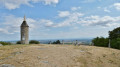
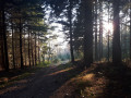
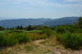
A view of the Roannais region from the Croix du Sud

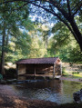
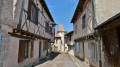
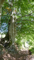
Just above Saint-Haon-le-Vieux and Saint-Haon-le-Châtel. Starting from the Croix du Sud, a walk through beautiful woodland with views of the Roannais region at several points. The paths are generally easy, with a few stony sections. The walk climbs slightly for a quarter of the route, after the turning point at the quiet hamlet of Combejardin. It remains an accessible walk for amateurs, and can be shortened by taking a different route.
The GPX track may prove useful.

Details

18044017
Creation:
Last update:
Last review:
  • Walking
    Activity: Walking
  • ↔
    Distance: 5.42 mi
  • ◔
    Average duration: 3h 25 
  • ▲
    Difficulty: Moderate

  • ⚐
    Back to start: Yes
  • ↗
    Ascent: + 1,102 ft
  • ↘
    Descent: - 1,119 ft

  • ▲
    Highest point: 2,753 ft
  • ▼
    Lowest point: 1,604 ft

Description of the walk

(S/E) From the car park, there are two paths to choose from; take the one on the right, which heads due south. You’ll reach a junction where several paths meet.

(1) Two paths lie ahead of you: a wide, clear one branching off to the right and a narrower one leading off to the left into a coniferous woodland. Take the one on the left, which opens out a few dozen metres further on. You’ll reach a large crossroads with four paths.

(2) Opposite you are two paths; take the one on the left, leaving the one furthest to the left, which will be your return route. You’ll reach Combejardin, where you can enjoy the view over the Roannais region and the surrounding area. Walk past thefirst house and continue to the end of the small road.

(3) Then turn sharply right to rejoin a west-facing path, ignoring the one leading to the houses. You’ll reach another crossroads with five paths.

(4) Take the path leading uphill directly in front of you. Further on, you’ll come back to the crossroads you passed on the way out.

(2) Cross this junction and take the wide path opposite. Continue straight on at every junction or crossroads to return to the starting point (S/E).

Waypoints

  1. S/E : mi 0 - alt. 2,648 ft - Car park
  2. 1 : mi 0.87 - alt. 2,579 ft - Crossroads; turn left
  3. 2 : mi 1.25 - alt. 2,362 ft - Crossroads at the end of the circular loop
  4. 3 : mi 2.68 - alt. 1,604 ft - Combejardin
  5. 4 : mi 4.13 - alt. 2,303 ft - Crossroads, opposite
  6. S/E : mi 5.42 - alt. 2,648 ft - Car park

Worth a visit

After passing the large crossroads at the point (2) where the route forms a figure of eight, on your right you’ll see a sign pointing to marks of uncertain origin; ranging from simple holes carved into the rock by rain to the footprints of prehistoric creatures.
If you’re interested, you’ll need to climb the embankment above the sign and walk a few metres into the woods until you reach a pile of rocks where you’ll find these marks.

There are views over the Roannais region and the surrounding area at various points: on arriving at and leaving Combejardin, and on the return journey between Combejardin and your final destination.

Reviews and comments

3.8 / 5
Based on 4 reviews

Reliability of the description
3.8 / 5
Ease of following the route
4 / 5
Route interest
3.5 / 5
anne ubrig
anne ubrig

Overall rating : 4 / 5

Date of your route : Mar 06, 2025
Reliability of the description : ★★★★☆ Good
Ease of following the route : ★★★★☆ Good
Route interest : ★★★★☆ Good
Very busy route : No

A lovely route, made all the more enjoyable by the lovely weather. I really enjoyed myself
but I don’t understand why the route starts near the Croix du Sud, as you begin by going downhill only to have to climb back up again. Personally, I prefer to do the opposite: go uphill first, then downhill. In fact, whilst looking for a walk, I almost set off from point 3, but I was worried I wouldn’t find it, so I followed the app’s recommendations.... This brings me to two questions. Why not start from the Croix du Sud? I walked the 0.600m from the starting point indicated at the Croix du Sud – it would be possible. Why not start at the entrance to the path leading to the starting point, which in this case would make the walk longer? And why not suggest starting from point 3, specifying the alternatives: first go up then down, or first go down then up?
Do bear in mind the few foreign visitors who only have a GPS to find their way there, ......

Machine-translated

bernardbertignat
bernardbertignat

Overall rating : 4.7 / 5

Date of your route : Oct 23, 2023
Reliability of the description : ★★★★★ Very good
Ease of following the route : ★★★★★ Very good
Route interest : ★★★★☆ Good
Very busy route : No

A lovely, easy route. Thanks

Machine-translated

murad
murad

Overall rating : 2 / 5

Date of your route : Aug 09, 2023
Reliability of the description : ★★☆☆☆ Disappointing
Ease of following the route : ★★☆☆☆ Disappointing
Route interest : ★★☆☆☆ Disappointing
Very busy route : No

We were only able to follow the start of the route because, at the first junction, when we were supposed to take a path on the left, it hadn’t been cleared of undergrowth and we had to turn back. We were very disappointed by the lack of maintenance on the walking trails, even though they’re listed on websites such as Visorando.

Machine-translated

pierre huraux
pierre huraux

Overall rating : 4.3 / 5

Date of your route : Mar 05, 2022
Reliability of the description : ★★★★☆ Good
Ease of following the route : ★★★★★ Very good
Route interest : ★★★★☆ Good
Very busy route : No

A 3-hour route. A pleasant route with unobstructed views thanks to the tree-thinning. It follows wide forest tracks for almost the entire way. There is little signposting and plenty of junctions, which is why it’s worth following the route on Visorando. However, the route starts with a descent to Combejardin, followed by a steady climb back up, which isn’t particularly strenuous.
A fairly short and enjoyable walk, with no difficulties.

Machine-translated

Other walks in the area

For more walks, use our search engine .

The GPS track and description are the property of this route's author. Please do not copy them without permission.